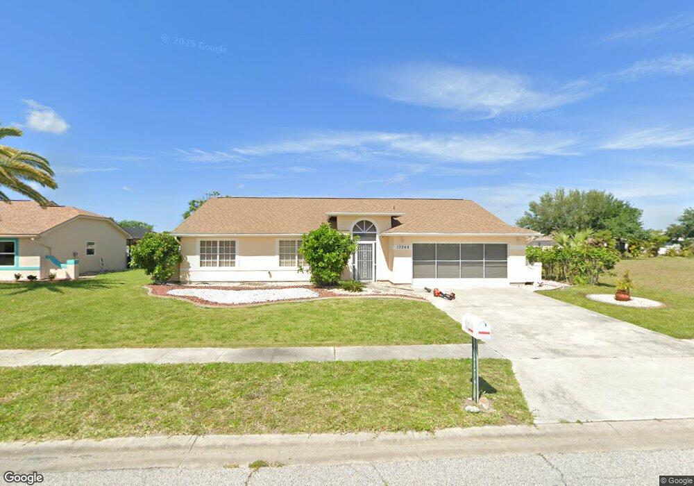
13268 Buckett Cir Port Charlotte, FL 33981
Gulf Cove NeighborhoodEstimated Value: $250,000 - $289,000
3
Beds
2
Baths
1,757
Sq Ft
$156/Sq Ft
Est. Value
About This Home
This home is located at 13268 Buckett Cir, Port Charlotte, FL 33981 and is currently estimated at $274,744, approximately $156 per square foot. 13268 Buckett Cir is a home located in Charlotte County with nearby schools including Myakka River Elementary School, L.A. Ainger Middle School, and Lemon Bay High School.
Ownership History
Date
Name
Owned For
Owner Type
Purchase Details
Closed on
Apr 24, 2023
Sold by
Zaggia Francine and Lillegard Jayne
Bought by
Ceramic Lobster Llc
Current Estimated Value
Purchase Details
Closed on
Mar 10, 2022
Sold by
Kyle John J
Bought by
Kyle Family Trust
Purchase Details
Closed on
Apr 26, 2006
Sold by
Kyle John J and John J Kyle Revocable Trust
Bought by
Kyle John J and Kyle Catherine T
Create a Home Valuation Report for This Property
The Home Valuation Report is an in-depth analysis detailing your home's value as well as a comparison with similar homes in the area
Home Values in the Area
Average Home Value in this Area
Purchase History
| Date | Buyer | Sale Price | Title Company |
|---|---|---|---|
| Ceramic Lobster Llc | $180,000 | None Listed On Document | |
| Kyle Family Trust | -- | None Listed On Document | |
| Kyle Family Trust | -- | None Listed On Document | |
| Kyle Family Trust | -- | None Listed On Document | |
| Kyle Family Trust | -- | None Listed On Document | |
| Kyle John J | -- | Attorney | |
| Kyle John J | -- | Attorney |
Source: Public Records
Tax History Compared to Growth
Tax History
| Year | Tax Paid | Tax Assessment Tax Assessment Total Assessment is a certain percentage of the fair market value that is determined by local assessors to be the total taxable value of land and additions on the property. | Land | Improvement |
|---|---|---|---|---|
| 2024 | $5,909 | $287,968 | $42,500 | $245,468 |
| 2023 | $5,909 | $277,347 | $0 | $0 |
| 2022 | $5,366 | $252,134 | $39,100 | $213,034 |
| 2021 | $2,148 | $96,202 | $0 | $0 |
| 2020 | $2,093 | $94,874 | $0 | $0 |
| 2019 | $2,003 | $92,741 | $0 | $0 |
| 2018 | $1,473 | $91,012 | $0 | $0 |
| 2017 | $1,448 | $89,140 | $0 | $0 |
| 2016 | $1,428 | $87,307 | $0 | $0 |
| 2015 | $1,411 | $86,700 | $0 | $0 |
| 2014 | $1,376 | $86,012 | $0 | $0 |
Source: Public Records
Map
Nearby Homes
- 13284 Buckett Cir
- 6219 Coliseum Blvd
- 13316 Darnell Ave
- 13367 Darnell Ave
- 13273 Fowler Ave
- 13366 Bronze Ave
- 6322 Thorman Rd
- 13301 Foresman Blvd
- 12475 Sunniland Ave
- 13309 Foresman Blvd
- 13384 Darnell Ave
- 13264 Foresman Blvd
- 13280 Foresman Blvd
- 13208 Foresman Blvd
- 13144 Eureka Lot 18 Cir
- 6294 Thorman Rd
- 13375 Bronze Ave
- 13366 Ballon Ave
- 6030 Broker Ct
- 13266 Drysdale Ave
- 13260 Buckett Cir
- 6507 Thorman Rd
- 6515 Thorman Rd
- 6499 Thorman Rd
- 6523 Thorman Rd
- 13268 Carter Ave
- 13292 Buckett Cir
- 13250 Copper Ave
- 6491 Thorman Rd
- 6531 Thorman Rd
- 13305 Buckett Cir
- 13278 Carter Ave
- 13300 Buckett Cir
- 6508 Thorman Rd
- 6516 Thorman Rd
- 6500 Thorman Rd
- 6481 Thorman Rd
- 6524 Thorman Rd
- 13325 Buckett Cir
- 6494 Thorman Rd