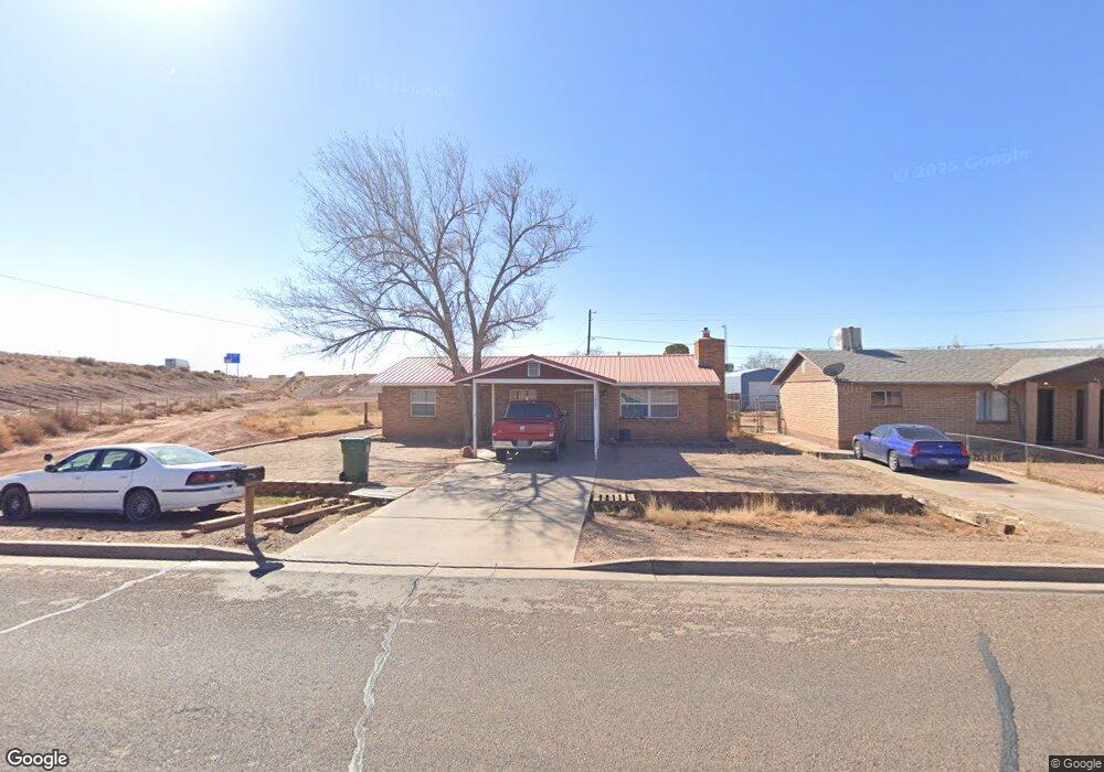
1327 E Maple St Winslow, AZ 86047
Estimated Value: $230,768 - $264,000
3
Beds
2
Baths
89
Sq Ft
$2,800/Sq Ft
Est. Value
About This Home
This home is located at 1327 E Maple St, Winslow, AZ 86047 and is currently estimated at $249,192, approximately $2,799 per square foot. 1327 E Maple St is a home located in Navajo County with nearby schools including Winslow High School and Red Sands Christian School.
Ownership History
Date
Name
Owned For
Owner Type
Purchase Details
Closed on
Sep 5, 2017
Sold by
Bush Richard A
Bought by
Chee Darrell and Chee Sharon A
Current Estimated Value
Home Financials for this Owner
Home Financials are based on the most recent Mortgage that was taken out on this home.
Original Mortgage
$104,080
Interest Rate
3.25%
Mortgage Type
FHA
Purchase Details
Closed on
Nov 14, 2012
Sold by
Fannie Mae
Bought by
Bush Richard A and Bush Sylvia Jane
Purchase Details
Closed on
Jul 31, 2012
Sold by
Yellohair Ella Mae
Bought by
Federal National Mortgage Association
Create a Home Valuation Report for This Property
The Home Valuation Report is an in-depth analysis detailing your home's value as well as a comparison with similar homes in the area
Purchase History
| Date | Buyer | Sale Price | Title Company |
|---|---|---|---|
| Chee Darrell | $106,000 | Pioneer Title Agency | |
| Bush Richard A | $38,900 | Old Republic Title Agency | |
| Federal National Mortgage Association | $108,496 | First American Title |
Source: Public Records
Mortgage History
| Date | Status | Borrower | Loan Amount |
|---|---|---|---|
| Previous Owner | Chee Darrell | $104,080 |
Source: Public Records
Tax History
| Year | Tax Paid | Tax Assessment Tax Assessment Total Assessment is a certain percentage of the fair market value that is determined by local assessors to be the total taxable value of land and additions on the property. | Land | Improvement |
|---|---|---|---|---|
| 2026 | $781 | -- | -- | -- |
| 2025 | $744 | $15,266 | $1,000 | $14,266 |
| 2024 | $710 | $14,827 | $845 | $13,982 |
| 2023 | $744 | $10,832 | $845 | $9,987 |
| 2022 | $710 | $0 | $0 | $0 |
| 2021 | $714 | $0 | $0 | $0 |
| 2020 | $693 | $0 | $0 | $0 |
| 2019 | $667 | $0 | $0 | $0 |
| 2018 | $637 | $0 | $0 | $0 |
| 2017 | $639 | $0 | $0 | $0 |
| 2016 | $606 | $0 | $0 | $0 |
| 2015 | $477 | $4,591 | $770 | $3,821 |
Source: Public Records
Map
Nearby Homes
- 0 E Aspinwall St
- 501 N Taylor Ave
- 4323 Old Highway 66
- 00 E 3rd St
- 0 E 3rd St
- 1221 E 3rd St
- 407 N Cottonwood Ave
- 222 E Aspinwall St
- Parcel 103-34-084
- 722 N Warren Ave
- 1140 French Rd
- 108 E 2nd St
- 113 W Fourth St
- 219 W Elm St
- 311 N Warren Ave
- 108 W 1st St
- 212 W First St
- 601 N Berry Ave
- 909 N Park Dr
- 201 Madison St
- 1325 E Maple St
- 1323 E Maple St
- 1340 E Oak St
- 1334 E Oak St
- 1330 E Oak St
- 1321 E Maple St
- 1328 E Oak St
- 1319 E Maple St
- 1324 E Oak St
- 1333 E Oak St
- 1329 E Oak St
- 1325 E Oak St
- 1317 E Maple St
- 1320 E Oak St
- 1321 E Oak St
- 0 E Aspinwall St Unit 6891081
- 1315 E Maple St
- 1330 E Aspinwall St
- 1330 E Aspinwall St
- 1316 E Oak St
Your Personal Tour Guide
Ask me questions while you tour the home.