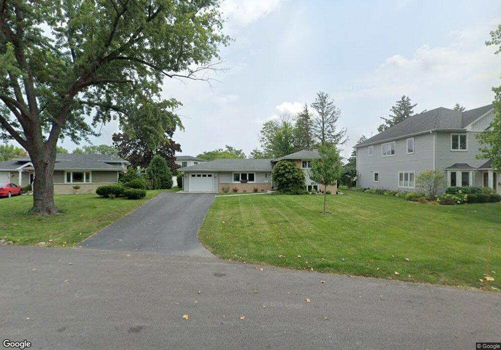
1327 Huber Ln Glenview, IL 60026
The Glen NeighborhoodEstimated Value: $672,081 - $803,000
4
Beds
2
Baths
1,916
Sq Ft
$388/Sq Ft
Est. Value
About This Home
This home is located at 1327 Huber Ln, Glenview, IL 60026 and is currently estimated at $742,694, approximately $387 per square foot. 1327 Huber Ln is a home located in Cook County with nearby schools including Westbrook Elementary School, Glen Grove Elementary School, and Attea Middle School.
Ownership History
Date
Name
Owned For
Owner Type
Purchase Details
Closed on
Jul 17, 2000
Sold by
Williams Robert R and Williams Dorothy M
Bought by
Brown Curtis E and Brown Sharon M
Current Estimated Value
Home Financials for this Owner
Home Financials are based on the most recent Mortgage that was taken out on this home.
Original Mortgage
$102,000
Interest Rate
8.05%
Create a Home Valuation Report for This Property
The Home Valuation Report is an in-depth analysis detailing your home's value as well as a comparison with similar homes in the area
Home Values in the Area
Average Home Value in this Area
Purchase History
| Date | Buyer | Sale Price | Title Company |
|---|---|---|---|
| Brown Curtis E | $305,000 | -- |
Source: Public Records
Mortgage History
| Date | Status | Borrower | Loan Amount |
|---|---|---|---|
| Previous Owner | Brown Curtis E | $102,000 |
Source: Public Records
Tax History Compared to Growth
Tax History
| Year | Tax Paid | Tax Assessment Tax Assessment Total Assessment is a certain percentage of the fair market value that is determined by local assessors to be the total taxable value of land and additions on the property. | Land | Improvement |
|---|---|---|---|---|
| 2024 | $9,544 | $46,000 | $10,010 | $35,990 |
| 2023 | $9,092 | $46,000 | $10,010 | $35,990 |
| 2022 | $9,092 | $46,000 | $10,010 | $35,990 |
| 2021 | $7,420 | $33,431 | $6,825 | $26,606 |
| 2020 | $7,376 | $33,431 | $6,825 | $26,606 |
| 2019 | $6,945 | $37,146 | $6,825 | $30,321 |
| 2018 | $7,603 | $36,834 | $5,915 | $30,919 |
| 2017 | $7,395 | $36,834 | $5,915 | $30,919 |
| 2016 | $7,159 | $36,834 | $5,915 | $30,919 |
| 2015 | $6,516 | $30,538 | $4,777 | $25,761 |
| 2014 | $6,430 | $30,538 | $4,777 | $25,761 |
| 2013 | $6,213 | $30,538 | $4,777 | $25,761 |
Source: Public Records
Map
Nearby Homes
- 3081 Saratoga Ln
- 3212 Lindenwood Ln
- 1045 Crystal Ct
- 2750 Langley Cir Unit 203013
- 1615 Greenwood Rd
- 3335 Elmdale Rd
- 2701 Commons Dr Unit 210
- 1891 Admiral Ct Unit 79
- 1867 Admiral Ct Unit 91
- 1619 Patriot Blvd
- 1704 Executive Ln
- 1735 Patriot Blvd
- 1088 Shermer Rd Unit DW
- 705 Glendale Rd
- 616 Glendale Rd
- 2005 Valor Ct Unit 43
- 608 Glenwood Ln
- 4004 Denice Ct Unit 3
- 521 Michael Manor
- 2156 Rugen Rd Unit A
- 1321 Huber Ln Unit B
- 1333 Huber Ln
- 3018 Peachgate Ln
- 3016 Peachgate Ln
- 1315 Huber Ln
- 1349 Huber Ln Unit B
- 3022 Peachgate Ln
- 1334 Huber Ln
- 1330 Huber Ln
- 3014 Peachgate Ln
- 1309 Huber Ln
- 3025 Peachgate Ln
- 1340 Huber Ln
- 3041 Independence Ave
- 3031 Independence Ave
- 1324 Huber Ln
- 3051 Independence Ave Unit 2
- 3021 Independence Ave Unit 2
- 3021 Peachgate Ln
- 1316 Huber Ln