Estimated Value: $202,000 - $289,247
3
Beds
1
Bath
1,848
Sq Ft
$128/Sq Ft
Est. Value
About This Home
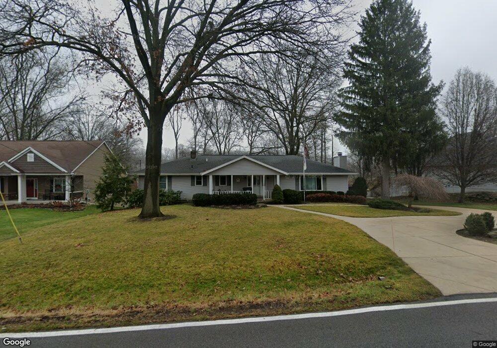
This home is located at 1327 Meadowbrook Blvd, Stow, OH 44224 and is currently estimated at $236,062, approximately $127 per square foot. 1327 Meadowbrook Blvd is a home located in Summit County with nearby schools including Stow-Munroe Falls High School, Primrose School of Hudson, and Holy Family Elementary School.
Ownership History
Date
Name
Owned For
Owner Type
Purchase Details
Closed on
Jun 27, 2025
Sold by
Gidley Family Living Trust and Messner Alisa K
Bought by
Mcgrogan Kristen M
Current Estimated Value
Home Financials for this Owner
Home Financials are based on the most recent Mortgage that was taken out on this home.
Original Mortgage
$160,000
Outstanding Balance
$159,730
Interest Rate
6.86%
Mortgage Type
New Conventional
Estimated Equity
$76,332
Purchase Details
Closed on
Nov 16, 2024
Sold by
Gidley Edward T
Bought by
Gidley Family Living Trust and Gidley
Purchase Details
Closed on
May 26, 2005
Sold by
Gidley Edward T and Gidley Linda D
Bought by
Gidley Edward T and Gidley Linda D
Create a Home Valuation Report for This Property
The Home Valuation Report is an in-depth analysis detailing your home's value as well as a comparison with similar homes in the area
Home Values in the Area
Average Home Value in this Area
Purchase History
| Date | Buyer | Sale Price | Title Company |
|---|---|---|---|
| Mcgrogan Kristen M | $200,000 | None Listed On Document | |
| Gidley Family Living Trust | -- | None Listed On Document | |
| Gidley Edward T | -- | -- |
Source: Public Records
Mortgage History
| Date | Status | Borrower | Loan Amount |
|---|---|---|---|
| Open | Mcgrogan Kristen M | $160,000 |
Source: Public Records
Tax History Compared to Growth
Tax History
| Year | Tax Paid | Tax Assessment Tax Assessment Total Assessment is a certain percentage of the fair market value that is determined by local assessors to be the total taxable value of land and additions on the property. | Land | Improvement |
|---|---|---|---|---|
| 2025 | $4,153 | $82,418 | $17,010 | $65,408 |
| 2024 | $4,153 | $82,418 | $17,010 | $65,408 |
| 2023 | $4,153 | $82,418 | $17,010 | $65,408 |
| 2022 | $3,394 | $61,425 | $12,600 | $48,825 |
| 2021 | $3,042 | $61,425 | $12,600 | $48,825 |
| 2020 | $2,990 | $61,430 | $12,600 | $48,830 |
| 2019 | $2,794 | $54,670 | $12,600 | $42,070 |
| 2018 | $2,749 | $54,670 | $12,600 | $42,070 |
| 2017 | $2,618 | $54,670 | $12,600 | $42,070 |
| 2016 | $2,694 | $51,210 | $12,600 | $38,610 |
| 2015 | $2,618 | $51,210 | $12,600 | $38,610 |
| 2014 | $2,621 | $51,210 | $12,600 | $38,610 |
| 2013 | $2,407 | $47,890 | $12,600 | $35,290 |
Source: Public Records
Map
Nearby Homes
- 1470 Mac Dr
- 0 Hibbard Dr
- 4877 Cedar Crest Ln
- 4891 Cedar Crest Ln
- V/L Lawnmark Dr
- 1664 Cypress Ct
- 1511 Apollo Dr
- 1808 Higby Dr Unit A
- 1627 Cypress Ct
- 1938 Higby Dr
- 4630 Red Willow Rd
- V/L Housley Rd
- 1620 Sapphire Dr
- 1759 E Sapphire Dr
- 1884 Village Ct Unit X66
- V/L Norton Rd
- 2327 Crockett Cir
- 5217 Beckett Ridge
- 0 Stow Rd Unit 5102979
- 2380 Port Williams Dr Unit 2380
- 1323 Meadowbrook Blvd
- 1337 Meadowbrook Blvd
- 1353 Meadowbrook Blvd
- 1318 Meadowbrook Blvd
- 1336 Meadowbrook Blvd
- 1307 Meadowbrook Blvd
- 4780 Sunnyside Dr
- 1367 Meadowbrook Blvd
- 1285 Meadowbrook Ct
- 1300 Meadowbrook Blvd
- 1285 Meadowbrook Blvd
- 1373 Meadowbrook Blvd
- 1303 Homesite Dr
- 4761 Sunnyside Dr
- 4770 Sunnyside Dr
- 1379 Meadowbrook Blvd
- 1290 Meadowbrook Blvd
- 1319 Homesite Dr
- 1297 Homesite Dr
- 1291 Meadowbrook Blvd