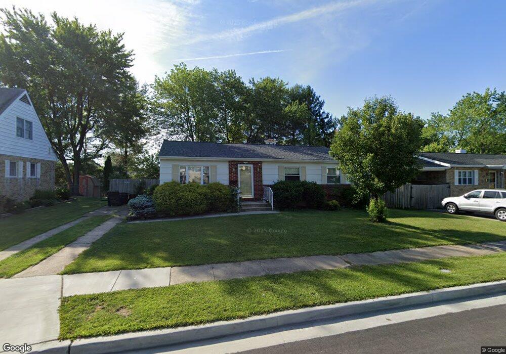
1327 Middleford Rd Catonsville, MD 21228
Estimated Value: $359,708 - $408,000
--
Bed
1
Bath
1,092
Sq Ft
$351/Sq Ft
Est. Value
About This Home
This home is located at 1327 Middleford Rd, Catonsville, MD 21228 and is currently estimated at $382,927, approximately $350 per square foot. 1327 Middleford Rd is a home located in Baltimore County with nearby schools including Woodbridge Elementary School, Southwest Academy, and Woodlawn High School.
Ownership History
Date
Name
Owned For
Owner Type
Purchase Details
Closed on
Dec 30, 2004
Sold by
Long Christa F
Bought by
Gallo Karen
Current Estimated Value
Purchase Details
Closed on
Dec 27, 2004
Sold by
Long Christa F
Bought by
Gallo Karen
Purchase Details
Closed on
Jun 14, 2000
Sold by
Wood Kenneth Wayne
Bought by
Long Christa F and Long Carolyn Renee
Purchase Details
Closed on
Feb 7, 1994
Sold by
Cohee Ethel
Bought by
Wood Kenneth W
Home Financials for this Owner
Home Financials are based on the most recent Mortgage that was taken out on this home.
Original Mortgage
$105,250
Interest Rate
7.12%
Create a Home Valuation Report for This Property
The Home Valuation Report is an in-depth analysis detailing your home's value as well as a comparison with similar homes in the area
Home Values in the Area
Average Home Value in this Area
Purchase History
| Date | Buyer | Sale Price | Title Company |
|---|---|---|---|
| Gallo Karen | $239,900 | -- | |
| Gallo Karen | $239,900 | -- | |
| Long Christa F | $128,000 | -- | |
| Wood Kenneth W | $104,000 | -- |
Source: Public Records
Mortgage History
| Date | Status | Borrower | Loan Amount |
|---|---|---|---|
| Previous Owner | Wood Kenneth W | $105,250 |
Source: Public Records
Tax History Compared to Growth
Tax History
| Year | Tax Paid | Tax Assessment Tax Assessment Total Assessment is a certain percentage of the fair market value that is determined by local assessors to be the total taxable value of land and additions on the property. | Land | Improvement |
|---|---|---|---|---|
| 2025 | $3,837 | $279,500 | -- | -- |
| 2024 | $3,837 | $262,800 | $77,800 | $185,000 |
| 2023 | $1,829 | $250,500 | $0 | $0 |
| 2022 | $3,479 | $238,200 | $0 | $0 |
| 2021 | $3,155 | $225,900 | $77,800 | $148,100 |
| 2020 | $3,155 | $218,233 | $0 | $0 |
| 2019 | $3,030 | $210,567 | $0 | $0 |
| 2018 | $2,933 | $202,900 | $64,300 | $138,600 |
| 2017 | $2,764 | $199,067 | $0 | $0 |
| 2016 | $2,445 | $195,233 | $0 | $0 |
| 2015 | $2,445 | $191,400 | $0 | $0 |
| 2014 | $2,445 | $191,400 | $0 | $0 |
Source: Public Records
Map
Nearby Homes
- 6031 Burnt Oak Rd
- 800 Crosby Rd
- 1418 Harberson Rd
- 6200 Gilston Park Rd
- 6028 Moorehead Rd
- 1009 Rowe Ln
- 3 Mcgrady Square
- 67 Walden Mill Way
- 6263 Gilston Park Rd
- 908 Vanderwood Rd
- 1111 Cummings Ave
- 1007 Kent Ave
- 920 Vanderwood Rd
- 930 Sedgley Rd
- 6011 Johnnycake Rd
- 1019 Cummings Ave
- 1013 Cummings Ave
- 6001 Johnnycake Rd
- 1109 Marksworth Rd
- 1503 Woodcliff Ave
- 1329 Middleford Rd
- 1325 Middleford Rd
- 1331 Middleford Rd
- 1320 Denbright Rd
- 1323 Middleford Rd
- 1318 Denbright Rd
- 1322 Denbright Rd
- 1328 Middleford Rd
- 1330 Middleford Rd
- 1316 Denbright Rd
- 1324 Denbright Rd
- 1324 Middleford Rd
- 1333 Middleford Rd
- 1321 Middleford Rd
- 1332 Middleford Rd
- 1314 Denbright Rd
- 1322 Middleford Rd
- 1335 Middleford Rd
- 1319 Middleford Rd
- 6103 Wheatland Rd