Estimated Value: $724,000 - $834,000
4
Beds
3
Baths
2,729
Sq Ft
$284/Sq Ft
Est. Value
About This Home
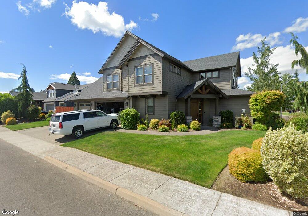
This home is located at 1327 N Elm St, Canby, OR 97013 and is currently estimated at $776,062, approximately $284 per square foot. 1327 N Elm St is a home with nearby schools including Howard Eccles Elementary School, Baker Prairie Middle School, and Canby High School.
Ownership History
Date
Name
Owned For
Owner Type
Purchase Details
Closed on
Oct 27, 2017
Sold by
Maulding Roger and Maulding Marie
Bought by
Maulding Kristi G and Maulding Colin B
Current Estimated Value
Home Financials for this Owner
Home Financials are based on the most recent Mortgage that was taken out on this home.
Original Mortgage
$415,394
Outstanding Balance
$346,604
Interest Rate
3.87%
Mortgage Type
FHA
Estimated Equity
$429,458
Purchase Details
Closed on
Mar 21, 2014
Sold by
2Krmt Inc
Bought by
Maulding Roger and Maulding Marie
Home Financials for this Owner
Home Financials are based on the most recent Mortgage that was taken out on this home.
Original Mortgage
$354,700
Interest Rate
4.18%
Mortgage Type
Credit Line Revolving
Create a Home Valuation Report for This Property
The Home Valuation Report is an in-depth analysis detailing your home's value as well as a comparison with similar homes in the area
Home Values in the Area
Average Home Value in this Area
Purchase History
| Date | Buyer | Sale Price | Title Company |
|---|---|---|---|
| Maulding Kristi G | $453,610 | Fidelity Natl Title Co Of Or | |
| Maulding Roger | $109,900 | Chicago Title |
Source: Public Records
Mortgage History
| Date | Status | Borrower | Loan Amount |
|---|---|---|---|
| Open | Maulding Kristi G | $415,394 | |
| Closed | Maulding Roger | $354,700 |
Source: Public Records
Tax History Compared to Growth
Tax History
| Year | Tax Paid | Tax Assessment Tax Assessment Total Assessment is a certain percentage of the fair market value that is determined by local assessors to be the total taxable value of land and additions on the property. | Land | Improvement |
|---|---|---|---|---|
| 2025 | $8,597 | $485,227 | -- | -- |
| 2024 | $8,356 | $471,095 | -- | -- |
| 2023 | $8,356 | $457,374 | $0 | $0 |
| 2022 | $7,685 | $444,053 | $0 | $0 |
| 2021 | $7,401 | $431,120 | $0 | $0 |
| 2020 | $7,268 | $418,564 | $0 | $0 |
| 2019 | $6,921 | $406,373 | $0 | $0 |
| 2018 | $6,767 | $394,537 | $0 | $0 |
| 2017 | $6,595 | $383,046 | $0 | $0 |
| 2016 | $6,375 | $371,889 | $0 | $0 |
| 2015 | $6,157 | $361,057 | $0 | $0 |
| 2014 | $1,644 | $96,369 | $0 | $0 |
Source: Public Records
Map
Nearby Homes
- 0 NW 10th Ave
- 1614 NW 16th Ave
- 1721 N Hyssop St
- 960 N Aspen Ct
- 187 NE 14th Ave
- 184 NE 10th Ave
- 312 NE 14th Ave
- 1751 N Laurelwood Loop
- 318 NE 9th Ave
- 580 N Grant St
- 1165 NW 22nd Ave
- 1199 NW 22nd Ave
- 1151 NW 22nd Ave
- 442 NW 4th Ave
- 2152 N Laurelwood St
- 660 NE 20th Ave
- 589 NW 3rd Ave
- 860 NE 14th Ave
- 832 NE 17th Ave
- 853 NE 17th Ave