Estimated Value: $202,000 - $210,000
4
Beds
1
Bath
1,299
Sq Ft
$159/Sq Ft
Est. Value
About This Home
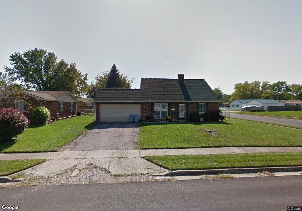
This home is located at 1327 Texas Dr, Xenia, OH 45385 and is currently estimated at $206,237, approximately $158 per square foot. 1327 Texas Dr is a home located in Greene County with nearby schools including Xenia High School, Summit Academy Community School for Alternative Learners - Xenia, and Legacy Christian Academy.
Ownership History
Date
Name
Owned For
Owner Type
Purchase Details
Closed on
May 29, 2007
Sold by
Neace Terry L and Neace Marla K
Bought by
Heppes Jason and Heppes Tracy L
Current Estimated Value
Home Financials for this Owner
Home Financials are based on the most recent Mortgage that was taken out on this home.
Original Mortgage
$109,000
Outstanding Balance
$66,769
Interest Rate
6.21%
Mortgage Type
Unknown
Estimated Equity
$139,468
Purchase Details
Closed on
Mar 27, 2001
Sold by
Shane Muterspaw and Shane Cross J
Bought by
Neace Terry L and Neace Maria K
Home Financials for this Owner
Home Financials are based on the most recent Mortgage that was taken out on this home.
Original Mortgage
$92,270
Interest Rate
7.02%
Mortgage Type
FHA
Create a Home Valuation Report for This Property
The Home Valuation Report is an in-depth analysis detailing your home's value as well as a comparison with similar homes in the area
Home Values in the Area
Average Home Value in this Area
Purchase History
| Date | Buyer | Sale Price | Title Company |
|---|---|---|---|
| Heppes Jason | $109,000 | Attorney | |
| Neace Terry L | $93,000 | -- |
Source: Public Records
Mortgage History
| Date | Status | Borrower | Loan Amount |
|---|---|---|---|
| Open | Heppes Jason | $109,000 | |
| Previous Owner | Neace Terry L | $92,270 |
Source: Public Records
Tax History Compared to Growth
Tax History
| Year | Tax Paid | Tax Assessment Tax Assessment Total Assessment is a certain percentage of the fair market value that is determined by local assessors to be the total taxable value of land and additions on the property. | Land | Improvement |
|---|---|---|---|---|
| 2024 | $2,322 | $54,260 | $12,730 | $41,530 |
| 2023 | $2,322 | $54,260 | $12,730 | $41,530 |
| 2022 | $1,930 | $38,480 | $7,490 | $30,990 |
| 2021 | $1,956 | $38,480 | $7,490 | $30,990 |
| 2020 | $1,874 | $38,480 | $7,490 | $30,990 |
| 2019 | $1,657 | $32,030 | $7,350 | $24,680 |
| 2018 | $1,664 | $32,030 | $7,350 | $24,680 |
| 2017 | $1,534 | $32,030 | $7,350 | $24,680 |
| 2016 | $1,534 | $28,980 | $7,350 | $21,630 |
| 2015 | $1,538 | $28,980 | $7,350 | $21,630 |
| 2014 | $1,473 | $28,980 | $7,350 | $21,630 |
Source: Public Records
Map
Nearby Homes
- 1403 Texas Dr
- 1866 Roxbury Dr
- 1778 Arapaho Dr
- 1769 Gayhart Dr
- 1829 Gayhart Dr
- 1908 Whitt St
- 1255 Colorado Dr
- 1618 Navajo Dr
- 1653 Seneca Dr
- 1107 Arkansas Dr
- 1272 Bellbrook Ave
- 1208 Bellbrook Ave
- 2499 Jenny Marie Dr
- 2257 Maryland Dr
- 2142 Michigan Dr
- 2345 Tennessee Dr
- 2540 Jenny Marie Dr
- 1568 Cheyenne Dr
- 2421 Louisiana Dr
- 2758 Wyoming Dr
- 1313 Texas Dr
- 1645 Commonwealth Dr
- 1659 Commonwealth Dr
- 1347 Texas Dr
- 1299 Texas Dr
- 1306 Texas Dr
- 1673 Commonwealth Dr
- 1621 Commonwealth Dr
- 1320 Texas Dr
- 1361 Texas Dr
- 1334 Texas Dr
- 1348 Texas Dr
- 1607 Commonwealth Dr
- 1683 Commonwealth Dr
- 1375 Texas Dr
- 1670 Commonwealth Dr
- 1684 Commonwealth Dr
- 1731 Utah Ct
- 1277 Texas Dr
- 1700 Commonwealth Dr