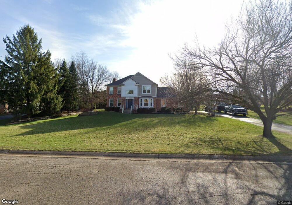
13275 Sumac Rd South Lyon, MI 48178
Estimated Value: $501,673 - $576,000
4
Beds
3
Baths
2,216
Sq Ft
$238/Sq Ft
Est. Value
About This Home
This home is located at 13275 Sumac Rd, South Lyon, MI 48178 and is currently estimated at $526,418, approximately $237 per square foot. 13275 Sumac Rd is a home located in Livingston County with nearby schools including William A. Brummer Elementary School, Centennial Middle School, and South Lyon High School.
Ownership History
Date
Name
Owned For
Owner Type
Purchase Details
Closed on
Oct 2, 2020
Sold by
Williams Joy
Bought by
Williams Kevin M
Current Estimated Value
Home Financials for this Owner
Home Financials are based on the most recent Mortgage that was taken out on this home.
Original Mortgage
$274,700
Outstanding Balance
$244,331
Interest Rate
2.9%
Mortgage Type
New Conventional
Estimated Equity
$282,087
Purchase Details
Closed on
Nov 29, 2004
Sold by
Otman Michael J and Otman Althea B
Bought by
Janda Donald L and Janda Kristin E
Create a Home Valuation Report for This Property
The Home Valuation Report is an in-depth analysis detailing your home's value as well as a comparison with similar homes in the area
Home Values in the Area
Average Home Value in this Area
Purchase History
| Date | Buyer | Sale Price | Title Company |
|---|---|---|---|
| Williams Kevin M | -- | Title Solutions Agency Llc | |
| Janda Donald L | $288,900 | -- |
Source: Public Records
Mortgage History
| Date | Status | Borrower | Loan Amount |
|---|---|---|---|
| Open | Williams Kevin M | $274,700 |
Source: Public Records
Tax History Compared to Growth
Tax History
| Year | Tax Paid | Tax Assessment Tax Assessment Total Assessment is a certain percentage of the fair market value that is determined by local assessors to be the total taxable value of land and additions on the property. | Land | Improvement |
|---|---|---|---|---|
| 2025 | $4,302 | $223,800 | $0 | $0 |
| 2024 | $2,898 | $201,800 | $0 | $0 |
| 2023 | $2,764 | $195,500 | $0 | $0 |
| 2022 | $3,513 | $139,800 | $0 | $0 |
| 2021 | $3,513 | $156,900 | $0 | $0 |
| 2020 | $3,495 | $153,700 | $0 | $0 |
| 2019 | $3,530 | $139,800 | $0 | $0 |
| 2018 | $3,486 | $130,200 | $0 | $0 |
| 2017 | $3,536 | $130,900 | $0 | $0 |
| 2016 | $3,588 | $120,500 | $0 | $0 |
| 2014 | $3,258 | $111,400 | $0 | $0 |
| 2012 | $3,258 | $110,200 | $0 | $0 |
Source: Public Records
Map
Nearby Homes
- 9851 Atwood Dr
- 9859 Aylebury Dr
- 13428 Sequoia Ln
- 13500 12 Mile Rd
- 13708 Monarch Dr
- 26003 N Dixboro Rd
- 13563 12 Mile Rd
- 62622 Raleigh Ct Unit 4
- 6040 Fieldstone Cir
- Bradford Plan at Charleston Park
- Bradford with Second Floor Plan at Charleston Park
- Bartelle Plan at Charleston Park
- Upton Plan at Charleston Park
- Westford Plan at Charleston Park
- Addison Plan at Charleston Park
- Madison Plan at Charleston Park
- Nantucket Plan at Charleston Park
- Preston Plan at Charleston Park
- Rockport II Plan at Charleston Park
- Remington Plan at Charleston Park
- 13269 Sumac Rd
- 13281 Sumac Rd
- 13356 Daleview Ct
- 13374 Daleview Ct
- 13338 Daleview Ct
- 13272 Sumac Rd
- 13287 Sumac Rd
- 13280 Sumac Rd
- 13261 Sumac Rd
- 13286 Daleview Ct
- 13266 Sumac Rd
- 13392 Daleview Ct
- 13312 Daleview Ct
- 13288 Sumac Rd
- 13293 Sumac Rd
- 13260 Sumac Rd
- 13196 Michalek Ln
- 13343 Daleview Ct
- 13410 Daleview Ct
- 9388 Daleview Dr