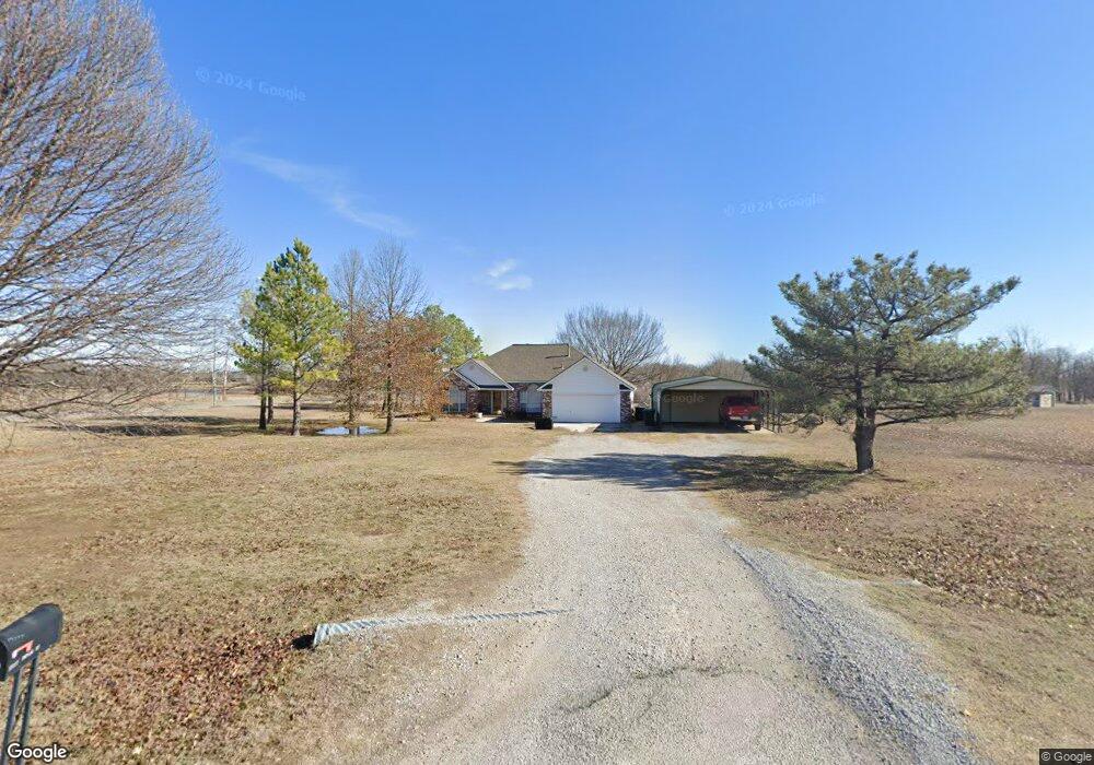
13277 Poplar St Skiatook, OK 74070
Estimated Value: $242,000 - $267,000
3
Beds
2
Baths
1,763
Sq Ft
$144/Sq Ft
Est. Value
About This Home
This home is located at 13277 Poplar St, Skiatook, OK 74070 and is currently estimated at $253,684, approximately $143 per square foot. 13277 Poplar St is a home located in Osage County with nearby schools including Marrs Elementary School, Newman Middle School, and Skiatook High School.
Ownership History
Date
Name
Owned For
Owner Type
Purchase Details
Closed on
Oct 28, 2000
Sold by
Prudential Residential Ser
Bought by
Saile Daniel K and Saile Juvelyn E
Current Estimated Value
Purchase Details
Closed on
Oct 27, 2000
Sold by
Stapleton Charles Homer
Bought by
Prudential Residential Ser
Purchase Details
Closed on
Apr 29, 1996
Sold by
Renaissance Properties Inc
Bought by
Stapleton Charles Homer
Purchase Details
Closed on
Jun 16, 1995
Sold by
Roberts Building Supply Inc
Bought by
Jones Kenneth H and Jones Donna C
Create a Home Valuation Report for This Property
The Home Valuation Report is an in-depth analysis detailing your home's value as well as a comparison with similar homes in the area
Home Values in the Area
Average Home Value in this Area
Purchase History
| Date | Buyer | Sale Price | Title Company |
|---|---|---|---|
| Saile Daniel K | $130,000 | -- | |
| Prudential Residential Ser | $130,000 | -- | |
| Stapleton Charles Homer | $96,500 | -- | |
| Renaissance Properties Inc | -- | -- | |
| Jones Kenneth H | -- | -- |
Source: Public Records
Tax History Compared to Growth
Tax History
| Year | Tax Paid | Tax Assessment Tax Assessment Total Assessment is a certain percentage of the fair market value that is determined by local assessors to be the total taxable value of land and additions on the property. | Land | Improvement |
|---|---|---|---|---|
| 2025 | $1,676 | $17,838 | $1,699 | $16,139 |
| 2024 | $1,629 | $17,318 | $1,649 | $15,669 |
| 2023 | $1,629 | $16,814 | $1,649 | $15,165 |
| 2022 | $1,518 | $15,849 | $1,649 | $14,200 |
| 2021 | $1,476 | $15,849 | $1,649 | $14,200 |
| 2020 | $1,439 | $15,849 | $1,649 | $14,200 |
| 2019 | $1,411 | $15,387 | $1,649 | $13,738 |
| 2018 | $1,405 | $14,939 | $1,649 | $13,290 |
| 2017 | $1,381 | $14,504 | $1,649 | $12,855 |
| 2016 | $1,343 | $14,081 | $1,649 | $12,432 |
| 2015 | $1,291 | $13,671 | $1,649 | $12,022 |
| 2014 | $1,189 | $13,273 | $1,649 | $11,624 |
| 2013 | $1,248 | $12,887 | $1,649 | $11,238 |
Source: Public Records
Map
Nearby Homes
- 1602 W 131st St N
- 2100 S Haynie Ct
- 109 W 133rd Place N
- 104 W 133rd Place N
- 108 W 135th St N
- 1127 S Russell St
- 1122 S Russell St
- 1122 W Beech St
- 143 E 136th St N
- 116 W Dogwood St
- 133 W Chestnut Place
- 1128 S Quail Creek Rd
- 14 W Chestnut St
- 724 S Haynie St
- 13107 N Cincinnati Ave
- 615 S Haynie St
- 3618 W Evergreen St
- 411 Pine Ave
- 3641 W Forest St
- 534 S Osage St
- 2101 S Poplar
- 2101 S Poplar
- 2150 S Poplar St
- 2200 S Poplar St
- 0 W 133rd St Unit 704194
- 0 W 133rd St Unit 826158
- 0 W 133rd St Unit 724941
- 0 W 133rd St Unit 805816
- 0 W 133rd St Unit 915652
- 0 W 133rd St Unit 905518
- 0 W 133rd St Unit 924832
- 0 W 133rd St Unit 1827935
- 909 W 131st St N
- 1594 W 133rd St N
- 1616 W 131st St N
- 13130 S Locust St
- 13284 S Locust St
- 2216 S Locust St
- 2220 S Locust St
- 1698 W 131st St N