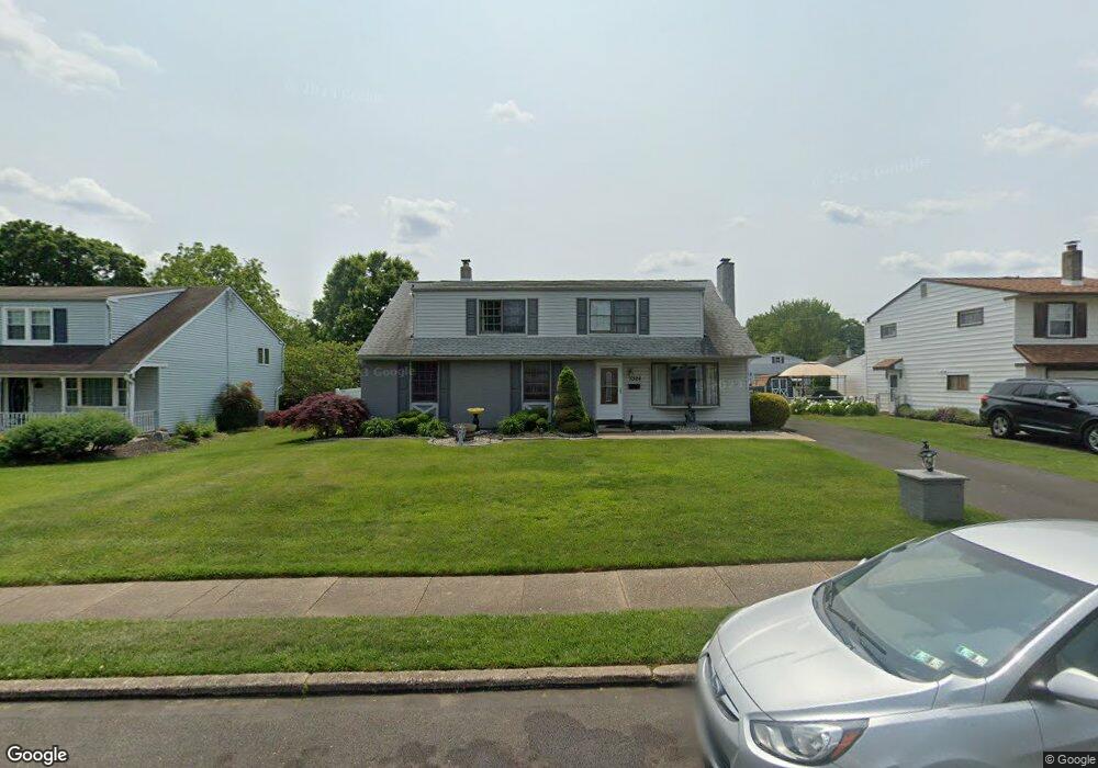
1328 Beverly Rd Warminster, PA 18974
Estimated Value: $482,000 - $558,000
4
Beds
3
Baths
2,160
Sq Ft
$239/Sq Ft
Est. Value
About This Home
This home is located at 1328 Beverly Rd, Warminster, PA 18974 and is currently estimated at $515,518, approximately $238 per square foot. 1328 Beverly Rd is a home located in Bucks County with nearby schools including Willow Dale El School, Log College Middle School, and William Tennent High School.
Ownership History
Date
Name
Owned For
Owner Type
Purchase Details
Closed on
Nov 12, 2010
Sold by
Haney Robert X and Bridges Elizabeth
Bought by
Miluzzo Gary
Current Estimated Value
Home Financials for this Owner
Home Financials are based on the most recent Mortgage that was taken out on this home.
Original Mortgage
$291,080
Outstanding Balance
$193,027
Interest Rate
4.37%
Mortgage Type
FHA
Estimated Equity
$322,491
Purchase Details
Closed on
Jun 22, 1959
Bought by
Haney Robert X
Create a Home Valuation Report for This Property
The Home Valuation Report is an in-depth analysis detailing your home's value as well as a comparison with similar homes in the area
Home Values in the Area
Average Home Value in this Area
Purchase History
| Date | Buyer | Sale Price | Title Company |
|---|---|---|---|
| Miluzzo Gary | $295,000 | None Available | |
| Haney Robert X | -- | -- |
Source: Public Records
Mortgage History
| Date | Status | Borrower | Loan Amount |
|---|---|---|---|
| Open | Miluzzo Gary | $291,080 |
Source: Public Records
Tax History Compared to Growth
Tax History
| Year | Tax Paid | Tax Assessment Tax Assessment Total Assessment is a certain percentage of the fair market value that is determined by local assessors to be the total taxable value of land and additions on the property. | Land | Improvement |
|---|---|---|---|---|
| 2025 | $5,657 | $26,800 | $5,080 | $21,720 |
| 2024 | $5,657 | $26,800 | $5,080 | $21,720 |
| 2023 | $5,482 | $26,800 | $5,080 | $21,720 |
| 2022 | $5,365 | $26,800 | $5,080 | $21,720 |
| 2021 | $5,240 | $26,800 | $5,080 | $21,720 |
| 2020 | $5,167 | $26,800 | $5,080 | $21,720 |
| 2019 | $4,892 | $26,800 | $5,080 | $21,720 |
| 2018 | $4,775 | $26,800 | $5,080 | $21,720 |
| 2017 | $4,635 | $26,800 | $5,080 | $21,720 |
| 2016 | $4,635 | $26,800 | $5,080 | $21,720 |
| 2015 | $4,539 | $26,800 | $5,080 | $21,720 |
| 2014 | $4,539 | $26,800 | $5,080 | $21,720 |
Source: Public Records
Map
Nearby Homes
- 1274 Beverly Rd
- 1277 Beverly Rd
- 1309 Clyde Rd
- 1130 Victoria Rd
- Faraday Plan at Liberty Ridge
- Westmont Plan at Liberty Ridge
- Northbrook Plan at Liberty Ridge
- 64 Villa Dr Unit 206
- 603 Liberty Ridge Rd
- 605 Liberty Ridge Rd
- 607 Liberty Ridge Rd
- 604 Liberty Ridge Rd
- 611 Liberty Ridge Rd
- 100 Villa Dr Unit 224
- 159 Villa Dr Unit 91
- 616 Liberty Ridge Rd
- 13 Eagle Ct
- 1002 Windsor Rd
- 1334 Mallard Cir
- 416 Aspen Ln
- 1320 Beverly Rd
- 1334 Beverly Rd
- 1312 Beverly Rd
- 126 Wellington Dr
- 107 Delmont Ave
- 1319 Caledonia Dr
- 1329 Caledonia Dr
- 1304 Beverly Rd
- 1341 Beverly Rd
- 1309 Caledonia Dr
- 125 Wellington Dr
- 1341 Caledonia Dr
- 132 Wellington Dr
- 1296 Beverly Rd
- 133 Delmont Ave
- 1299 Caledonia Dr
- 135 Wellington Dr
- 140 Wellington Dr
- 1290 Beverly Rd
- 84 Delmont Ave