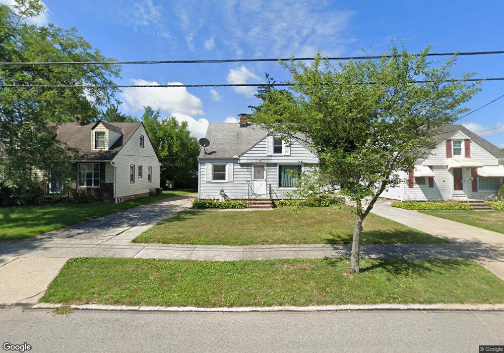
1328 Caryl Dr Bedford, OH 44146
Estimated Value: $121,035 - $163,000
2
Beds
1
Bath
1,092
Sq Ft
$123/Sq Ft
Est. Value
About This Home
This home is located at 1328 Caryl Dr, Bedford, OH 44146 and is currently estimated at $134,259, approximately $122 per square foot. 1328 Caryl Dr is a home located in Cuyahoga County with nearby schools including Heskett Middle School, Bedford High School, and Ohio College Preparatory School.
Ownership History
Date
Name
Owned For
Owner Type
Purchase Details
Closed on
Mar 16, 2021
Sold by
Lange Candace and Lange Robert Thomas
Bought by
Lange Robert M
Current Estimated Value
Home Financials for this Owner
Home Financials are based on the most recent Mortgage that was taken out on this home.
Original Mortgage
$68,835
Outstanding Balance
$61,737
Interest Rate
2.73%
Mortgage Type
FHA
Estimated Equity
$72,522
Purchase Details
Closed on
Jan 1, 1975
Bought by
Travnik Helen
Create a Home Valuation Report for This Property
The Home Valuation Report is an in-depth analysis detailing your home's value as well as a comparison with similar homes in the area
Home Values in the Area
Average Home Value in this Area
Purchase History
| Date | Buyer | Sale Price | Title Company |
|---|---|---|---|
| Lange Robert M | $85,000 | Title Professionals | |
| Travnik Helen | -- | -- |
Source: Public Records
Mortgage History
| Date | Status | Borrower | Loan Amount |
|---|---|---|---|
| Open | Lange Robert M | $68,835 |
Source: Public Records
Tax History Compared to Growth
Tax History
| Year | Tax Paid | Tax Assessment Tax Assessment Total Assessment is a certain percentage of the fair market value that is determined by local assessors to be the total taxable value of land and additions on the property. | Land | Improvement |
|---|---|---|---|---|
| 2024 | $2,913 | $37,240 | $7,665 | $29,575 |
| 2023 | $2,618 | $28,710 | $6,550 | $22,160 |
| 2022 | $2,321 | $28,700 | $6,550 | $22,160 |
| 2021 | $2,295 | $28,700 | $6,550 | $22,160 |
| 2020 | $2,158 | $24,120 | $5,500 | $18,620 |
| 2019 | $2,104 | $68,900 | $15,700 | $53,200 |
| 2018 | $2,094 | $24,120 | $5,500 | $18,620 |
| 2017 | $2,110 | $23,000 | $5,040 | $17,960 |
| 2016 | $2,092 | $23,000 | $5,040 | $17,960 |
| 2015 | $2,079 | $23,000 | $5,040 | $17,960 |
| 2014 | $2,079 | $25,000 | $5,500 | $19,500 |
Source: Public Records
Map
Nearby Homes
- 92 John St
- 21481 Forbes Rd
- 43 Forbes Rd
- 7262 Free Ave
- 7263 Free Ave
- 7210 Grove Ave
- 23241 Kirkland Dr
- 7222 Grove Ave
- 209 Dalepark Dr Unit 7
- 209 Dalepark Dr
- 7228 Grove Ave
- 80 Egbert Rd
- 194 Dalepark Dr Unit 5
- 24611 Ridgeline Dr
- 6569 Pau Ct
- 6538 Pau Ct
- 7349 Wright Ave
- 6604 Basswood Dr
- 6735 Basswood Dr
- 25046 Buckthorn Rd
- 1324 Caryl Dr
- 1332 Caryl Dr
- 1336 Caryl Dr
- 1322 Caryl Dr
- 1333 Broadway Ave
- 1329 Broadway Ave
- 1337 Broadway Ave
- 1344 Caryl Dr
- 1320 Caryl Dr
- 1325 Broadway Ave
- 1341 Broadway Ave
- 1337 Caryl Dr
- 1329 Caryl Dr
- 1314 Caryl Dr
- 1345 Broadway Ave
- 1321 Broadway Ave
- 1346 Caryl Dr
- 1339 Caryl Dr
- 1325 Caryl Dr
- 1343 Caryl Dr