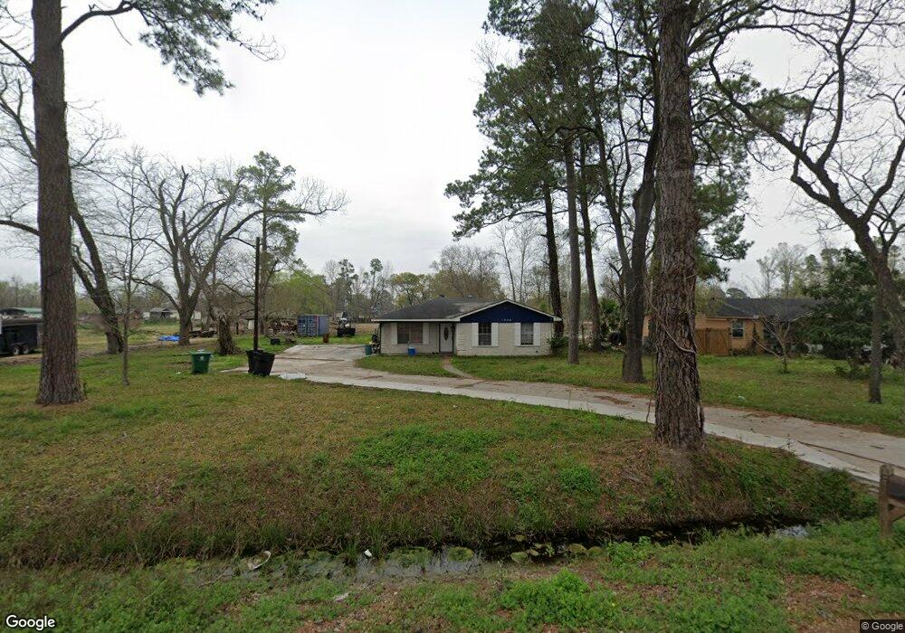
1328 Paul Quinn St Houston, TX 77091
Acres Homes NeighborhoodEstimated Value: $449,000 - $979,000
--
Bed
--
Bath
--
Sq Ft
0.96
Acres
About This Home
This home is located at 1328 Paul Quinn St, Houston, TX 77091 and is currently estimated at $837,177. 1328 Paul Quinn St is a home located in Harris County with nearby schools including Highland Heights Elementary School, Williams Middle, and Waltrip High School.
Ownership History
Date
Name
Owned For
Owner Type
Purchase Details
Closed on
Dec 29, 2017
Sold by
Carrett Ii John
Bought by
Phillips Lawrence
Current Estimated Value
Purchase Details
Closed on
Mar 13, 2003
Sold by
Garrett John
Bought by
Phillips Lawrence
Home Financials for this Owner
Home Financials are based on the most recent Mortgage that was taken out on this home.
Original Mortgage
$74,000
Interest Rate
9.38%
Purchase Details
Closed on
Mar 9, 1997
Sold by
Hudspeth Robert
Bought by
Garrett Ii John
Create a Home Valuation Report for This Property
The Home Valuation Report is an in-depth analysis detailing your home's value as well as a comparison with similar homes in the area
Home Values in the Area
Average Home Value in this Area
Purchase History
| Date | Buyer | Sale Price | Title Company |
|---|---|---|---|
| Phillips Lawrence | -- | None Available | |
| Phillips Lawrence | -- | Texas American Title Company | |
| Garrett Ii John | -- | -- |
Source: Public Records
Mortgage History
| Date | Status | Borrower | Loan Amount |
|---|---|---|---|
| Previous Owner | Phillips Lawrence | $74,000 |
Source: Public Records
Tax History Compared to Growth
Tax History
| Year | Tax Paid | Tax Assessment Tax Assessment Total Assessment is a certain percentage of the fair market value that is determined by local assessors to be the total taxable value of land and additions on the property. | Land | Improvement |
|---|---|---|---|---|
| 2025 | $9,706 | $462,075 | $462,075 | -- |
| 2024 | $9,706 | $463,878 | $463,878 | -- |
| 2023 | $9,706 | $463,878 | $462,075 | $1,803 |
| 2022 | $3,057 | $286,749 | $284,946 | $1,803 |
| 2021 | $2,941 | $217,438 | $215,635 | $1,803 |
| 2020 | $2,778 | $140,426 | $138,623 | $1,803 |
| 2019 | $2,639 | $112,701 | $110,898 | $1,803 |
| 2018 | $1,929 | $94,819 | $92,415 | $2,404 |
| 2017 | $2,008 | $79,417 | $77,013 | $2,404 |
| 2016 | $2,008 | $79,417 | $77,013 | $2,404 |
| 2015 | $854 | $64,014 | $61,610 | $2,404 |
| 2014 | $854 | $33,209 | $30,805 | $2,404 |
Source: Public Records
Map
Nearby Homes
- 5723 White Magnolia St
- Plan C at Commons at West Tidwell
- Plan A at Commons at West Tidwell
- 5733 White Magnolia St
- 1620 Paul Quinn St
- 1540 W Tidwell Rd
- 1650 W Tidwell Rd
- 1648 W Tidwell Rd
- 1407 Mansfield St
- 880 Paul Quinn St
- 892 Paul Quinn St
- 890 Paul Quinn St
- 406 W Tidwell Rd
- 1218 & 1216 Paul Quinn St
- 1830 W Tidwell Rd
- 1824 W Tidwell Rd
- 1122 Paul Quinn St
- 1844 W Tidwell Rd
- 1850 W Tidwell Rd
- 1852 W Tidwell Rd
- 1328 Paul Quinn St
- 1418 Paul Quinn St
- 1422 Paul Quinn St
- 1323 Paul Quinn St
- 1424 Paul Quinn St
- 5722 White Magnolia St
- 5726 White Magnolia St
- 5720 White Magnolia St
- 5728 White Magnolia St
- 1401 Paul Quinn St
- 5712 White Magnolia St
- 1407 Paul Quinn St
- 5736 White Magnolia St
- 1528 Paul Quinn St
- 5626 Bersey Ln
- 5738 White Magnolia St
- 5704 White Magnolia St
- 1403 Mansfield St
- 5702 White Magnolia St
- 1306 Paul Quinn St