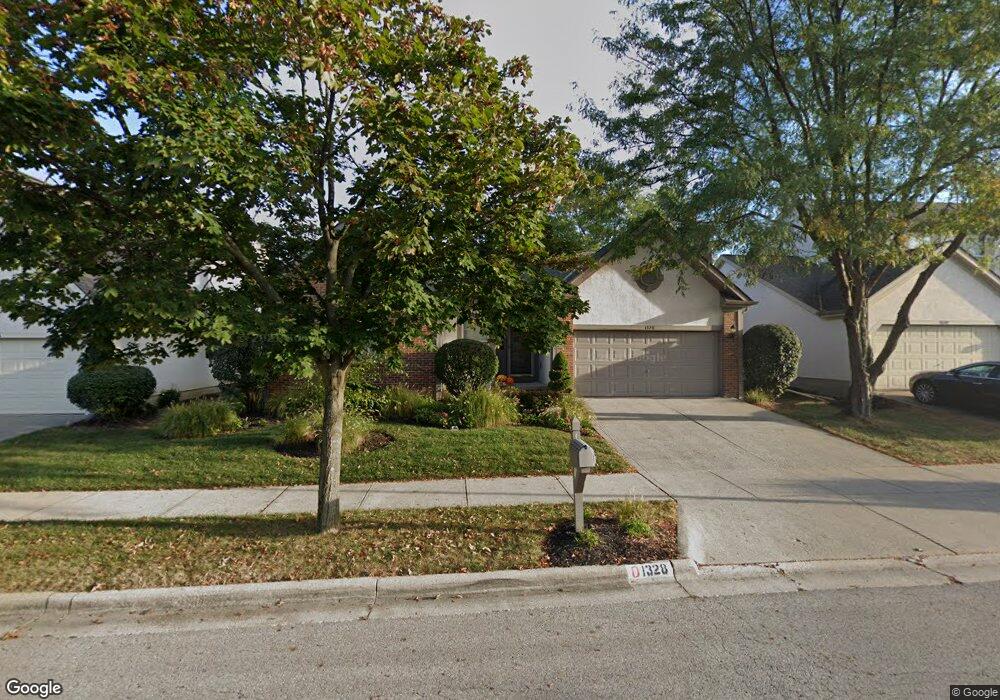
1328 Sandstone Loop S Westerville, OH 43081
Estimated Value: $368,558 - $409,000
3
Beds
2
Baths
1,616
Sq Ft
$243/Sq Ft
Est. Value
About This Home
This home is located at 1328 Sandstone Loop S, Westerville, OH 43081 and is currently estimated at $392,140, approximately $242 per square foot. 1328 Sandstone Loop S is a home located in Franklin County with nearby schools including Mcvay Elementary School, Walnut Springs Middle School, and Westerville-North High School.
Ownership History
Date
Name
Owned For
Owner Type
Purchase Details
Closed on
Oct 31, 2003
Sold by
Millar Michael W and Millar Lona L
Bought by
Starr Christine M
Current Estimated Value
Home Financials for this Owner
Home Financials are based on the most recent Mortgage that was taken out on this home.
Original Mortgage
$151,800
Outstanding Balance
$69,444
Interest Rate
5.81%
Mortgage Type
Purchase Money Mortgage
Estimated Equity
$322,696
Purchase Details
Closed on
Aug 27, 2003
Sold by
Leiner Matthew B and Leiner Marlene E
Bought by
Millar Michael W and Millar Lona L
Home Financials for this Owner
Home Financials are based on the most recent Mortgage that was taken out on this home.
Original Mortgage
$151,800
Interest Rate
6.18%
Mortgage Type
Purchase Money Mortgage
Purchase Details
Closed on
Jan 24, 2003
Sold by
Stegmiller Linda C and Estate Of Rita J Lee
Bought by
Leiner Matthew B and Leiner Marlene E
Purchase Details
Closed on
Mar 21, 1994
Bought by
Lee Rita J
Purchase Details
Closed on
Sep 2, 1993
Purchase Details
Closed on
Mar 4, 1993
Create a Home Valuation Report for This Property
The Home Valuation Report is an in-depth analysis detailing your home's value as well as a comparison with similar homes in the area
Home Values in the Area
Average Home Value in this Area
Purchase History
| Date | Buyer | Sale Price | Title Company |
|---|---|---|---|
| Starr Christine M | $189,800 | -- | |
| Millar Michael W | $189,800 | -- | |
| Leiner Matthew B | $175,000 | Title First Agency Inc | |
| Lee Rita J | $146,600 | -- | |
| -- | $222,500 | -- | |
| -- | -- | -- |
Source: Public Records
Mortgage History
| Date | Status | Borrower | Loan Amount |
|---|---|---|---|
| Open | Starr Christine M | $151,800 | |
| Previous Owner | Millar Michael W | $151,800 |
Source: Public Records
Tax History Compared to Growth
Tax History
| Year | Tax Paid | Tax Assessment Tax Assessment Total Assessment is a certain percentage of the fair market value that is determined by local assessors to be the total taxable value of land and additions on the property. | Land | Improvement |
|---|---|---|---|---|
| 2024 | $6,016 | $105,810 | $28,000 | $77,810 |
| 2023 | $5,886 | $105,805 | $28,000 | $77,805 |
| 2022 | $8,393 | $76,590 | $15,580 | $61,010 |
| 2021 | $5,627 | $76,590 | $15,580 | $61,010 |
| 2020 | $5,611 | $76,590 | $15,580 | $61,010 |
| 2019 | $4,960 | $63,920 | $12,990 | $50,930 |
| 2018 | $4,833 | $63,920 | $12,990 | $50,930 |
| 2017 | $4,919 | $63,920 | $12,990 | $50,930 |
| 2016 | $4,960 | $59,160 | $17,610 | $41,550 |
| 2015 | $4,804 | $59,160 | $17,610 | $41,550 |
| 2014 | $4,807 | $59,160 | $17,610 | $41,550 |
| 2013 | $2,400 | $59,150 | $17,605 | $41,545 |
Source: Public Records
Map
Nearby Homes
- 1201 Wallean Dr
- 1368 Nutmeg Ct
- 90 Spring Creek Dr
- 969 Farrington Dr
- 1146 Forest Rise Dr
- 613 Valley Wood Ct
- 1209 Chatham Ridge Rd
- 73 Keethler Dr S
- 750 Autumn Branch Rd
- 737 Autumn Branch Rd
- 994 Autumn Lake Ct
- 203 N Hempstead Rd
- 1260 Autumn Park Ct
- 192 Buckeye Ct
- 768 Collingwood Dr
- 974 Lakeland Dr
- 371 Delaware Dr
- 461 Delaware Ct
- 182 Hillcrest Dr
- 6452 Rockhold Dr
- 1324 Sandstone Loop S
- 1332 Sandstone Loop S
- 1331 Cobblestone Ave
- 1336 Sandstone Loop S
- 1320 Sandstone Loop S
- 1333 Cobblestone Ave
- 1329 Cobblestone Ave
- 1331 Sandstone Loop S
- 1327 Sandstone Loop S
- 1335 Sandstone Loop S
- 1327 Cobblestone Ave
- 1323 Sandstone Loop S
- 1340 Sandstone Loop S
- 146 Cobblestone Ave E
- 1339 Sandstone Loop S
- 141 Cobblestone Ave E
- 1321 Sandstone Loop S
- 153 Sandstone Loop E
- 1344 Sandstone Loop S
- 157 Sandstone Loop W