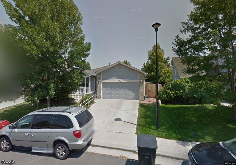
13280 Columbine Ct Thornton, CO 80241
Signal Creek NeighborhoodEstimated Value: $552,535 - $607,000
3
Beds
3
Baths
1,759
Sq Ft
$334/Sq Ft
Est. Value
About This Home
This home is located at 13280 Columbine Ct, Thornton, CO 80241 and is currently estimated at $588,384, approximately $334 per square foot. 13280 Columbine Ct is a home located in Adams County with nearby schools including Tarver Elementary School, Century Middle School, and Horizon High School.
Ownership History
Date
Name
Owned For
Owner Type
Purchase Details
Closed on
Jan 26, 1999
Sold by
Village Homes Of Colorado Inc
Bought by
Schmuck Gary L and Duffy Schmuck Patricia J
Current Estimated Value
Home Financials for this Owner
Home Financials are based on the most recent Mortgage that was taken out on this home.
Original Mortgage
$169,300
Outstanding Balance
$39,866
Interest Rate
6.68%
Estimated Equity
$548,518
Create a Home Valuation Report for This Property
The Home Valuation Report is an in-depth analysis detailing your home's value as well as a comparison with similar homes in the area
Home Values in the Area
Average Home Value in this Area
Purchase History
| Date | Buyer | Sale Price | Title Company |
|---|---|---|---|
| Schmuck Gary L | $178,215 | Land Title |
Source: Public Records
Mortgage History
| Date | Status | Borrower | Loan Amount |
|---|---|---|---|
| Open | Schmuck Gary L | $169,300 |
Source: Public Records
Tax History Compared to Growth
Tax History
| Year | Tax Paid | Tax Assessment Tax Assessment Total Assessment is a certain percentage of the fair market value that is determined by local assessors to be the total taxable value of land and additions on the property. | Land | Improvement |
|---|---|---|---|---|
| 2024 | $3,298 | $36,760 | $6,880 | $29,880 |
| 2023 | $3,264 | $42,350 | $7,100 | $35,250 |
| 2022 | $2,620 | $30,730 | $7,300 | $23,430 |
| 2021 | $2,707 | $30,730 | $7,300 | $23,430 |
| 2020 | $2,731 | $31,630 | $7,510 | $24,120 |
| 2019 | $2,737 | $31,630 | $7,510 | $24,120 |
| 2018 | $2,525 | $29,140 | $7,490 | $21,650 |
| 2017 | $2,295 | $29,140 | $7,490 | $21,650 |
| 2016 | $1,747 | $24,220 | $4,540 | $19,680 |
| 2015 | $1,745 | $16,260 | $3,050 | $13,210 |
| 2014 | $2,472 | $22,390 | $3,580 | $18,810 |
Source: Public Records
Map
Nearby Homes
- 2746 E 132nd Place
- 2788 E 132nd Cir
- 2691 E 132nd Ave
- 13540 Detroit St
- 13398 Race St
- 2275 E 129th Ave
- 12811 Josephine Ct
- 13560 High Cir
- 12829 Claude Place
- 2883 E 136th Place
- 13485 Marion St
- 3022 E 137th Place
- 2420 E 127th Ave
- 2552 E 126th Way
- 12905 Lafayette St Unit H
- 12931 Lafayette St Unit G
- 1162 E 130th Ave Unit B
- 13080 Harrison Dr
- 13758 Cook St
- 13068 Harrison Dr
- 13272 Columbine Ct
- 13284 Columbine Ct
- 13264 Columbine Ct
- 13317 Elizabeth St
- 13321 Elizabeth St
- 13288 Columbine Ct
- 13331 Elizabeth St
- 13311 Elizabeth St
- 13279 Columbine Ct
- 13269 Columbine Ct
- 13260 Columbine Ct
- 13292 Columbine Ct
- 13341 Elizabeth St
- 13309 Elizabeth St
- 13257 Columbine Ct
- 13256 Columbine Ct
- 13302 Columbine Cir
- 13361 Elizabeth St
- 13307 Elizabeth St
- 13296 Columbine Ct