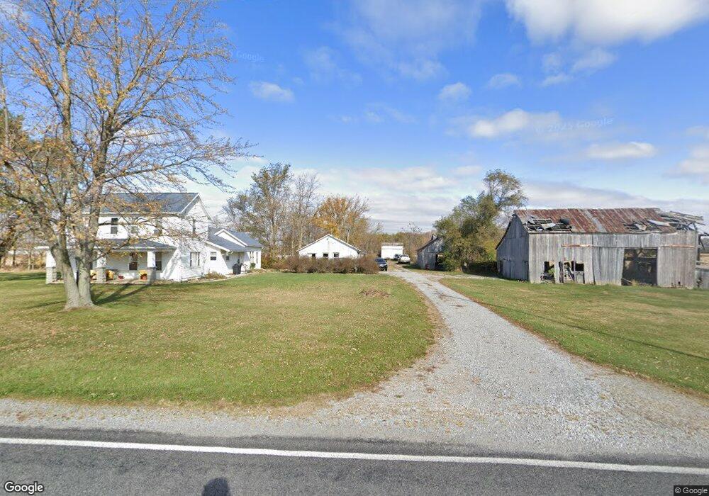
13287 National Rd Wapakoneta, OH 45895
Estimated Value: $304,729 - $337,000
3
Beds
2
Baths
2,372
Sq Ft
$134/Sq Ft
Est. Value
About This Home
This home is located at 13287 National Rd, Wapakoneta, OH 45895 and is currently estimated at $316,932, approximately $133 per square foot. 13287 National Rd is a home located in Auglaize County with nearby schools including Cridersville Elementary School, Wapakoneta High School, and Wapakoneta Middle School.
Ownership History
Date
Name
Owned For
Owner Type
Purchase Details
Closed on
Jun 13, 2025
Sold by
Epperson Beth A and Ruppert Michael S
Bought by
Ruppert David Shawn and Ruppert Emily
Current Estimated Value
Home Financials for this Owner
Home Financials are based on the most recent Mortgage that was taken out on this home.
Original Mortgage
$230,000
Outstanding Balance
$230,000
Interest Rate
6.76%
Mortgage Type
New Conventional
Estimated Equity
$86,932
Purchase Details
Closed on
Sep 26, 2018
Sold by
Ruppert Paula J
Bought by
Ruppert Michael S and Cousino Beth A
Purchase Details
Closed on
Jun 30, 1995
Bought by
Ruppert David G
Purchase Details
Closed on
Apr 1, 1987
Create a Home Valuation Report for This Property
The Home Valuation Report is an in-depth analysis detailing your home's value as well as a comparison with similar homes in the area
Home Values in the Area
Average Home Value in this Area
Purchase History
| Date | Buyer | Sale Price | Title Company |
|---|---|---|---|
| Ruppert David Shawn | $300,000 | American Legacy Title | |
| Ruppert Michael S | -- | None Available | |
| Ruppert David G | -- | -- | |
| -- | $61,000 | -- |
Source: Public Records
Mortgage History
| Date | Status | Borrower | Loan Amount |
|---|---|---|---|
| Open | Ruppert David Shawn | $230,000 | |
| Previous Owner | Ruppert David G | $30,000 | |
| Previous Owner | Ruppert David G | $90,000 |
Source: Public Records
Tax History Compared to Growth
Tax History
| Year | Tax Paid | Tax Assessment Tax Assessment Total Assessment is a certain percentage of the fair market value that is determined by local assessors to be the total taxable value of land and additions on the property. | Land | Improvement |
|---|---|---|---|---|
| 2024 | $3,598 | $72,320 | $31,820 | $40,500 |
| 2023 | $2,129 | $72,320 | $31,820 | $40,500 |
| 2022 | $2,253 | $70,000 | $27,010 | $42,990 |
| 2021 | $2,233 | $70,000 | $27,010 | $42,990 |
| 2020 | $1,128 | $70,000 | $27,006 | $42,994 |
| 2019 | $1,849 | $57,376 | $22,138 | $35,238 |
| 2018 | $1,855 | $57,376 | $22,138 | $35,238 |
| 2017 | $1,845 | $57,376 | $22,138 | $35,238 |
| 2016 | $1,560 | $50,044 | $19,072 | $30,972 |
| 2015 | $1,558 | $50,044 | $19,072 | $30,972 |
| 2014 | $1,549 | $50,044 | $19,072 | $30,972 |
| 2013 | $1,431 | $45,938 | $14,966 | $30,972 |
Source: Public Records
Map
Nearby Homes
- 3650 Redbud Ln
- 3680 Yoakam Rd
- 311 Marcella Ln
- 3523 Woodhaven Ln
- 3495 Woodhaven Ln
- 310 W Main St
- 2638 Summer Rambo Ct
- 2648 Summer Rambo Ct
- 3648 Hiawatha Trail
- 2691 Jonathan Dr
- 2613 Jonathon Dr
- 4268 Blue Spruce Ln
- 2517 Hall Dr
- 4039 Magnolia
- 137 Caribou Cir
- 3039 Lakeshore Dr
- 4475 Wintergreen Dr
- 3744 Linfield Ln
- 4075 Yellowood St
- 212 S Oak St
- 13554 National Rd
- 20880 S Wapakoneta Rd
- 20573 S Wapakoneta Rd
- 12918 National Rd
- 13686 National Rd
- 5545 S Wapakoneta Rd
- 13734 National Rd
- 20404 State Route 501
- 13694 National Rd
- 20322 S Wapakoneta Rd
- 12730 National Rd
- 13839 National Rd
- 12680 National Rd
- 5267 Norfolk St
- 5261 Norfolk St
- 20238 State Route 501
- 13887 National Rd