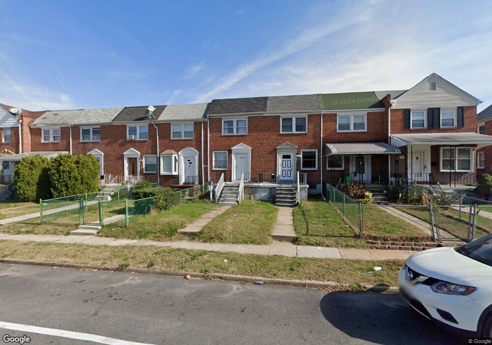
1329 Broening Hwy Baltimore, MD 21224
O'Donnell Heights NeighborhoodEstimated Value: $125,000 - $152,004
2
Beds
1
Bath
840
Sq Ft
$165/Sq Ft
Est. Value
About This Home
This home is located at 1329 Broening Hwy, Baltimore, MD 21224 and is currently estimated at $138,502, approximately $164 per square foot. 1329 Broening Hwy is a home located in Baltimore City with nearby schools including Graceland Park-O'Donnell Heights Elementary/Middle School, Booker T. Washington Middle School, and Patterson High School.
Ownership History
Date
Name
Owned For
Owner Type
Purchase Details
Closed on
Feb 21, 2011
Sold by
Malik Usman F and Malik Mohammed F
Bought by
Torres Nillely Velazquez
Current Estimated Value
Purchase Details
Closed on
Sep 5, 2006
Sold by
Washington Carlos
Bought by
Malik Mohammed F
Home Financials for this Owner
Home Financials are based on the most recent Mortgage that was taken out on this home.
Original Mortgage
$75,000
Interest Rate
7%
Mortgage Type
Purchase Money Mortgage
Purchase Details
Closed on
May 2, 2000
Sold by
Walter C Elberson Wf
Bought by
Washington Carlos
Create a Home Valuation Report for This Property
The Home Valuation Report is an in-depth analysis detailing your home's value as well as a comparison with similar homes in the area
Home Values in the Area
Average Home Value in this Area
Purchase History
| Date | Buyer | Sale Price | Title Company |
|---|---|---|---|
| Torres Nillely Velazquez | $53,000 | None Available | |
| Malik Mohammed F | $85,000 | -- | |
| Washington Carlos | $41,400 | -- |
Source: Public Records
Mortgage History
| Date | Status | Borrower | Loan Amount |
|---|---|---|---|
| Previous Owner | Malik Mohammed F | $75,000 | |
| Previous Owner | Malik Mohammed F | $10,000 |
Source: Public Records
Tax History Compared to Growth
Tax History
| Year | Tax Paid | Tax Assessment Tax Assessment Total Assessment is a certain percentage of the fair market value that is determined by local assessors to be the total taxable value of land and additions on the property. | Land | Improvement |
|---|---|---|---|---|
| 2025 | $2,198 | $99,400 | $15,000 | $84,400 |
| 2024 | $2,198 | $93,600 | $0 | $0 |
| 2023 | $2,062 | $87,800 | $0 | $0 |
| 2022 | $1,935 | $82,000 | $15,000 | $67,000 |
| 2021 | $1,847 | $78,267 | $0 | $0 |
| 2020 | $1,759 | $74,533 | $0 | $0 |
| 2019 | $1,663 | $70,800 | $15,000 | $55,800 |
| 2018 | $1,671 | $70,800 | $15,000 | $55,800 |
| 2017 | $1,671 | $70,800 | $0 | $0 |
| 2016 | $1,831 | $79,200 | $0 | $0 |
| 2015 | $1,831 | $78,567 | $0 | $0 |
| 2014 | $1,831 | $77,933 | $0 | $0 |
Source: Public Records
Map
Nearby Homes
- 6109 Bessemer Ave
- 1600 Charlotte Ave
- 6424 Bushey St
- 6302 Brown Ave
- 6321 Brown Ave
- 6609 Bushey St
- 6705 Gary Ave
- 724 Umbra St
- 6707 1/2 Gary Ave
- 6714 Boston Ave
- 6620 Bushey St
- 6700 Hudson St
- 5905 O Donnell St
- 705 Tolna St
- 6728 Boston Ave
- 6628 Hartwait St
- 466 Hornel St
- 464 Hornel St
- 625 Savage St
- 714 Rappolla St
- 1331 Broening Hwy
- 1333 Broening Hwy
- 1327 Broening Hwy
- 1335 Broening Hwy
- 1325 Broening Hwy
- 1323 Broening Hwy
- 1337 Broening Hwy
- 1321 Broening Hwy
- 1339 Broening Hwy
- 1319 Broening Hwy
- 1341 Broening Hwy
- 1343 Broening Hwy
- 1317 Broening Hwy
- 1345 Broening Hwy
- 1347 Broening Hwy
- 1315 Broening Hwy
- 1349 Broening Hwy
- 1313 Broening Hwy
- 1311 Broening Hwy
- 1351 Broening Hwy