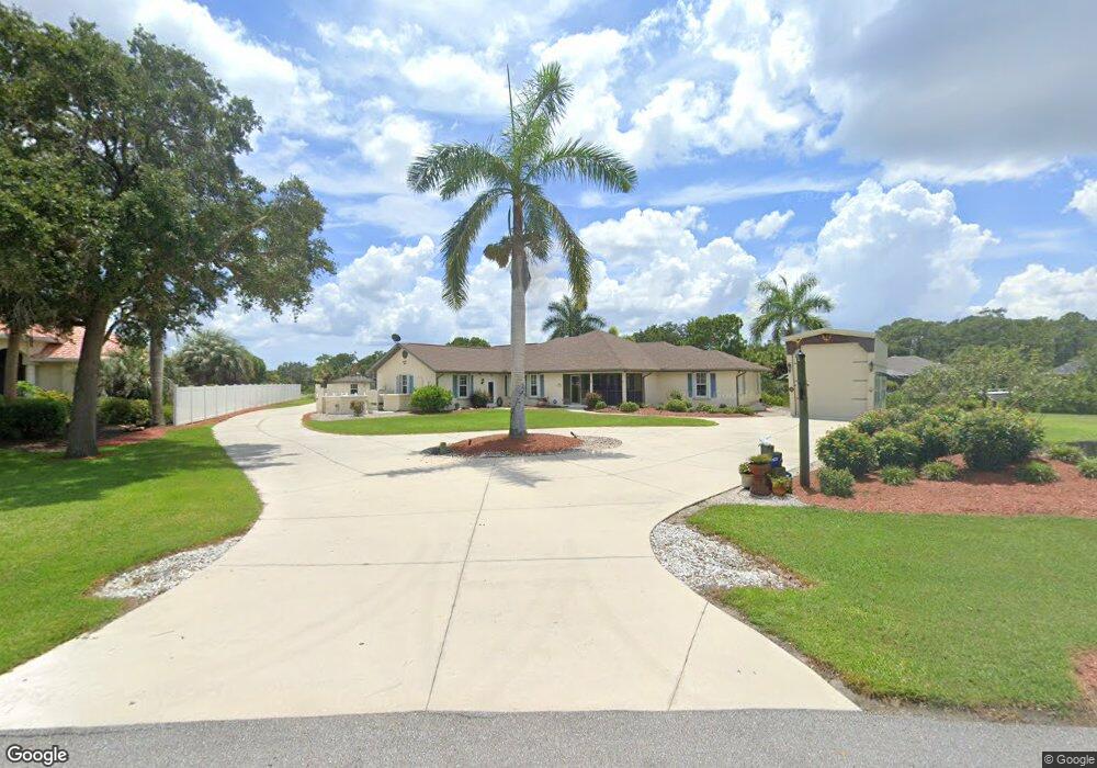
1329 Liggett Cir Port Charlotte, FL 33953
Northwest Port Charlotte NeighborhoodEstimated Value: $568,000 - $1,353,000
3
Beds
3
Baths
2,469
Sq Ft
$342/Sq Ft
Est. Value
About This Home
This home is located at 1329 Liggett Cir, Port Charlotte, FL 33953 and is currently estimated at $845,438, approximately $342 per square foot. 1329 Liggett Cir is a home located in Charlotte County with nearby schools including Liberty Elementary School, Murdock Middle School, and Port Charlotte High School.
Ownership History
Date
Name
Owned For
Owner Type
Purchase Details
Closed on
Nov 19, 1999
Sold by
Wiliams Stella S
Bought by
Green Timothy J and Green Francine L
Current Estimated Value
Purchase Details
Closed on
Aug 31, 1999
Sold by
Stoner Patricia A
Bought by
Green Timothy J and Green Francine L
Home Financials for this Owner
Home Financials are based on the most recent Mortgage that was taken out on this home.
Original Mortgage
$140,000
Interest Rate
7.5%
Create a Home Valuation Report for This Property
The Home Valuation Report is an in-depth analysis detailing your home's value as well as a comparison with similar homes in the area
Home Values in the Area
Average Home Value in this Area
Purchase History
| Date | Buyer | Sale Price | Title Company |
|---|---|---|---|
| Green Timothy J | $18,000 | -- | |
| Green Timothy J | $210,000 | -- |
Source: Public Records
Mortgage History
| Date | Status | Borrower | Loan Amount |
|---|---|---|---|
| Previous Owner | Green Timothy J | $140,000 |
Source: Public Records
Tax History Compared to Growth
Tax History
| Year | Tax Paid | Tax Assessment Tax Assessment Total Assessment is a certain percentage of the fair market value that is determined by local assessors to be the total taxable value of land and additions on the property. | Land | Improvement |
|---|---|---|---|---|
| 2023 | $5,135 | $269,528 | $0 | $0 |
| 2022 | $4,979 | $262,671 | $0 | $0 |
| 2021 | $4,987 | $255,020 | $0 | $0 |
| 2020 | $4,902 | $251,499 | $0 | $0 |
| 2019 | $4,782 | $245,845 | $0 | $0 |
| 2018 | $4,479 | $241,261 | $0 | $0 |
| 2017 | $4,442 | $236,299 | $0 | $0 |
| 2016 | $4,422 | $231,439 | $0 | $0 |
| 2015 | $4,068 | $213,693 | $0 | $0 |
| 2014 | $3,842 | $211,997 | $0 | $0 |
Source: Public Records
Map
Nearby Homes
- 1288 Wheatley St
- 1343 Underhill Cir
- 1392 Liggett Cir
- 12444 Eisenhower Dr
- 12518 Eisenhower Dr
- 12308 Eisenhower Dr
- 13495 Eisenhower Dr
- 13487 Eisenhower Dr
- 1221 Underhill Cir
- 1259 Underhill Cir
- 12301 Endicott Ln Unit 10
- 1369 Glanmore Dr
- 1310 Braklet Terrace
- 12281 Greenleaf Ln
- 12345 Greenleaf Ln
- 12360 Greenleaf Ln
- 12262 Toynbee Ln
- 12280 Greenleaf Ln
- 12256 Corporal Cir
- 12477 Eisenhower Dr Unit 6
- 1341 Liggett Cir
- 1338 Liggett Cir
- 1309 Liggett Cir
- 1353 Liggett Cir
- 1308 Liggett Cir
- 1296 Wheatley St
- 1304 Wheatley St
- 1363 Liggett Cir
- 1320 Wheatley St
- 1293 Liggett Cir
- 1312 Wheatley St
- 1371 Liggett Cir
- 1292 Liggett Cir
- 1328 Wheatley St
- 1311 Underhill Cir
- 1303 Underhill Cir
- 1284 Liggett Cir
- 12368 Toynbee Ln Wheatley St
- 1379 Liggett Cir
- 1338 Wheatley St