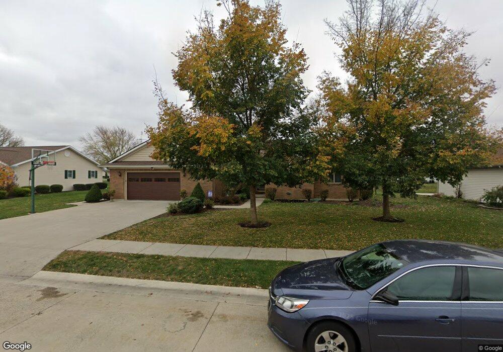
1329 Michael Ave Celina, OH 45822
Estimated Value: $354,803 - $475,000
3
Beds
3
Baths
1,837
Sq Ft
$216/Sq Ft
Est. Value
About This Home
This home is located at 1329 Michael Ave, Celina, OH 45822 and is currently estimated at $397,451, approximately $216 per square foot. 1329 Michael Ave is a home located in Mercer County with nearby schools including Celina Middle School, Celina High School, and Immaculate Conception School.
Ownership History
Date
Name
Owned For
Owner Type
Purchase Details
Closed on
Apr 5, 2006
Sold by
Howell Steven Philip and Howell Phyllis Ann
Bought by
King Jason D and King Joel L
Current Estimated Value
Home Financials for this Owner
Home Financials are based on the most recent Mortgage that was taken out on this home.
Original Mortgage
$150,000
Outstanding Balance
$83,638
Interest Rate
6.33%
Mortgage Type
New Conventional
Estimated Equity
$313,813
Create a Home Valuation Report for This Property
The Home Valuation Report is an in-depth analysis detailing your home's value as well as a comparison with similar homes in the area
Home Values in the Area
Average Home Value in this Area
Purchase History
| Date | Buyer | Sale Price | Title Company |
|---|---|---|---|
| King Jason D | $200,520 | None Available |
Source: Public Records
Mortgage History
| Date | Status | Borrower | Loan Amount |
|---|---|---|---|
| Open | King Jason D | $150,000 |
Source: Public Records
Tax History
| Year | Tax Paid | Tax Assessment Tax Assessment Total Assessment is a certain percentage of the fair market value that is determined by local assessors to be the total taxable value of land and additions on the property. | Land | Improvement |
|---|---|---|---|---|
| 2025 | $4,167 | $105,710 | $13,410 | $92,300 |
| 2024 | $4,171 | $105,710 | $13,410 | $92,300 |
| 2023 | $4,171 | $105,710 | $13,410 | $92,300 |
| 2022 | $3,620 | $80,150 | $9,870 | $70,280 |
| 2021 | $3,629 | $80,150 | $9,870 | $70,280 |
| 2020 | $3,040 | $80,150 | $9,870 | $70,280 |
| 2019 | $2,743 | $67,840 | $8,090 | $59,750 |
| 2018 | $2,851 | $67,840 | $8,090 | $59,750 |
| 2017 | $744 | $67,840 | $8,090 | $59,750 |
| 2016 | $3,003 | $72,280 | $8,820 | $63,460 |
| 2015 | $2,915 | $72,280 | $8,820 | $63,460 |
| 2014 | $2,859 | $70,740 | $8,820 | $61,920 |
| 2013 | $2,787 | $64,900 | $8,090 | $56,810 |
Source: Public Records
Map
Nearby Homes
- 1312 Michael Ave
- 1001 N Sugar St
- 908 N Sugar St
- 906 N Sugar St
- 905 N Walnut St
- 115 Touvelle St
- 680 N Main St
- 206 Magnolia St
- 308 Dogwood Dr
- 316 Dogwood Dr
- 120 E Blake St
- 609 N Cherry St
- 1021 Hemlock St
- 1109 Shimp Dr
- 116 S Elm St
- 1201 Lilac Dr
- 1018 Lilac St
- 526 Willow St
- 328 E Livingston St
- 319 E Fayette St
- 1325 Michael Ave
- 1333 Michael Ave
- 1224 Touvelle St
- 1232 Touvelle St
- 1328 Michael Ave
- 1324 Michael Ave
- 1321 Michael Ave
- 1337 Michael Ave
- 1332 Michael Ave
- 1220 Touvelle St
- 1236 Touvelle St
- 1320 Michael Ave
- 1336 Michael Ave
- 1421 James Dr
- 1317 Michael Ave
- 1417 James Dr
- 1341 Michael Ave
- 1425 James Dr
- 1316 Michael Ave
- 1221 Touvelle St
Your Personal Tour Guide
Ask me questions while you tour the home.