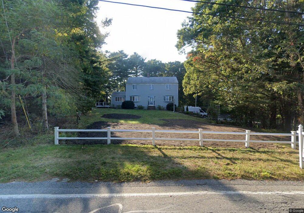
1329 Santuit-Newtown Rd Barnstable, MA 02635
Cotuit NeighborhoodEstimated Value: $1,028,692 - $1,044,000
4
Beds
3
Baths
2,184
Sq Ft
$475/Sq Ft
Est. Value
About This Home
This home is located at 1329 Santuit-Newtown Rd, Barnstable, MA 02635 and is currently estimated at $1,036,673, approximately $474 per square foot. 1329 Santuit-Newtown Rd is a home located in Barnstable County with nearby schools including West Villages Elementary School, Barnstable United Elementary School, and Barnstable Intermediate School.
Ownership History
Date
Name
Owned For
Owner Type
Purchase Details
Closed on
May 16, 2025
Sold by
Catini Emp Ma One Llc
Bought by
Catini Ma Business Llc
Current Estimated Value
Purchase Details
Closed on
Apr 23, 2024
Sold by
Santuit Newtown Rt and Flick
Bought by
Catini Emp Ma One Llc
Purchase Details
Closed on
Jul 7, 2023
Sold by
Heino Jon W Est and Heino
Bought by
Santuit -Newtown Rt and Flick
Purchase Details
Closed on
Jan 22, 2010
Sold by
Heino Jon W and Heino Kathleen A
Bought by
Heino Jon W and Heino Kathleen A
Purchase Details
Closed on
Sep 29, 2004
Sold by
Heino Jon W and Heino Kathleen A
Bought by
Heino Christopher and Heino Jon W
Purchase Details
Closed on
Jan 4, 1995
Sold by
Phipps Wayne and Phipps Barbara B
Bought by
Heino Jon W and Heino Kathleen A
Create a Home Valuation Report for This Property
The Home Valuation Report is an in-depth analysis detailing your home's value as well as a comparison with similar homes in the area
Home Values in the Area
Average Home Value in this Area
Purchase History
| Date | Buyer | Sale Price | Title Company |
|---|---|---|---|
| Catini Ma Business Llc | -- | -- | |
| Catini Ma Business Llc | -- | -- | |
| Catini Ma Business Llc | -- | -- | |
| Catini Ma Business Llc | -- | -- | |
| Catini Emp Ma One Llc | $750,000 | None Available | |
| Catini Emp Ma One Llc | $750,000 | None Available | |
| Catini Emp Ma One Llc | $750,000 | None Available | |
| Catini Emp Ma One Llc | $750,000 | None Available | |
| Santuit -Newtown Rt | $575,000 | None Available | |
| Santuit -Newtown Rt | $575,000 | None Available | |
| Santuit -Newtown Rt | $575,000 | None Available | |
| Santuit -Newtown Rt | $575,000 | None Available | |
| Santuit -Newtown Rt | $575,000 | None Available | |
| Santuit -Newtown Rt | $575,000 | None Available | |
| Heino Jon W | -- | -- | |
| Heino Jon W | -- | -- | |
| Heino Christopher | -- | -- | |
| Heino Christopher | -- | -- | |
| Heino Jon W | $180,800 | -- | |
| Heino Jon W | $180,800 | -- | |
| Heino Jon W | $180,800 | -- | |
| Heino Jon W | $180,800 | -- |
Source: Public Records
Tax History
| Year | Tax Paid | Tax Assessment Tax Assessment Total Assessment is a certain percentage of the fair market value that is determined by local assessors to be the total taxable value of land and additions on the property. | Land | Improvement |
|---|---|---|---|---|
| 2025 | $6,526 | $781,600 | $176,300 | $605,300 |
| 2024 | $5,814 | $737,800 | $176,300 | $561,500 |
| 2023 | $5,347 | $638,800 | $160,300 | $478,500 |
| 2022 | $5,243 | $507,100 | $118,800 | $388,300 |
| 2021 | $5,233 | $474,000 | $118,800 | $355,200 |
| 2020 | $5,082 | $434,000 | $118,800 | $315,200 |
| 2019 | $5,159 | $434,300 | $118,800 | $315,500 |
| 2018 | $4,676 | $393,600 | $125,000 | $268,600 |
| 2017 | $4,550 | $385,600 | $125,000 | $260,600 |
| 2016 | $4,438 | $385,600 | $125,000 | $260,600 |
| 2015 | $4,269 | $370,600 | $124,000 | $246,600 |
Source: Public Records
Map
Nearby Homes
- 170 Forest Hills Rd
- 1456 Santuit-Newtown Rd
- 78 Brittany Dr
- 75 Bob White Run
- 15 Geraldine Rd
- 63 Deer Ridge Rd
- 173 Main St
- 45 Pequot Rd
- 4 Bishops Park
- 226 Dunrobin Rd
- 235 Main St
- 22 Stratford Ridge Unit 22
- 244 Wakeby Rd
- 602 Putnam Ave
- 35 Santuit Pond Way Unit 7B
- 16 Spring Brook Ln
- 70 Cape Dr Unit 14D
- 70 Cape Dr Unit 15D
- 70 Cape Dr Unit 11D
- 70 Cape Dr Unit 15D
- 1329 Santuit Newtown Rd
- 1351 Santuit Newtown Rd
- 1329 Newtown
- 1293 Santuit Newtown Rd
- 1293 Santuit-Newtown Rd
- 140 Forest Hills Rd
- 1350 Santuit Newtown Rd
- 1350 Santuit-Newtown Rd
- 181 Forest Hills Rd
- 130 Forest Hills Rd
- 1290 Santuit Newtown Rd
- 145 Forest Hills Rd
- 1373 Santuit-Newtown Rd
- 1373 Santuit Newtown Rd
- 1374 Santuit Newtown Rd
- 133 Forest Hills Rd
- 1374 Santuit-Newtown Rd
- 1274 Santuit Newtown Rd
- 0 Forest Hills Rd
- 121 Forest Hills Rd
Your Personal Tour Guide
Ask me questions while you tour the home.