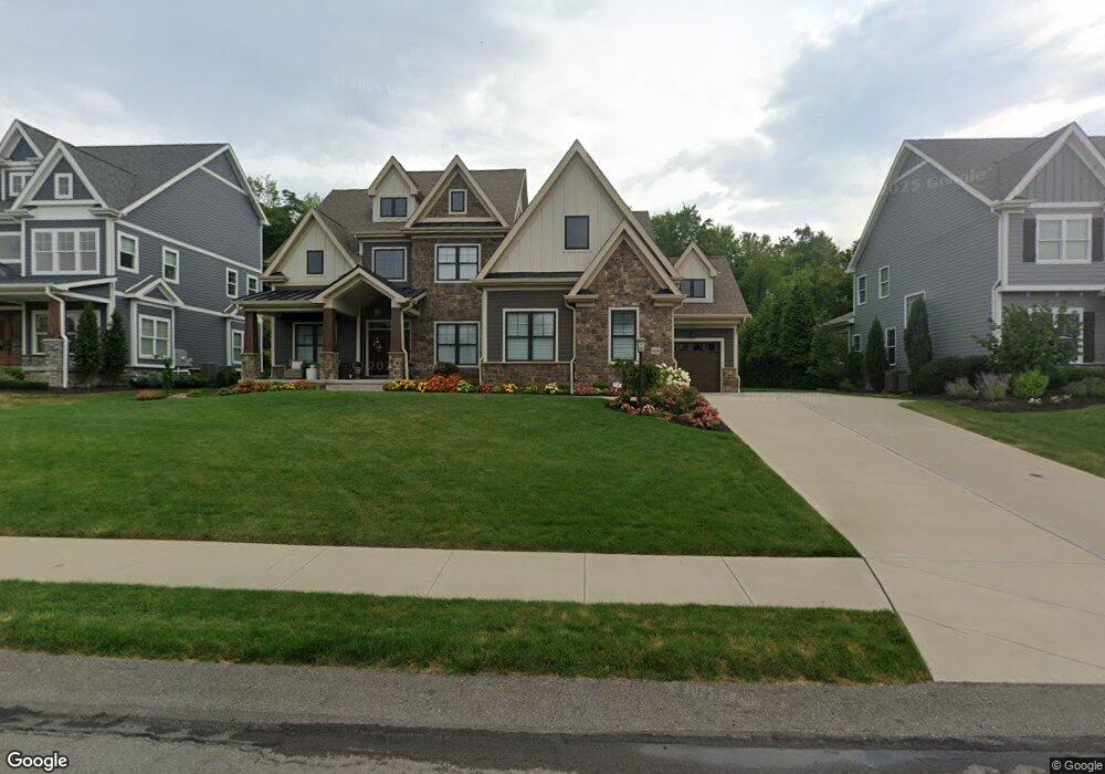
133 Birch Dr Wexford, PA 15090
Pine Township NeighborhoodEstimated Value: $1,573,741 - $1,733,000
4
Beds
5
Baths
5,967
Sq Ft
$274/Sq Ft
Est. Value
About This Home
This home is located at 133 Birch Dr, Wexford, PA 15090 and is currently estimated at $1,633,580, approximately $273 per square foot. 133 Birch Dr is a home with nearby schools including Eden Hall Upper Elementary, Richland Elementary School, and Pine-Richland Middle School.
Ownership History
Date
Name
Owned For
Owner Type
Purchase Details
Closed on
Sep 11, 2020
Sold by
C G Master G P L L C
Bought by
Conley Brianne R and Kordenbrock Eric J
Current Estimated Value
Home Financials for this Owner
Home Financials are based on the most recent Mortgage that was taken out on this home.
Original Mortgage
$788,011
Interest Rate
2.7%
Mortgage Type
New Conventional
Purchase Details
Closed on
Feb 6, 2020
Sold by
Riviera Land Partners Lp
Bought by
Bove Kerry M and Bove Pamela K
Create a Home Valuation Report for This Property
The Home Valuation Report is an in-depth analysis detailing your home's value as well as a comparison with similar homes in the area
Home Values in the Area
Average Home Value in this Area
Purchase History
| Date | Buyer | Sale Price | Title Company |
|---|---|---|---|
| Conley Brianne R | $170,000 | None Available | |
| Bove Kerry M | $171,700 | American General Services |
Source: Public Records
Mortgage History
| Date | Status | Borrower | Loan Amount |
|---|---|---|---|
| Previous Owner | Conley Brianne R | $788,011 |
Source: Public Records
Tax History Compared to Growth
Tax History
| Year | Tax Paid | Tax Assessment Tax Assessment Total Assessment is a certain percentage of the fair market value that is determined by local assessors to be the total taxable value of land and additions on the property. | Land | Improvement |
|---|---|---|---|---|
| 2025 | $21,750 | $859,200 | $98,300 | $760,900 |
| 2024 | $21,750 | $859,200 | $98,300 | $760,900 |
| 2023 | $21,750 | $859,200 | $98,300 | $760,900 |
| 2022 | $22,206 | $859,200 | $98,300 | $760,900 |
| 2021 | $49 | $10,400 | $10,400 | $0 |
| 2020 | $263 | $10,400 | $10,400 | $0 |
| 2019 | $263 | $10,400 | $10,400 | $0 |
Source: Public Records
Map
Nearby Homes
- 131 Birch Dr
- 120 Timothy Rd
- 503 Cambridge Ct
- 690 Pearce Mill Rd
- 2013 Cherry Rd
- 223 Fox Meadow Dr
- 4108 Spruce Rd
- 2015 Cherry Rd
- 124 Fox Meadow Dr
- 9002 Hickory Rd
- 7002 Eagle Rd
- 9007 Hickory Rd
- 300 Mccutcheon Ct
- 340 Fox Meadow Dr
- (Lot 133) 310 Mccutcheon Ct
- 5003 Old Orchard Ln
- (Lot 323) 214 Macfadden Dr
- 1804 Appleridge Ct
- (Lot 115) 557 Macleod Dr
- 104 Broadstone Dr