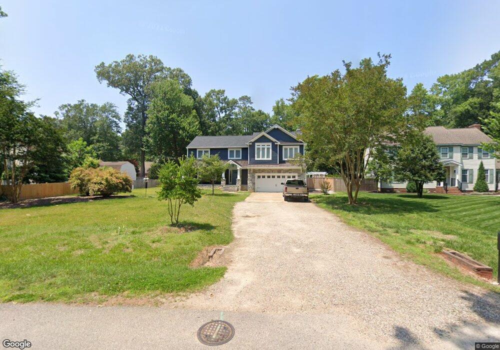
133 Breezy Point Dr Yorktown, VA 23692
Grafton NeighborhoodEstimated Value: $565,000 - $658,534
4
Beds
3
Baths
2,920
Sq Ft
$207/Sq Ft
Est. Value
About This Home
This home is located at 133 Breezy Point Dr, Yorktown, VA 23692 and is currently estimated at $604,384, approximately $206 per square foot. 133 Breezy Point Dr is a home located in York County with nearby schools including Grafton Bethel Elementary School, Grafton Middle School, and Grafton High School.
Ownership History
Date
Name
Owned For
Owner Type
Purchase Details
Closed on
Jun 27, 2003
Sold by
Zudell Steven
Bought by
Stallings Jeffrey
Current Estimated Value
Home Financials for this Owner
Home Financials are based on the most recent Mortgage that was taken out on this home.
Original Mortgage
$205,000
Outstanding Balance
$88,927
Interest Rate
5.53%
Mortgage Type
New Conventional
Estimated Equity
$515,457
Create a Home Valuation Report for This Property
The Home Valuation Report is an in-depth analysis detailing your home's value as well as a comparison with similar homes in the area
Home Values in the Area
Average Home Value in this Area
Purchase History
| Date | Buyer | Sale Price | Title Company |
|---|---|---|---|
| Stallings Jeffrey | $235,000 | -- |
Source: Public Records
Mortgage History
| Date | Status | Borrower | Loan Amount |
|---|---|---|---|
| Open | Stallings Jeffrey | $205,000 |
Source: Public Records
Tax History Compared to Growth
Tax History
| Year | Tax Paid | Tax Assessment Tax Assessment Total Assessment is a certain percentage of the fair market value that is determined by local assessors to be the total taxable value of land and additions on the property. | Land | Improvement |
|---|---|---|---|---|
| 2025 | $4,621 | $624,500 | $138,900 | $485,600 |
| 2024 | $4,621 | $624,500 | $138,900 | $485,600 |
| 2023 | $3,629 | $471,300 | $138,900 | $332,400 |
| 2022 | $3,092 | $396,400 | $138,900 | $257,500 |
| 2021 | $2,957 | $372,000 | $138,900 | $233,100 |
| 2020 | $2,854 | $359,000 | $138,900 | $220,100 |
| 2019 | $4,017 | $352,400 | $132,300 | $220,100 |
| 2018 | $4,017 | $352,400 | $132,300 | $220,100 |
| 2017 | $2,597 | $345,600 | $130,000 | $215,600 |
| 2016 | $2,597 | $345,600 | $130,000 | $215,600 |
| 2015 | -- | $345,600 | $130,000 | $215,600 |
| 2014 | -- | $345,600 | $130,000 | $215,600 |
Source: Public Records
Map
Nearby Homes
- 103 Jonadab Rd
- 132 Breezy Point Dr
- 508 E Woodland Dr
- 405 Octavia Dr
- 107 Goffigans Trace
- 420 Yorkville Rd
- 101 Goffigans Trace
- 203 William Storrs Rd
- 107 William Storrs Rd
- 103 William Storrs Rd
- 102 Octavia Dr
- 119 River Point Dr
- 111 Mill Rd
- 138 Yorkshire Dr
- 100 Chestnut Ct
- 814 Calthrop Neck Rd
- 124 Yorkshire Dr
- 112 Lambs Creek Dr
- 306 Meadowlake Rd
- Lot 81 Smith Farm Estates
- 135 Breezy Point Dr
- 111 Woodland Rd W
- 111 W Woodland Rd
- 113 Woodland Rd W
- 113 W Woodland Rd
- 109 Woodland Rd W
- 109 W Woodland Rd
- 137 Breezy Point Dr
- 310 Lindsay Landing Ln
- 107 W Woodland Rd
- 312 Lindsay Landing Ln
- 107 Woodland Rd W
- 306 Lindsay Landing Ln
- 134 Breezy Point Dr
- 139 Breezy Point Dr
- 123 Breezy Point Dr
- 136 Breezy Point Dr
- 110 Woodland Rd W
- 105 Jonadab Rd
- 110 W Woodland Rd