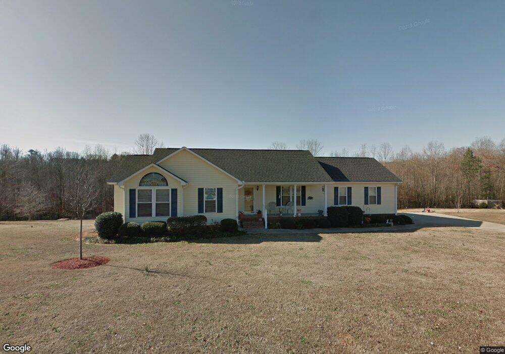
133 Brooke Lee Cir Taylors, SC 29687
Estimated Value: $281,000 - $379,000
3
Beds
2
Baths
1,600
Sq Ft
$209/Sq Ft
Est. Value
About This Home
This home is located at 133 Brooke Lee Cir, Taylors, SC 29687 and is currently estimated at $334,105, approximately $208 per square foot. 133 Brooke Lee Cir is a home located in Greenville County with nearby schools including Mountain View Elementary School, Blue Ridge Middle School, and Blue Ridge High School.
Ownership History
Date
Name
Owned For
Owner Type
Purchase Details
Closed on
May 9, 2025
Sold by
Snyder Julie and Lis Philip
Bought by
Strom Andrew Charles
Current Estimated Value
Home Financials for this Owner
Home Financials are based on the most recent Mortgage that was taken out on this home.
Original Mortgage
$220,000
Outstanding Balance
$219,748
Interest Rate
5.25%
Mortgage Type
New Conventional
Estimated Equity
$114,357
Purchase Details
Closed on
May 28, 2010
Sold by
Staggs William Chad and Staggs April Riddle
Bought by
Snyder Shirley and Snyder Julie
Purchase Details
Closed on
Oct 10, 2003
Sold by
Delta Properties Of Sc Inc
Bought by
Riddle April Lee
Create a Home Valuation Report for This Property
The Home Valuation Report is an in-depth analysis detailing your home's value as well as a comparison with similar homes in the area
Home Values in the Area
Average Home Value in this Area
Purchase History
| Date | Buyer | Sale Price | Title Company |
|---|---|---|---|
| Strom Andrew Charles | $275,000 | None Listed On Document | |
| Snyder Shirley | $150,000 | -- | |
| Riddle April Lee | $16,000 | -- |
Source: Public Records
Mortgage History
| Date | Status | Borrower | Loan Amount |
|---|---|---|---|
| Open | Strom Andrew Charles | $220,000 | |
| Previous Owner | Staggs William Chad | $105,000 | |
| Previous Owner | Staggs William Chad | $11,500 |
Source: Public Records
Tax History Compared to Growth
Tax History
| Year | Tax Paid | Tax Assessment Tax Assessment Total Assessment is a certain percentage of the fair market value that is determined by local assessors to be the total taxable value of land and additions on the property. | Land | Improvement |
|---|---|---|---|---|
| 2024 | $1,003 | $8,010 | $1,210 | $6,800 |
| 2023 | $1,003 | $8,010 | $1,210 | $6,800 |
| 2022 | $936 | $8,010 | $1,210 | $6,800 |
| 2021 | $926 | $8,010 | $1,210 | $6,800 |
| 2020 | $817 | $6,960 | $1,050 | $5,910 |
| 2019 | $812 | $6,960 | $1,050 | $5,910 |
| 2018 | $810 | $6,960 | $1,050 | $5,910 |
| 2017 | $791 | $6,960 | $1,050 | $5,910 |
| 2016 | $753 | $174,140 | $26,300 | $147,840 |
| 2015 | $753 | $174,140 | $26,300 | $147,840 |
| 2014 | $655 | $157,750 | $18,900 | $138,850 |
Source: Public Records
Map
Nearby Homes
- 108 Brooke Lee Cir
- 401 Center Dr
- 15 Otter Ln
- 902 Blue Moon St
- 303 Farmers Market St
- 405 Yellow Bird St
- 203 Bean Springs Ct
- 304 Willow Wynter Ln Unit BRV 62 Crestwind C
- 210 Bean Springs Ct Unit BRV 71 Sweetbay C
- 24 Twiggs Ln Unit FP 2 Teton B
- 22 Twiggs Ln Unit FP 3 Teton A1E
- 308 Willow Wynter Ln Unit BRV 60 Crestwind C
- 303 Willow Wynter Ln Unit BRV 41 Crestwind B
- 301 Willow Wynter Ln Unit BRV 40 Sweetbay B
- 305 Waters Rd
- 514 Coolwater Dr
- 518 Coolwater Dr
- 104 Sawyer Kyle Way
- 0 Center Dr Unit 1565272
- 0 Center Dr Unit 1565271
- 131 Brooke Lee Cir
- 137 Brooke Lee Cir
- 128 Brooke Lee Cir
- 129 Brooke Lee Cir
- 132 Brooke Lee Cir
- 124 Brooke Lee Cir
- 139 Brooke Lee Cir
- 127 Brooke Lee Cir
- 140 Brooke Lee Cir
- 120 Brooke Lee Cir
- 125 Brooke Lee Cir
- 141 Brooke Lee Cir
- 144 Brooke Lee Cir
- 407 Pearle Brook Ln
- 408 Pearle Brook Ln
- 123 Brooke Lee Cir
- 116 Brooke Lee Cir
- 143 Brooke Lee Cir
- 121 Brooke Lee Cir
- 146 Brooke Lee Cir