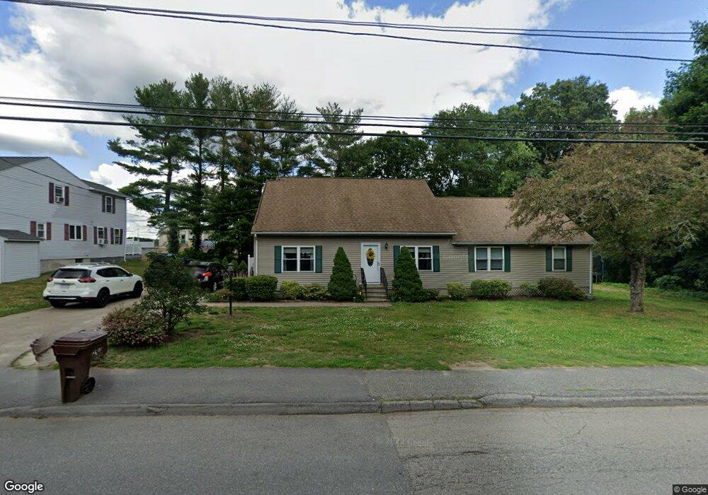
133 Bryn Mawr Ave Auburn, MA 01501
Stoneville NeighborhoodEstimated Value: $447,000 - $660,000
3
Beds
1
Bath
944
Sq Ft
$629/Sq Ft
Est. Value
About This Home
This home is located at 133 Bryn Mawr Ave, Auburn, MA 01501 and is currently estimated at $593,601, approximately $628 per square foot. 133 Bryn Mawr Ave is a home located in Worcester County with nearby schools including Auburn Senior High School and Shrewsbury Montessori School - Auburn Campus.
Ownership History
Date
Name
Owned For
Owner Type
Purchase Details
Closed on
Apr 10, 2002
Sold by
Holmes Linda A and Keefe Michael E
Bought by
Morrow Matthew and Hufnagle-Morrow Linda
Current Estimated Value
Home Financials for this Owner
Home Financials are based on the most recent Mortgage that was taken out on this home.
Original Mortgage
$147,250
Interest Rate
6.84%
Mortgage Type
Purchase Money Mortgage
Purchase Details
Closed on
Jul 12, 1996
Sold by
Benvenuti Anthony and Benvenuti Patricia
Bought by
Keefe Michael E
Purchase Details
Closed on
Jan 13, 1994
Sold by
Fletcher Francis S and Fletcher Deborah C
Bought by
Benvenuti Anthony and Benvenuti Patricia
Purchase Details
Closed on
May 28, 1987
Sold by
Moreno David A
Bought by
Fletcher Deborah C
Create a Home Valuation Report for This Property
The Home Valuation Report is an in-depth analysis detailing your home's value as well as a comparison with similar homes in the area
Home Values in the Area
Average Home Value in this Area
Purchase History
| Date | Buyer | Sale Price | Title Company |
|---|---|---|---|
| Morrow Matthew | $155,000 | -- | |
| Keefe Michael E | $92,500 | -- | |
| Benvenuti Anthony | $75,000 | -- | |
| Fletcher Deborah C | $106,900 | -- |
Source: Public Records
Mortgage History
| Date | Status | Borrower | Loan Amount |
|---|---|---|---|
| Open | Fletcher Deborah C | $241,500 | |
| Closed | Fletcher Deborah C | $147,250 | |
| Previous Owner | Fletcher Deborah C | $19,000 |
Source: Public Records
Tax History Compared to Growth
Tax History
| Year | Tax Paid | Tax Assessment Tax Assessment Total Assessment is a certain percentage of the fair market value that is determined by local assessors to be the total taxable value of land and additions on the property. | Land | Improvement |
|---|---|---|---|---|
| 2025 | $76 | $529,400 | $128,100 | $401,300 |
| 2024 | $7,610 | $509,700 | $122,900 | $386,800 |
| 2023 | $7,503 | $472,500 | $111,700 | $360,800 |
| 2022 | $6,950 | $413,200 | $111,700 | $301,500 |
| 2021 | $6,703 | $369,500 | $98,600 | $270,900 |
| 2020 | $6,483 | $358,900 | $98,600 | $260,300 |
| 2019 | $6,441 | $349,700 | $97,700 | $252,000 |
| 2018 | $5,810 | $341,500 | $91,400 | $250,100 |
| 2017 | $5,841 | $318,500 | $82,900 | $235,600 |
| 2016 | $5,592 | $309,100 | $85,900 | $223,200 |
| 2015 | $5,299 | $307,000 | $85,900 | $221,100 |
| 2014 | $5,146 | $297,600 | $81,800 | $215,800 |
Source: Public Records
Map
Nearby Homes
- 131 Bryn Mawr Ave
- 135 Bryn Mawr Ave
- 132 Bryn Mawr Ave
- 128 Bryn Mawr Ave
- 339 Oxford St N
- 125 Bryn Mawr Ave
- 325 Oxford St N
- 341 Oxford St N
- 126 Bryn Mawr Ave
- 323 Oxford St N
- 34 Swanson Rd
- 319 Oxford St N
- 122 Bryn Mawr Ave
- 137 Bryn Mawr Ave
- 330 Oxford St N
- 332 Oxford St N
- 99 Bryn Mawr Ave
- 317 Oxford St N
- 334 Oxford St N
- 11 Simonds St Unit 15