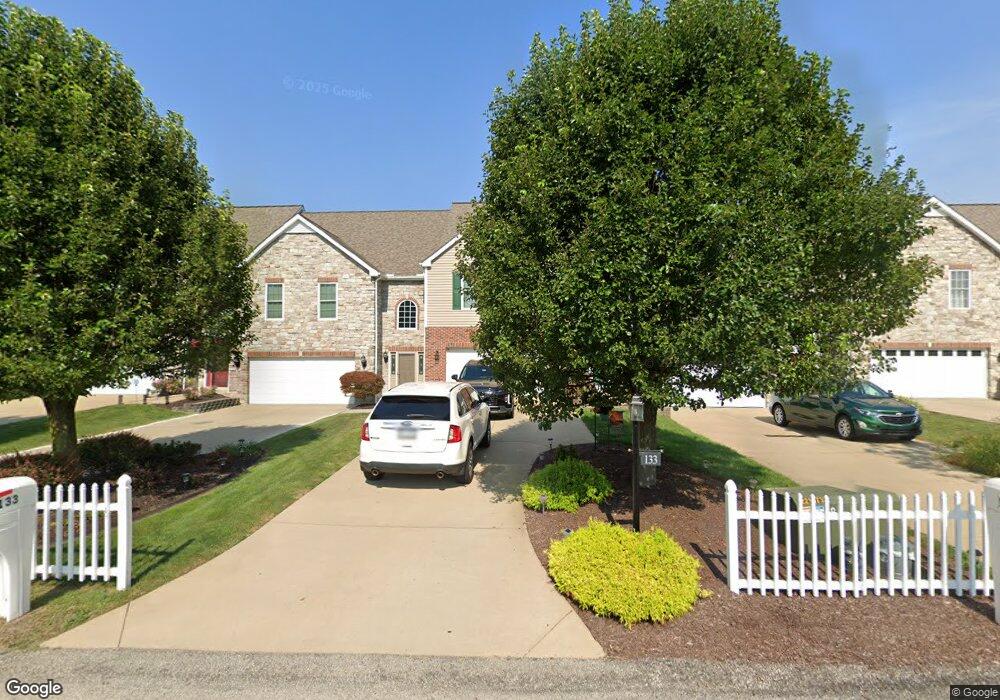
133 Chesnic Dr Canonsburg, PA 15317
Estimated Value: $327,000 - $335,000
3
Beds
3
Baths
2,072
Sq Ft
$159/Sq Ft
Est. Value
About This Home
This home is located at 133 Chesnic Dr, Canonsburg, PA 15317 and is currently estimated at $329,644, approximately $159 per square foot. 133 Chesnic Dr is a home located in Washington County with nearby schools including Canon-Mcmillan Senior High School and Central Christian Academy.
Ownership History
Date
Name
Owned For
Owner Type
Purchase Details
Closed on
Jul 15, 2004
Sold by
Mcfarland Lane Builder In
Bought by
Vinton Robert J
Current Estimated Value
Home Financials for this Owner
Home Financials are based on the most recent Mortgage that was taken out on this home.
Original Mortgage
$149,720
Outstanding Balance
$75,091
Interest Rate
6.28%
Mortgage Type
New Conventional
Estimated Equity
$254,553
Create a Home Valuation Report for This Property
The Home Valuation Report is an in-depth analysis detailing your home's value as well as a comparison with similar homes in the area
Home Values in the Area
Average Home Value in this Area
Purchase History
| Date | Buyer | Sale Price | Title Company |
|---|---|---|---|
| Vinton Robert J | $184,900 | -- |
Source: Public Records
Mortgage History
| Date | Status | Borrower | Loan Amount |
|---|---|---|---|
| Open | Vinton Robert J | $149,720 |
Source: Public Records
Tax History Compared to Growth
Tax History
| Year | Tax Paid | Tax Assessment Tax Assessment Total Assessment is a certain percentage of the fair market value that is determined by local assessors to be the total taxable value of land and additions on the property. | Land | Improvement |
|---|---|---|---|---|
| 2025 | $3,853 | $225,400 | $21,100 | $204,300 |
| 2024 | $3,597 | $225,400 | $21,100 | $204,300 |
| 2023 | $3,597 | $225,400 | $21,100 | $204,300 |
| 2022 | $3,587 | $225,400 | $21,100 | $204,300 |
| 2021 | $3,587 | $225,400 | $21,100 | $204,300 |
| 2020 | $3,406 | $225,400 | $21,100 | $204,300 |
| 2019 | $3,350 | $225,400 | $21,100 | $204,300 |
| 2018 | $3,280 | $225,400 | $21,100 | $204,300 |
| 2017 | $1,047 | $225,400 | $21,100 | $204,300 |
| 2016 | $1,047 | $30,017 | $2,072 | $27,945 |
| 2015 | $3,443 | $30,017 | $2,072 | $27,945 |
| 2014 | $1,092 | $30,017 | $2,072 | $27,945 |
| 2013 | $1,092 | $30,017 | $2,072 | $27,945 |
Source: Public Records
Map
Nearby Homes
- 111 Chesnic Dr
- 573 Chesnic Dr
- 121 Sedeca Dr
- 509 Elm St
- 220 Brae Glen Dr
- 120 Chartiers St
- 144 Cherry St
- 422 Hawthorn Hill Dr
- 447 Hawthorn Hill Dr
- 438 Hawthorn Hill Dr
- 178 Wylie Ave
- Rockford Plan at Magnolia Ridge
- Tucson Plan at Magnolia Ridge
- Truman Plan at Magnolia Ridge
- Birmingham Plan at Magnolia Ridge
- Chattanooga Plan at Magnolia Ridge
- Somerset Plan at Magnolia Ridge
- Boston Plan at Magnolia Ridge
- Waterloo Plan at Magnolia Ridge
- 206 Alexander Ave
- 135 Chesnic Dr
- 131 Chesnic Dr
- 137 Chesnic Dr
- 129 Chesnic Dr
- 129 Chesnic Dr
- 139 Chesnic Dr
- 127 Chesnic Dr
- 141 Chesnic Dr
- 125 Chesnic Dr
- 123 Chesnic Dr
- 0 Chesnic Dr
- 121 Chesnic Dr
- 596 Chesnic Dr
- 119 Chesnic Dr
- 100 Houston Square
- 117 Chesnic Dr
- 124 Chesnic Dr
- 130 Chesnic Dr
- 130 Chesnic Dr
- 115 Chesnic Dr