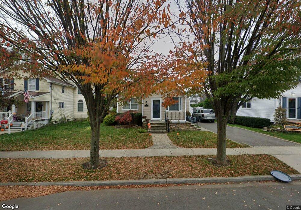
133 Commonwealth Ave Merrick, NY 11566
Estimated Value: $701,000 - $773,940
3
Beds
2
Baths
1,324
Sq Ft
$549/Sq Ft
Est. Value
About This Home
This home is located at 133 Commonwealth Ave, Merrick, NY 11566 and is currently estimated at $726,485, approximately $548 per square foot. 133 Commonwealth Ave is a home located in Nassau County with nearby schools including Merrick Avenue Middle School, Sanford H Calhoun High School, and Grace Christian Academy.
Ownership History
Date
Name
Owned For
Owner Type
Purchase Details
Closed on
May 19, 2016
Sold by
Santiago James and Messina Renee
Bought by
Devlin James and Devlin Kristy
Current Estimated Value
Home Financials for this Owner
Home Financials are based on the most recent Mortgage that was taken out on this home.
Original Mortgage
$399,600
Outstanding Balance
$313,906
Interest Rate
3.59%
Mortgage Type
New Conventional
Estimated Equity
$412,579
Purchase Details
Closed on
May 1, 2006
Sold by
Scales Charles
Bought by
Santiago James
Purchase Details
Closed on
Apr 30, 1996
Sold by
Healy Mary
Bought by
Scales Charles and Scales Kathleen
Home Financials for this Owner
Home Financials are based on the most recent Mortgage that was taken out on this home.
Original Mortgage
$120,348
Interest Rate
7.67%
Create a Home Valuation Report for This Property
The Home Valuation Report is an in-depth analysis detailing your home's value as well as a comparison with similar homes in the area
Home Values in the Area
Average Home Value in this Area
Purchase History
| Date | Buyer | Sale Price | Title Company |
|---|---|---|---|
| Devlin James | $444,000 | Old Republic National Title | |
| Santiago James | $442,900 | -- | |
| Scales Charles | $130,875 | -- |
Source: Public Records
Mortgage History
| Date | Status | Borrower | Loan Amount |
|---|---|---|---|
| Open | Devlin James | $399,600 | |
| Previous Owner | Scales Charles | $120,348 |
Source: Public Records
Tax History
| Year | Tax Paid | Tax Assessment Tax Assessment Total Assessment is a certain percentage of the fair market value that is determined by local assessors to be the total taxable value of land and additions on the property. | Land | Improvement |
|---|---|---|---|---|
| 2025 | $13,265 | $437 | $187 | $250 |
| 2024 | $3,337 | $462 | $198 | $264 |
| 2023 | $14,780 | $489 | $209 | $280 |
| 2022 | $14,780 | $528 | $226 | $302 |
| 2021 | $23,137 | $507 | $217 | $290 |
| 2020 | $17,424 | $928 | $581 | $347 |
| 2019 | $17,653 | $761 | $581 | $180 |
| 2018 | $13,596 | $761 | $0 | $0 |
| 2017 | $6,456 | $761 | $581 | $180 |
| 2016 | $9,387 | $761 | $581 | $180 |
| 2015 | $2,718 | $761 | $581 | $180 |
| 2014 | $2,718 | $761 | $581 | $180 |
| 2013 | $2,572 | $761 | $581 | $180 |
Source: Public Records
Map
Nearby Homes
- 2203 Washington St
- 1811 Bedford Ave
- 160 Bedford Ave
- 29 Babylon Turnpike
- 1931 Miller Place
- 221 Thelma Ave
- 236 Thelma Ave
- 45 Gregory Ave
- 1911 Carroll Ave
- 131 Gregory Ave
- 1729 Gormley Ave
- 80 Dobson Ave
- 2341 Dobson Ave
- 24 Loines Ave
- 138 Hewlett Ave
- 16 Margaret Blvd
- 1763 E Berkshire Rd
- 19 Margaret Blvd
- 1741 Bushwick Ave
- 174 Babylon Turnpike
- 1824 Commonwealth Ave
- 129 Commonwealth Ave
- 1818 Commonwealth Ave
- 1832 Commonwealth Ave
- 127 Commonwealth Ave
- 1812 Commonwealth Ave
- 1825 Stuyvesant Ave
- 126 Stuyvesant Ave
- 1823 Commonwealth Ave
- 119 Commonwealth Ave
- 1815 Stuyvesant Ave
- 128 Commonwealth Ave
- 1817 Commonwealth Ave
- 1829 Stuyvesant Ave
- 1806 Commonwealth Ave
- 126 Commonwealth Ave
- 1811 Stuyvesant Ave
- 1811 Commonwealth Ave
- 118 Stuyvesant Ave
- 122 Commonwealth Ave
Your Personal Tour Guide
Ask me questions while you tour the home.