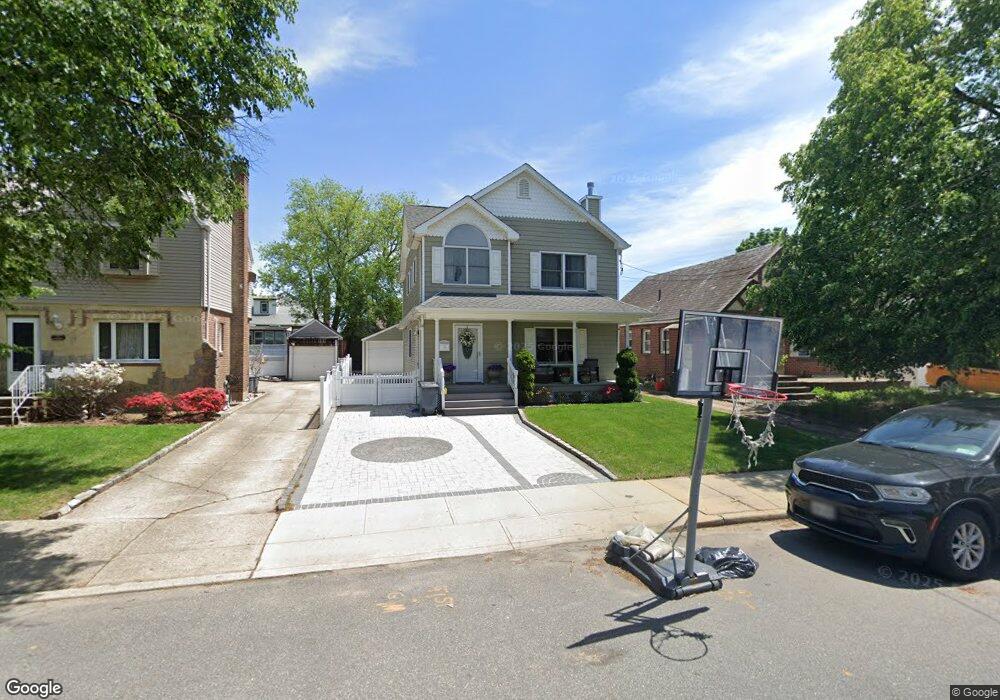
133 Commonwealth St Franklin Square, NY 11010
Estimated Value: $822,000 - $906,421
Studio
1
Bath
1,870
Sq Ft
$462/Sq Ft
Est. Value
About This Home
This home is located at 133 Commonwealth St, Franklin Square, NY 11010 and is currently estimated at $864,211, approximately $462 per square foot. 133 Commonwealth St is a home located in Nassau County with nearby schools including St Anne's School.
Ownership History
Date
Name
Owned For
Owner Type
Purchase Details
Closed on
Apr 24, 2009
Sold by
Meloni And Sons Enterprises Llc
Bought by
Kalogiros Connie and Kalogiros Thomas
Current Estimated Value
Home Financials for this Owner
Home Financials are based on the most recent Mortgage that was taken out on this home.
Original Mortgage
$448,000
Interest Rate
4.9%
Mortgage Type
Purchase Money Mortgage
Purchase Details
Closed on
Jan 30, 2008
Sold by
Mcelliott Dorothy
Bought by
Meloni & Sons Enterprises
Create a Home Valuation Report for This Property
The Home Valuation Report is an in-depth analysis detailing your home's value as well as a comparison with similar homes in the area
Home Values in the Area
Average Home Value in this Area
Purchase History
| Date | Buyer | Sale Price | Title Company |
|---|---|---|---|
| Kalogiros Connie | $560,000 | -- | |
| Meloni & Sons Enterprises | $335,000 | -- |
Source: Public Records
Mortgage History
| Date | Status | Borrower | Loan Amount |
|---|---|---|---|
| Previous Owner | Kalogiros Connie | $448,000 |
Source: Public Records
Tax History
| Year | Tax Paid | Tax Assessment Tax Assessment Total Assessment is a certain percentage of the fair market value that is determined by local assessors to be the total taxable value of land and additions on the property. | Land | Improvement |
|---|---|---|---|---|
| 2025 | $14,027 | $638 | $240 | $398 |
| 2024 | $5,621 | $638 | $240 | $398 |
Source: Public Records
Map
Nearby Homes
- 137 Commonwealth St
- 129 Commonwealth St
- 141 Commonwealth St
- 134 Rintin St
- 121 Commonwealth St
- 138 Rintin St
- 145 Commonwealth St
- 771 Benris Ave
- 134 Commonwealth St
- 138 Commonwealth St
- 149 Commonwealth St
- 130 Commonwealth St
- 142 Commonwealth St
- 148 Rintin St
- 122 Commonwealth St
- 146 Commonwealth St
- 153 Commonwealth St
- 154 Rintin St
- 150 Commonwealth St
- 121 Rintin St
Your Personal Tour Guide
Ask me questions while you tour the home.