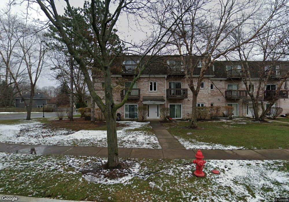
133 E Winchester Rd Unit 305 Libertyville, IL 60048
Estimated Value: $258,000 - $279,000
--
Bed
2
Baths
936
Sq Ft
$287/Sq Ft
Est. Value
About This Home
This home is located at 133 E Winchester Rd Unit 305, Libertyville, IL 60048 and is currently estimated at $268,654, approximately $287 per square foot. 133 E Winchester Rd Unit 305 is a home located in Lake County with nearby schools including Adler Park School, Highland Middle School, and Libertyville High School.
Ownership History
Date
Name
Owned For
Owner Type
Purchase Details
Closed on
Nov 5, 2018
Sold by
Bushing David
Bought by
Farmer Joseph
Current Estimated Value
Purchase Details
Closed on
Dec 23, 2008
Sold by
Bushing David and Bushing Nicole
Bought by
Bushing David
Purchase Details
Closed on
Dec 15, 2006
Sold by
Pantazis Argyro Maita John and Hamburg Argyro
Bought by
Bushing David and Bushing Nicole
Home Financials for this Owner
Home Financials are based on the most recent Mortgage that was taken out on this home.
Original Mortgage
$132,000
Interest Rate
6.16%
Mortgage Type
Purchase Money Mortgage
Purchase Details
Closed on
Oct 16, 1998
Sold by
Ivins Mary B
Bought by
Pantazis Argyro Maita John
Home Financials for this Owner
Home Financials are based on the most recent Mortgage that was taken out on this home.
Original Mortgage
$60,000
Interest Rate
6.72%
Mortgage Type
Balloon
Purchase Details
Closed on
Sep 30, 1996
Sold by
Mark Jennifer Ann
Bought by
Ivins Mary B
Home Financials for this Owner
Home Financials are based on the most recent Mortgage that was taken out on this home.
Original Mortgage
$78,000
Interest Rate
8%
Mortgage Type
FHA
Purchase Details
Closed on
Dec 15, 1994
Sold by
Harris Bank Libertyville
Bought by
Mark Jennifer Ann
Home Financials for this Owner
Home Financials are based on the most recent Mortgage that was taken out on this home.
Original Mortgage
$58,000
Interest Rate
9.23%
Create a Home Valuation Report for This Property
The Home Valuation Report is an in-depth analysis detailing your home's value as well as a comparison with similar homes in the area
Home Values in the Area
Average Home Value in this Area
Purchase History
| Date | Buyer | Sale Price | Title Company |
|---|---|---|---|
| Farmer Joseph | $127,500 | Ata Gmt Title Agency | |
| Bushing David | -- | None Available | |
| Bushing David | $165,000 | Multiple | |
| Pantazis Argyro Maita John | $90,000 | Standard Title | |
| Ivins Mary B | $80,000 | -- | |
| Mark Jennifer Ann | $64,500 | Ticor Title Insurance Compan |
Source: Public Records
Mortgage History
| Date | Status | Borrower | Loan Amount |
|---|---|---|---|
| Previous Owner | Bushing David | $132,000 | |
| Previous Owner | Pantazis Argyro Maita John | $60,000 | |
| Previous Owner | Ivins Mary B | $78,000 | |
| Previous Owner | Mark Jennifer Ann | $58,000 |
Source: Public Records
Tax History Compared to Growth
Tax History
| Year | Tax Paid | Tax Assessment Tax Assessment Total Assessment is a certain percentage of the fair market value that is determined by local assessors to be the total taxable value of land and additions on the property. | Land | Improvement |
|---|---|---|---|---|
| 2024 | $4,040 | $54,390 | $23,156 | $31,234 |
| 2023 | $3,837 | $50,166 | $21,358 | $28,808 |
| 2022 | $3,837 | $47,976 | $20,528 | $27,448 |
| 2021 | $3,697 | $46,943 | $20,086 | $26,857 |
| 2020 | $3,391 | $43,956 | $18,808 | $25,148 |
| 2019 | $2,856 | $43,538 | $18,629 | $24,909 |
| 2018 | $3,029 | $41,207 | $21,886 | $19,321 |
| 2017 | $2,988 | $39,906 | $21,195 | $18,711 |
| 2016 | $2,896 | $37,837 | $20,096 | $17,741 |
| 2015 | $2,878 | $35,365 | $18,783 | $16,582 |
| 2014 | $2,899 | $34,910 | $18,506 | $16,404 |
| 2012 | $3,293 | $35,213 | $18,667 | $16,546 |
Source: Public Records
Map
Nearby Homes
- 1211 Parliament Ct
- 204 W Ellis Ave
- 208 W Ellis Ave
- 212 W Ellis Ave
- 141 Johnson Ave
- 31132-31140 N Milwaukee Ave
- 1479 N Milwaukee Ave Unit 203
- 224 Newberry Ave
- 619 Parkside Ct
- 624 Parkside Ct
- 654 Parkside Ct
- 505 Lange Ct
- 217 E Church St
- 212 Elm Ct
- 212 W Maple Ave
- 226 W Maple Ave
- 16108 W Des Plaines Dr
- Halston Plan at Liberty Junction
- Highwood Plan at Liberty Junction
- Jayton Plan at Liberty Junction
- 113 E Winchester Rd Unit 72P
- 111 E Winchester Rd Unit 31P
- 115 E Winchester Rd Unit 133P
- 133 E Winchester Rd Unit 295P
- 133 E Winchester Rd Unit 285P
- 131 E Winchester Rd Unit 234P
- 131 E Winchester Rd Unit 194P
- 115 E Winchester Rd Unit 173P
- 115 E Winchester Rd Unit 163P
- 113 E Winchester Rd Unit 122P
- 113 E Winchester Rd Unit 92P
- 113 E Winchester Rd Unit 82P
- 111 E Winchester Rd Unit 61P
- 111 E Winchester Rd Unit 51P
- 111 E Winchester Rd Unit 41P
- 115 E Winchester Rd Unit 143P
- 133 E Winchester Rd Unit 255P
- 133 E Winchester Rd Unit 295
- 133 E Winchester Rd Unit 285
- 133 E Winchester Rd Unit 275