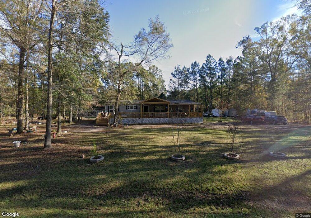
133 Fox Ln Fleming, GA 31309
Estimated Value: $61,226 - $243,000
3
Beds
2
Baths
1,920
Sq Ft
$86/Sq Ft
Est. Value
About This Home
This home is located at 133 Fox Ln, Fleming, GA 31309 and is currently estimated at $165,057, approximately $85 per square foot. 133 Fox Ln is a home located in Liberty County with nearby schools including Joseph Martin Elementary School, Midway Middle School, and Liberty County High School.
Ownership History
Date
Name
Owned For
Owner Type
Purchase Details
Closed on
Mar 10, 2017
Sold by
Hoyt Hubbard Emerson
Bought by
Fleck Jennifer
Current Estimated Value
Purchase Details
Closed on
Feb 19, 2015
Sold by
Lewis Jerry
Bought by
Hoyt Hubbard Emerson
Purchase Details
Closed on
Oct 2, 2012
Sold by
Connelly Michael
Bought by
Lewis Jerry
Purchase Details
Closed on
Mar 1, 2012
Sold by
Lewis Jerry
Bought by
Connelly Michael and Preston Pamela C
Purchase Details
Closed on
Oct 17, 2001
Sold by
Wainright Jimmy C
Bought by
Horne Larry
Create a Home Valuation Report for This Property
The Home Valuation Report is an in-depth analysis detailing your home's value as well as a comparison with similar homes in the area
Purchase History
| Date | Buyer | Sale Price | Title Company |
|---|---|---|---|
| Fleck Jennifer | $19,500 | -- | |
| Hoyt Hubbard Emerson | $18,000 | -- | |
| Lewis Jerry | -- | -- | |
| Connelly Michael | $24,300 | -- | |
| Horne Larry | $10,000 | -- |
Source: Public Records
Tax History
| Year | Tax Paid | Tax Assessment Tax Assessment Total Assessment is a certain percentage of the fair market value that is determined by local assessors to be the total taxable value of land and additions on the property. | Land | Improvement |
|---|---|---|---|---|
| 2024 | $221 | $5,362 | $4,306 | $1,056 |
| 2023 | $221 | $26,813 | $4,306 | $22,507 |
| 2022 | $981 | $25,969 | $3,444 | $22,525 |
| 2021 | $979 | $26,001 | $3,444 | $22,557 |
| 2020 | $973 | $26,017 | $3,444 | $22,573 |
| 2019 | $953 | $26,034 | $3,444 | $22,590 |
| 2018 | $943 | $26,038 | $3,444 | $22,594 |
| 2016 | $155 | $4,485 | $3,444 | $1,041 |
| 2013 | -- | $5,296 | $4,243 | $1,153 |
Source: Public Records
Map
Nearby Homes
- 0 Cherry Ln
- 70 Pate Rogers Rd
- 192 Lexie Ln
- 195 Wilkins Rd
- 435 Wilkins Rd
- 590 Wilkins Rd
- 455 Tondee Way
- 776 Phillips Rd
- 0 Main Trail Unit 10385280
- Lot 18 Main Trail
- 2022 Luke Rd
- 0 Oak Ct Unit SA331468
- 0 Oak Ct Unit 160688
- 131 Haven Rd
- 28 Deer Trail Ln
- 221 Outpost Trail
- 70 1st St
- 24 Jerico Marsh Lot 24 Rd
- 42 Greenwood
- 138-140 Dogwood Ln
Your Personal Tour Guide
Ask me questions while you tour the home.