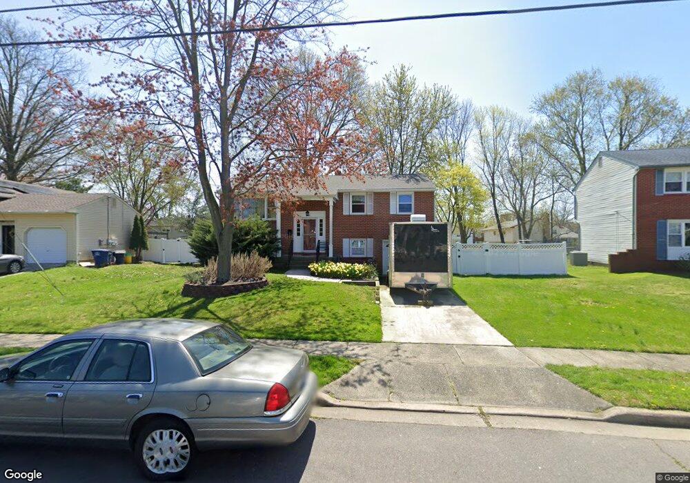
133 Glenbrook Dr Mount Laurel, NJ 08054
Ramblewood NeighborhoodEstimated Value: $285,917 - $462,000
Studio
--
Bath
1,640
Sq Ft
$241/Sq Ft
Est. Value
About This Home
This home is located at 133 Glenbrook Dr, Mount Laurel, NJ 08054 and is currently estimated at $394,979, approximately $240 per square foot. 133 Glenbrook Dr is a home located in Burlington County with nearby schools including Countryside Elementary School, T.E. Harrington Middle School, and Mount Laurel Hartford School.
Ownership History
Date
Name
Owned For
Owner Type
Purchase Details
Closed on
Oct 2, 1998
Sold by
Hill William E and Harriett Ann K
Bought by
Rogers Robert B and Buncie Barbara D
Current Estimated Value
Home Financials for this Owner
Home Financials are based on the most recent Mortgage that was taken out on this home.
Original Mortgage
$97,600
Outstanding Balance
$21,184
Interest Rate
6.8%
Mortgage Type
Stand Alone First
Estimated Equity
$373,795
Purchase Details
Closed on
Mar 15, 1994
Sold by
Hill William E
Bought by
Hill William E and Harriett Ann K
Create a Home Valuation Report for This Property
The Home Valuation Report is an in-depth analysis detailing your home's value as well as a comparison with similar homes in the area
Home Values in the Area
Average Home Value in this Area
Purchase History
| Date | Buyer | Sale Price | Title Company |
|---|---|---|---|
| Rogers Robert B | $122,000 | Commonwealth Land Title | |
| Hill William E | -- | -- | |
| Hill William E | -- | -- |
Source: Public Records
Mortgage History
| Date | Status | Borrower | Loan Amount |
|---|---|---|---|
| Open | Rogers Robert B | $97,600 |
Source: Public Records
Tax History
| Year | Tax Paid | Tax Assessment Tax Assessment Total Assessment is a certain percentage of the fair market value that is determined by local assessors to be the total taxable value of land and additions on the property. | Land | Improvement |
|---|---|---|---|---|
| 2025 | $5,323 | $168,600 | $67,500 | $101,100 |
| 2024 | $5,122 | $168,600 | $67,500 | $101,100 |
| 2023 | $5,122 | $168,600 | $67,500 | $101,100 |
| 2022 | $5,105 | $168,600 | $67,500 | $101,100 |
| 2021 | $4,566 | $168,600 | $67,500 | $101,100 |
| 2020 | $4,911 | $168,600 | $67,500 | $101,100 |
| 2019 | $4,861 | $168,600 | $67,500 | $101,100 |
| 2018 | $4,824 | $168,600 | $67,500 | $101,100 |
| 2017 | $4,699 | $168,600 | $67,500 | $101,100 |
| 2016 | $4,628 | $168,600 | $67,500 | $101,100 |
| 2015 | $4,574 | $168,600 | $67,500 | $101,100 |
| 2014 | $4,529 | $168,600 | $67,500 | $101,100 |
Source: Public Records
Map
Nearby Homes
- 174 Schoolhouse Ln
- 7 Federal St
- 29 Beaver Ave
- 537 Doe Ln
- 25 S Church Rd Unit 128
- 25 S Church Rd Unit 129
- 25 S Church Rd Unit 138
- 25 S Church Rd Unit 131
- 422 Chapel Ave E
- 411 Chapel Ave E
- 416 Chapel Ave E
- 418 Kingston Dr
- 8 Fountain Ct
- 606 Kings Croft
- 318 Kings Croft
- 28 Forest Hill Dr
- 708 Kings Croft Unit C0708
- 37 Forest Hill Dr
- 734 Kings Croft
- 102 Kings Croft
- 135 Glenbrook Dr
- 131 Glenbrook Dr
- 206 Beechwood Ct
- 204 Beechwood Ct
- 137 Glenbrook Dr
- 208 Beechwood Ct
- 202 Beechwood Ct
- 129 Glenbrook Dr
- 158 Glenbrook Dr
- 156 Glenbrook Dr
- 160 Glenbrook Dr
- 104 Beechwood Dr
- 139 Glenbrook Dr
- 154 Glenbrook Dr
- 162 Glenbrook Dr
- 106 Beechwood Dr
- 224 Beechwood Ct
- 212 Beechwood Ct
- 141 Glenbrook Dr Unit 504B
- 226 Beechwood Ct
Your Personal Tour Guide
Ask me questions while you tour the home.