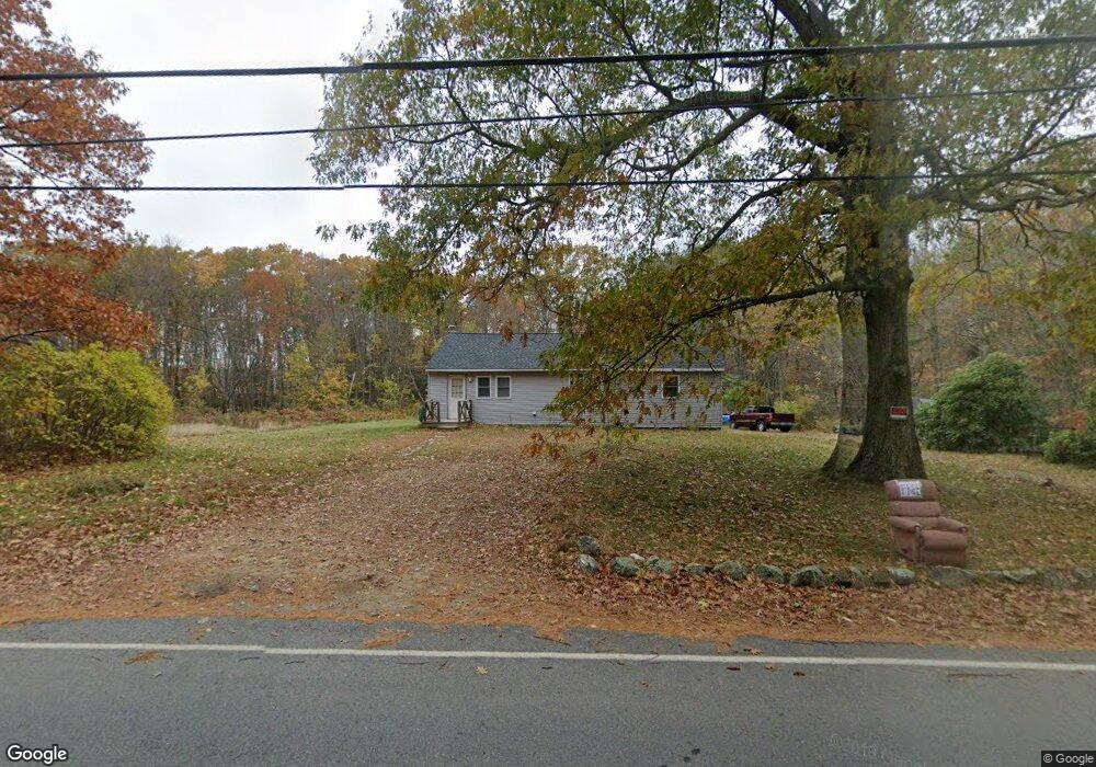
133 Glenwood Rd Rutland, MA 01543
Estimated Value: $346,000 - $422,000
3
Beds
1
Bath
1,206
Sq Ft
$319/Sq Ft
Est. Value
About This Home
This home is located at 133 Glenwood Rd, Rutland, MA 01543 and is currently estimated at $384,568, approximately $318 per square foot. 133 Glenwood Rd is a home located in Worcester County with nearby schools including Wachusett Regional High School.
Ownership History
Date
Name
Owned For
Owner Type
Purchase Details
Closed on
Jun 27, 2023
Sold by
Hooper James A
Bought by
Hooper James A and Chan Suyhen L
Current Estimated Value
Purchase Details
Closed on
Aug 10, 2012
Sold by
Ringgard Rita J
Bought by
Hooper James A
Purchase Details
Closed on
Jun 27, 2012
Sold by
Hooper James A and Hooper Anne M
Bought by
Ringgard Rita J
Purchase Details
Closed on
Oct 8, 2004
Sold by
Hooper Anne M and Hooper James A
Bought by
Hooper James A
Create a Home Valuation Report for This Property
The Home Valuation Report is an in-depth analysis detailing your home's value as well as a comparison with similar homes in the area
Home Values in the Area
Average Home Value in this Area
Purchase History
| Date | Buyer | Sale Price | Title Company |
|---|---|---|---|
| Hooper James A | -- | None Available | |
| Hooper James A | -- | None Available | |
| Hooper James A | -- | None Available | |
| Hooper James A | -- | -- | |
| Hooper James A | -- | -- | |
| Ringgard Rita J | -- | -- | |
| Ringgard Rita J | -- | -- | |
| Hooper James A | -- | -- | |
| Hooper James A | -- | -- |
Source: Public Records
Tax History Compared to Growth
Tax History
| Year | Tax Paid | Tax Assessment Tax Assessment Total Assessment is a certain percentage of the fair market value that is determined by local assessors to be the total taxable value of land and additions on the property. | Land | Improvement |
|---|---|---|---|---|
| 2025 | $3,741 | $262,700 | $98,600 | $164,100 |
| 2024 | $3,816 | $257,300 | $94,700 | $162,600 |
| 2023 | $3,429 | $249,900 | $89,300 | $160,600 |
| 2022 | $3,698 | $234,200 | $75,600 | $158,600 |
| 2021 | $3,338 | $199,900 | $75,500 | $124,400 |
| 2020 | $2,663 | $151,200 | $71,700 | $79,500 |
| 2019 | $2,664 | $148,900 | $68,200 | $80,700 |
| 2018 | $2,613 | $144,100 | $68,200 | $75,900 |
| 2017 | $2,636 | $143,900 | $68,000 | $75,900 |
| 2016 | $3,163 | $182,100 | $64,700 | $117,400 |
| 2015 | $3,036 | $172,000 | $64,700 | $107,300 |
| 2014 | $3,299 | $192,800 | $64,700 | $128,100 |
Source: Public Records
Map
Nearby Homes
- 101 Brintnal Dr
- 175 Glenwood Rd
- 73 Brintnal Dr
- 35 Brintnal Dr
- 25 Watson Ln
- 147 E County Rd Unit 149
- 16 Richards Ave
- 55 Pommogussett Rd
- 2 Simon Davis Dr
- 569 E County Rd
- 5 Miles Rd
- 40 Brunelle Dr
- 32 Pommogussett Rd Unit 1
- 271 Glenwood Rd
- 27 Lewis St
- 11 Lewis St
- 21 Lewis St
- 12 Lewis St
- 28 Forest Hill Dr
- 81 Glenwood Place
- 136 Glenwood Rd
- 138 Glenwood Rd
- 141 Glenwood Rd
- 145 Glenwood Rd
- 142 Glenwood Rd
- 147 Glenwood Rd
- 167A Glenwood Rd
- 167C Glenwood Rd
- 198 Campbell St
- 126 Glenwood Rd
- 105 Glenwood Rd
- 196 Campbell St
- 156 Glenwood Rd
- 103 Glenwood Rd
- 103 Glenwood Rd
- 114 Brintnal Dr
- 163 Glenwood Rd
- 118 Brintnal Dr
- 116 Brintnal Dr
- 160 Glenwood Rd