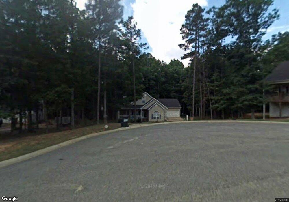
133 Gober Dr Commerce, GA 30530
Estimated Value: $349,329 - $438,000
3
Beds
2
Baths
2,458
Sq Ft
$158/Sq Ft
Est. Value
About This Home
This home is located at 133 Gober Dr, Commerce, GA 30530 and is currently estimated at $389,582, approximately $158 per square foot. 133 Gober Dr is a home located in Jackson County with nearby schools including East Jackson Elementary School, East Jackson Middle School, and East Jackson Comprehensive High School.
Ownership History
Date
Name
Owned For
Owner Type
Purchase Details
Closed on
Dec 21, 2021
Sold by
Peek Timothy S
Bought by
Peek Catherine Z
Current Estimated Value
Purchase Details
Closed on
Sep 21, 2010
Sold by
Federal National Mortgage Association
Bought by
Peek Timothy S
Home Financials for this Owner
Home Financials are based on the most recent Mortgage that was taken out on this home.
Original Mortgage
$115,518
Interest Rate
4.25%
Mortgage Type
FHA
Purchase Details
Closed on
Mar 2, 2010
Sold by
Regions Bank
Bought by
Federal National Mtg Associati
Purchase Details
Closed on
Oct 23, 2000
Sold by
Brooks Timothy M
Bought by
Holt Michalle R
Purchase Details
Closed on
Apr 8, 1999
Sold by
Wilbanks Lamar
Bought by
Brooks Timothy M
Create a Home Valuation Report for This Property
The Home Valuation Report is an in-depth analysis detailing your home's value as well as a comparison with similar homes in the area
Home Values in the Area
Average Home Value in this Area
Purchase History
| Date | Buyer | Sale Price | Title Company |
|---|---|---|---|
| Peek Catherine Z | -- | -- | |
| Peek Timothy S | $117,075 | -- | |
| Federal National Mtg Associati | $162,410 | -- | |
| Regions Bank | $162,410 | -- | |
| Holt Michalle R | $127,900 | -- | |
| Brooks Timothy M | -- | -- |
Source: Public Records
Mortgage History
| Date | Status | Borrower | Loan Amount |
|---|---|---|---|
| Previous Owner | Regions Bank | $115,518 |
Source: Public Records
Tax History
| Year | Tax Paid | Tax Assessment Tax Assessment Total Assessment is a certain percentage of the fair market value that is determined by local assessors to be the total taxable value of land and additions on the property. | Land | Improvement |
|---|---|---|---|---|
| 2025 | $2,822 | $111,920 | $11,600 | $100,320 |
| 2024 | $2,822 | $111,920 | $11,600 | $100,320 |
| 2023 | $2,851 | $98,720 | $11,600 | $87,120 |
| 2022 | $2,314 | $79,720 | $11,600 | $68,120 |
| 2021 | $2,330 | $79,720 | $11,600 | $68,120 |
| 2020 | $2,176 | $68,080 | $11,600 | $56,480 |
| 2019 | $2,208 | $68,080 | $11,600 | $56,480 |
| 2018 | $2,149 | $65,360 | $11,600 | $53,760 |
| 2017 | $2,150 | $64,867 | $11,600 | $53,267 |
| 2016 | $2,162 | $64,867 | $11,600 | $53,267 |
| 2015 | $1,879 | $56,067 | $2,800 | $53,267 |
| 2014 | $1,654 | $48,925 | $2,800 | $46,125 |
| 2013 | -- | $48,924 | $2,800 | $46,124 |
Source: Public Records
Map
Nearby Homes
- 1115 Ila Rd
- 564 Old Airport Rd
- 581 Ila Rd
- 526 Madison St
- 580 Belmont Park Dr
- 36 Wildcat Ln
- 94 Hillcrest St
- 200 Harris St
- 192 Nunn St
- 173 Madison St
- 0 S Elm St Unit 16541343
- 67 Cotton St
- 395 S Elm St
- 246 Spring St
- 184 Ashford Ln
- 20118 Us-441 S
- 1029 S Elm St
- 0 S US Highway 441 Unit 10428347
- 0 S US Highway 441 Unit 10621923
- 270 Victoria St
Your Personal Tour Guide
Ask me questions while you tour the home.