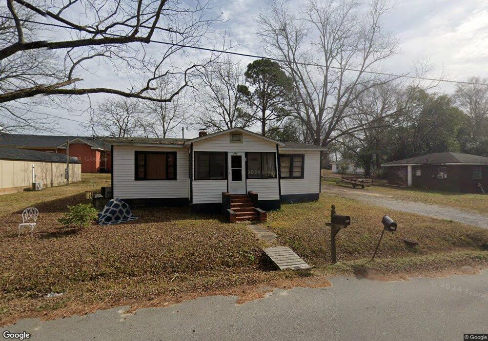
133 Kent St Statesboro, GA 30458
Estimated Value: $72,000 - $151,000
3
Beds
1
Bath
1,044
Sq Ft
$105/Sq Ft
Est. Value
About This Home
This home is located at 133 Kent St, Statesboro, GA 30458 and is currently estimated at $109,558, approximately $104 per square foot. 133 Kent St is a home located in Bulloch County with nearby schools including Julia P. Bryant Elementary School, Statesboro High School, and William James Middle School.
Ownership History
Date
Name
Owned For
Owner Type
Purchase Details
Closed on
Feb 2, 2017
Sold by
Allen Robert L
Bought by
Franklin Desiree
Current Estimated Value
Home Financials for this Owner
Home Financials are based on the most recent Mortgage that was taken out on this home.
Original Mortgage
$5,000
Outstanding Balance
$4,140
Interest Rate
4.2%
Mortgage Type
New Conventional
Estimated Equity
$105,418
Purchase Details
Closed on
Aug 29, 2008
Sold by
Not Provided
Bought by
Allen Robert L
Purchase Details
Closed on
Mar 4, 2008
Sold by
Not Provided
Bought by
Allen Robert L
Purchase Details
Closed on
Jun 30, 2004
Bought by
Roberts Ronnie
Create a Home Valuation Report for This Property
The Home Valuation Report is an in-depth analysis detailing your home's value as well as a comparison with similar homes in the area
Home Values in the Area
Average Home Value in this Area
Purchase History
| Date | Buyer | Sale Price | Title Company |
|---|---|---|---|
| Franklin Desiree | $25,000 | -- | |
| Allen Robert L | $35,000 | -- | |
| Allen Robert L | $48,404 | -- | |
| Roberts Ronnie | -- | -- |
Source: Public Records
Mortgage History
| Date | Status | Borrower | Loan Amount |
|---|---|---|---|
| Open | Franklin Desiree | $5,000 |
Source: Public Records
Tax History Compared to Growth
Tax History
| Year | Tax Paid | Tax Assessment Tax Assessment Total Assessment is a certain percentage of the fair market value that is determined by local assessors to be the total taxable value of land and additions on the property. | Land | Improvement |
|---|---|---|---|---|
| 2024 | $38 | $1,400 | $1,400 | $0 |
| 2023 | $40 | $1,400 | $1,400 | $0 |
| 2022 | $28 | $1,426 | $1,426 | $0 |
| 2021 | $29 | $1,426 | $1,426 | $0 |
| 2020 | $30 | $1,426 | $1,426 | $0 |
| 2019 | $30 | $1,426 | $1,426 | $0 |
| 2018 | $31 | $1,426 | $1,426 | $0 |
| 2017 | $303 | $13,739 | $2,800 | $10,939 |
| 2016 | $305 | $13,496 | $2,800 | $10,696 |
| 2015 | $291 | $13,553 | $2,800 | $10,753 |
| 2014 | $268 | $12,845 | $2,800 | $10,045 |
Source: Public Records
Map
Nearby Homes
- 141 Williams Rd
- 103 Floyd St
- 0 Miller Street Extension Unit LOT 17 10595930
- 0 Miller Street Extension Unit LOT 18 10595926
- 0 Miller Street Extension Unit LOT 19 10595919
- 0 Miller Street Extension Unit LOT 20 10595908
- 0 Miller Street Extension Unit LOT 21 10595866
- 0 Miller Street Extension Unit LOT 22 10595860
- 0 Miller Street Extension Unit LOT 23 10594167
- 118 Roundtree St
- 7 E Moore St
- 113 Church St
- 318 N Main St
- 124 Pin Oak Ln
- 118 Pin Oak Ln Unit 47
- 111 Zetterower Rd
- 405 N Main St
- 460 Martin Luther King jr Dr
- 0 Highway 80 W Unit 10534803
- LOT 22 Oak Hill Dr
- 131 Kent St
- 0 Kent St Unit 7458592
- 129 Kent St
- 135 Kent St
- 132 Kent St
- 127 Kent St
- 136 Kent St
- 35 Lovett St
- 138 Kent St
- 34 Lovett St
- 4 Lovett St Unit 5
- 2855 Northside Dr W
- 33 Lovett St
- 117 Kent St
- 2823 Northside Dr W
- 116 Kent St
- 27 Lovett St
- 113 Kent St
- 0 Williams Rd Unit LOT 40
- 0 Williams Rd Unit 8452547