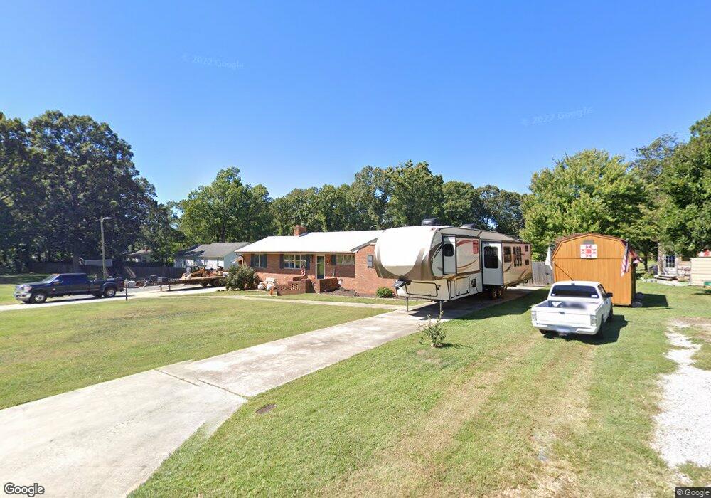
133 Maplewood Ave Thomasville, NC 27360
Estimated Value: $206,000 - $345,000
3
Beds
2
Baths
3,424
Sq Ft
$75/Sq Ft
Est. Value
About This Home
This home is located at 133 Maplewood Ave, Thomasville, NC 27360 and is currently estimated at $257,446, approximately $75 per square foot. 133 Maplewood Ave is a home located in Davidson County with nearby schools including Fair Grove Elementary School, E. Lawson Brown Middle School, and East Davidson High School.
Ownership History
Date
Name
Owned For
Owner Type
Purchase Details
Closed on
Jun 24, 2021
Sold by
Mcadams Joseph Edwin
Bought by
Bodenheimer Amber Nicole and Bodenheimer Wesley Allen
Current Estimated Value
Home Financials for this Owner
Home Financials are based on the most recent Mortgage that was taken out on this home.
Original Mortgage
$122,527
Interest Rate
3%
Mortgage Type
FHA
Purchase Details
Closed on
May 16, 1967
Create a Home Valuation Report for This Property
The Home Valuation Report is an in-depth analysis detailing your home's value as well as a comparison with similar homes in the area
Home Values in the Area
Average Home Value in this Area
Purchase History
| Date | Buyer | Sale Price | Title Company |
|---|---|---|---|
| Bodenheimer Amber Nicole | $134,000 | None Available | |
| -- | -- | -- |
Source: Public Records
Mortgage History
| Date | Status | Borrower | Loan Amount |
|---|---|---|---|
| Previous Owner | Bodenheimer Amber Nicole | $122,527 |
Source: Public Records
Tax History Compared to Growth
Tax History
| Year | Tax Paid | Tax Assessment Tax Assessment Total Assessment is a certain percentage of the fair market value that is determined by local assessors to be the total taxable value of land and additions on the property. | Land | Improvement |
|---|---|---|---|---|
| 2025 | $2,156 | $188,690 | $0 | $0 |
| 2024 | $2,156 | $188,690 | $0 | $0 |
| 2023 | $2,156 | $188,690 | $0 | $0 |
| 2022 | $2,156 | $188,690 | $0 | $0 |
| 2021 | $2,156 | $188,690 | $0 | $0 |
| 2020 | $1,760 | $156,770 | $0 | $0 |
| 2019 | $1,788 | $156,840 | $0 | $0 |
| 2018 | $1,788 | $156,840 | $0 | $0 |
| 2017 | $1,788 | $156,840 | $0 | $0 |
| 2016 | $1,725 | $156,840 | $0 | $0 |
| 2015 | $1,725 | $156,840 | $0 | $0 |
| 2014 | $1,546 | $140,530 | $0 | $0 |
Source: Public Records
Map
Nearby Homes
- 25 Cedar Lodge Rd
- 223 S Westwood Ave
- 296 Fairgrove Rd
- 1 Westwood Ave
- 300 Willowbrook Dr
- 0 Smith Dr
- 122 S Old Fisher Ferry Rd
- 259 S Old Raleigh Rd
- 6 Curtis Ct
- 307 Fisher Ferry St
- 14 Welloski Dr
- 715 Dillon St
- 708 Ferndale Dr
- GALEN Plan at Aspen Place
- TAYLOR Plan at Aspen Place
- KYLE Plan at Aspen Place
- PENWELL Plan at Aspen Place
- BELHAVEN Plan at Aspen Place
- HAYDEN Plan at Aspen Place
- Freeport Plan at Aspen Place
- 152 Hillcrest Rd
- 144 Hillcrest Rd
- 131 Maplewood Ave
- 129 Maplewood Ave
- 134 Maplewood Ave
- 140 Hillcrest Rd
- 149 Hillcrest Rd
- 147 Hillcrest Rd
- 145 Hillcrest Rd
- 132 Maplewood Ave
- 136 Maplewood Ave
- 141 Hillcrest Rd
- 151 Hillcrest Rd
- 136 Hillcrest Rd
- 200 Maplewood Ave
- 139 Hillcrest Rd
- 130 Maplewood Ave
- 125 Maplewood Ave
- 127 Maplewood Ave
- 137 Hillcrest Rd