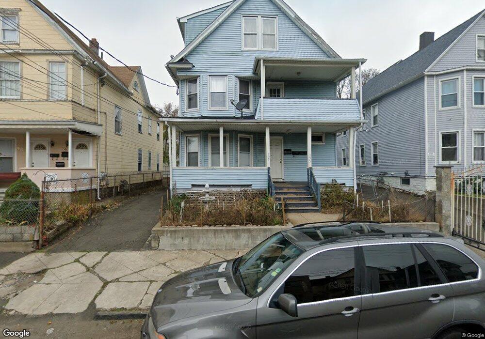
133 Merriam St Unit 135 Bridgeport, CT 06604
The Hollow NeighborhoodEstimated Value: $346,186 - $521,000
6
Beds
3
Baths
2,554
Sq Ft
$175/Sq Ft
Est. Value
About This Home
This home is located at 133 Merriam St Unit 135, Bridgeport, CT 06604 and is currently estimated at $446,047, approximately $174 per square foot. 133 Merriam St Unit 135 is a home located in Fairfield County with nearby schools including Read School, Harding High School, and Achievement First Bridgeport Academy Elementary School.
Ownership History
Date
Name
Owned For
Owner Type
Purchase Details
Closed on
Aug 28, 2000
Sold by
Ogbenta Urssla C
Bought by
Okereke Jude O
Current Estimated Value
Purchase Details
Closed on
Apr 20, 1999
Sold by
Giacobbe Dinardo Llc
Bought by
Ogbenta Urssla C
Purchase Details
Closed on
Mar 17, 1988
Sold by
Murray Vivian
Bought by
Murray Anthony
Create a Home Valuation Report for This Property
The Home Valuation Report is an in-depth analysis detailing your home's value as well as a comparison with similar homes in the area
Home Values in the Area
Average Home Value in this Area
Purchase History
| Date | Buyer | Sale Price | Title Company |
|---|---|---|---|
| Okereke Jude O | $140,000 | -- | |
| Okereke Jude O | $140,000 | -- | |
| Ogbenta Urssla C | $119,700 | -- | |
| Ogbenta Urssla C | $119,700 | -- | |
| Murray Anthony | $40,000 | -- |
Source: Public Records
Mortgage History
| Date | Status | Borrower | Loan Amount |
|---|---|---|---|
| Open | Murray Anthony | $174,055 | |
| Closed | Murray Anthony | $50,000 |
Source: Public Records
Tax History Compared to Growth
Tax History
| Year | Tax Paid | Tax Assessment Tax Assessment Total Assessment is a certain percentage of the fair market value that is determined by local assessors to be the total taxable value of land and additions on the property. | Land | Improvement |
|---|---|---|---|---|
| 2025 | $6,382 | $146,880 | $37,810 | $109,070 |
| 2024 | $6,382 | $146,880 | $37,810 | $109,070 |
| 2023 | $6,382 | $146,880 | $37,810 | $109,070 |
| 2022 | $6,382 | $146,880 | $37,810 | $109,070 |
| 2021 | $6,382 | $146,880 | $37,810 | $109,070 |
| 2020 | $5,858 | $108,510 | $17,910 | $90,600 |
| 2019 | $5,858 | $108,510 | $17,910 | $90,600 |
| 2018 | $5,900 | $108,510 | $17,910 | $90,600 |
| 2017 | $5,900 | $108,510 | $17,910 | $90,600 |
| 2016 | $5,900 | $108,510 | $17,910 | $90,600 |
| 2015 | $6,646 | $157,490 | $37,260 | $120,230 |
| 2014 | $6,646 | $157,490 | $37,260 | $120,230 |
Source: Public Records
Map
Nearby Homes
- 152 River St
- 76 Porter St
- 957 William St Unit A
- 604 William St
- 2395 Main St Unit 2397
- 1014 Noble Ave
- 39 Jane St
- 330 French St
- 369 Park St
- 438 Park St
- 291 Stillman St
- 5 William Place
- 627 Noble Ave
- 502 Berkshire Ave
- 1296 Noble Ave
- 1218 Kossuth St
- 744 Park St
- 289 Harriet St
- 485 Noble Ave
- 390 Charles St Unit 106
- 127 Merriam St Unit 129
- 143 Merriam St Unit 145
- 149 Merriam St
- 124 Merriam St Unit 126
- 140 Merriam St Unit 142
- 116 Merriam St Unit 120
- 142 Merriam St
- 144 Merriam St Unit 146
- 106 Merriam St Unit 110
- 84 Randall Ave
- 98 Randall Ave
- 94 Randall Ave
- 76 Randall Ave
- 68 Randall Ave
- 215 Lindley St Unit 217
- 62 Randall Ave
- 205 Lindley St Unit 207
- 56 Randall Ave Unit 2
- 223 Lindley St Unit 225
- 235 Lindley St