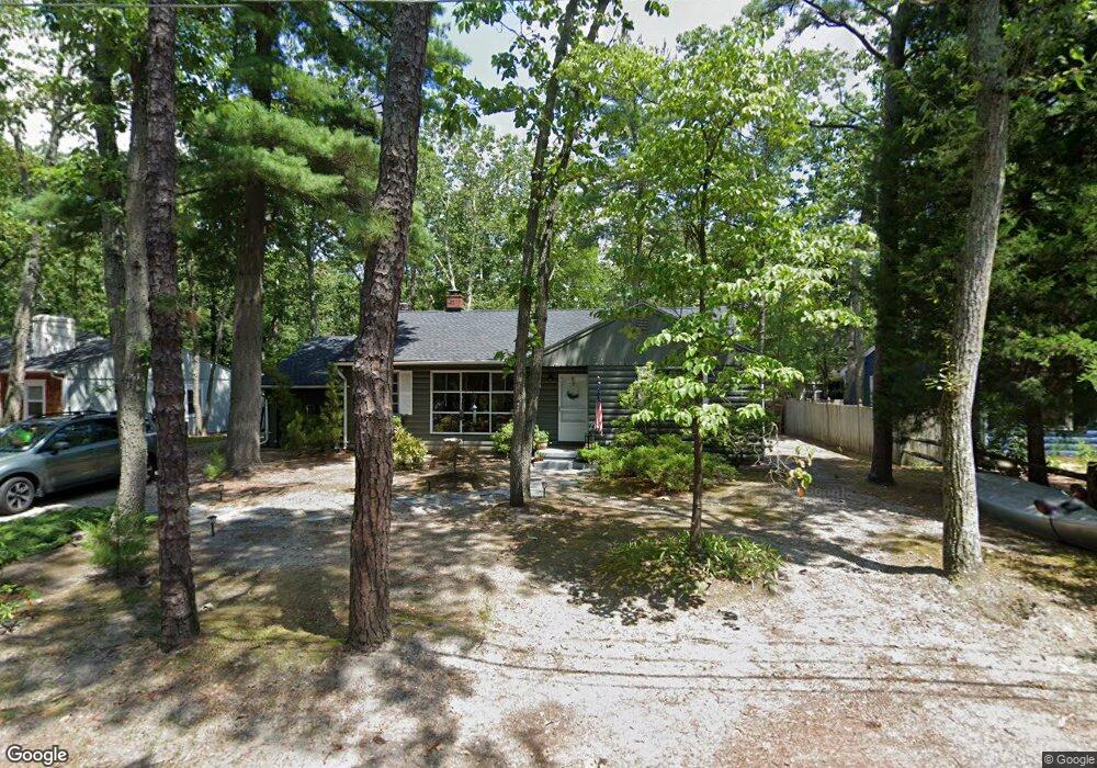
133 Mohawk Trail Medford, NJ 08055
Estimated Value: $401,000 - $448,000
Studio
--
Bath
1,472
Sq Ft
$291/Sq Ft
Est. Value
About This Home
This home is located at 133 Mohawk Trail, Medford, NJ 08055 and is currently estimated at $427,884, approximately $290 per square foot. 133 Mohawk Trail is a home located in Burlington County with nearby schools including Nokomis School, Neeta School, and Shawnee High School.
Ownership History
Date
Name
Owned For
Owner Type
Purchase Details
Closed on
Nov 2, 2021
Sold by
Cooper Peter T and Cooper Jo Mary
Bought by
Carr Anthony M and Carr Andrea
Current Estimated Value
Home Financials for this Owner
Home Financials are based on the most recent Mortgage that was taken out on this home.
Original Mortgage
$225,000
Interest Rate
3.12%
Mortgage Type
New Conventional
Purchase Details
Closed on
May 23, 1976
Bought by
Cooper Peter T and Mary Jo
Create a Home Valuation Report for This Property
The Home Valuation Report is an in-depth analysis detailing your home's value as well as a comparison with similar homes in the area
Home Values in the Area
Average Home Value in this Area
Purchase History
| Date | Buyer | Sale Price | Title Company |
|---|---|---|---|
| Carr Anthony M | $250,000 | Donohugh Clyde J | |
| Cooper Peter T | -- | -- |
Source: Public Records
Mortgage History
| Date | Status | Borrower | Loan Amount |
|---|---|---|---|
| Previous Owner | Carr Anthony M | $225,000 |
Source: Public Records
Tax History
| Year | Tax Paid | Tax Assessment Tax Assessment Total Assessment is a certain percentage of the fair market value that is determined by local assessors to be the total taxable value of land and additions on the property. | Land | Improvement |
|---|---|---|---|---|
| 2025 | $7,863 | $206,800 | $78,500 | $128,300 |
| 2024 | $7,434 | $206,800 | $78,500 | $128,300 |
| 2023 | $7,434 | $206,800 | $78,500 | $128,300 |
| 2022 | $7,273 | $206,800 | $78,500 | $128,300 |
| 2021 | $7,075 | $206,800 | $78,500 | $128,300 |
| 2020 | $6,886 | $206,800 | $78,500 | $128,300 |
| 2019 | $6,874 | $206,800 | $78,500 | $128,300 |
| 2018 | $6,700 | $206,800 | $78,500 | $128,300 |
| 2017 | $6,398 | $206,800 | $78,500 | $128,300 |
| 2016 | $6,239 | $206,800 | $78,500 | $128,300 |
| 2015 | $6,200 | $206,800 | $78,500 | $128,300 |
| 2014 | $6,055 | $206,800 | $78,500 | $128,300 |
Source: Public Records
Map
Nearby Homes
- Lot 8.03 Sunrise Trail
- 134 Narragansett Trail
- 178 Nahma Trail
- 19 Big Look Trail
- 176 Tuckerton Rd
- 155 Tuckerton Rd
- 167 Winooska Trail
- 11 Hawthorne Dr
- 23 Lenape Trail
- 65 Cutchogue Trail
- 18 Tomahawk Ct
- 55 Wrentham Dr Unit 69
- 13 Running Water Ct
- 98 Nantucket Trail
- 0 Tuckerton and Atsion Rd
- 8 Wethersfield Dr
- 30 Brattleboro Ct Unit 30
- 0 Jackson Rd Unit NJBL2085060
- 9 Wethersfield Dr
- 187 S Lakeside Dr E
- 137 Mohawk Trail
- 131 Mohawk Trail
- 132 Nokomis Trail
- 136 Nokomis Trail
- 128 Nokomis Trail
- 127 Mohawk Trail
- 136 Mohawk Trail
- 141 Mohawk Trail
- 132 Mohawk Trail
- 138 Mohawk Trail
- 138 Nokomis Trail
- 125 Mohawk Trail
- 142 Mohawk Trail
- 131 Nokomis Trail
- 128 Mohawk Trail
- 127 Nokomis Trail
- 143 Mohawk Trail
- 135 Nokomis Trail
- 126 Nokomis Trail
- 148 Mohawk Trail
Your Personal Tour Guide
Ask me questions while you tour the home.