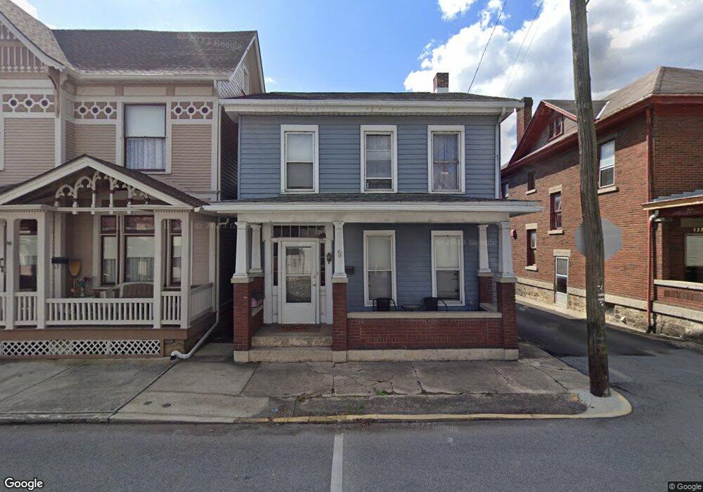
133 N 2nd St Newport, PA 17074
Estimated Value: $112,000 - $155,000
3
Beds
3
Baths
2,111
Sq Ft
$64/Sq Ft
Est. Value
About This Home
This home is located at 133 N 2nd St, Newport, PA 17074 and is currently estimated at $135,904, approximately $64 per square foot. 133 N 2nd St is a home located in Perry County with nearby schools including Newport Elementary School, Newport Middle School, and Newport High School.
Ownership History
Date
Name
Owned For
Owner Type
Purchase Details
Closed on
May 19, 2011
Sold by
Orrstown Bank
Bought by
Steffy Richard B and Steffy Dana H
Current Estimated Value
Home Financials for this Owner
Home Financials are based on the most recent Mortgage that was taken out on this home.
Original Mortgage
$48,000
Interest Rate
4.74%
Mortgage Type
Purchase Money Mortgage
Purchase Details
Closed on
Feb 10, 2011
Sold by
Nace Carl E
Bought by
Orrstown Bank
Create a Home Valuation Report for This Property
The Home Valuation Report is an in-depth analysis detailing your home's value as well as a comparison with similar homes in the area
Home Values in the Area
Average Home Value in this Area
Purchase History
| Date | Buyer | Sale Price | Title Company |
|---|---|---|---|
| Steffy Richard B | $60,000 | None Available | |
| Orrstown Bank | $20,000 | None Available |
Source: Public Records
Mortgage History
| Date | Status | Borrower | Loan Amount |
|---|---|---|---|
| Closed | Steffy Richard B | $48,000 |
Source: Public Records
Tax History Compared to Growth
Tax History
| Year | Tax Paid | Tax Assessment Tax Assessment Total Assessment is a certain percentage of the fair market value that is determined by local assessors to be the total taxable value of land and additions on the property. | Land | Improvement |
|---|---|---|---|---|
| 2025 | $1,519 | $57,700 | $19,400 | $38,300 |
| 2024 | $1,471 | $57,700 | $19,400 | $38,300 |
| 2023 | $1,444 | $57,700 | $19,400 | $38,300 |
| 2022 | $1,421 | $57,700 | $19,400 | $38,300 |
| 2021 | $1,384 | $57,700 | $19,400 | $38,300 |
| 2020 | $1,312 | $57,700 | $19,400 | $38,300 |
| 2019 | $1,291 | $57,700 | $19,400 | $38,300 |
| 2018 | $1,276 | $57,700 | $19,400 | $38,300 |
| 2017 | $1,260 | $57,700 | $19,400 | $38,300 |
| 2016 | -- | $57,700 | $19,400 | $38,300 |
| 2015 | -- | $57,700 | $19,400 | $38,300 |
| 2014 | $2,058 | $57,700 | $19,400 | $38,300 |
Source: Public Records
Map
Nearby Homes
- 301 N 3rd St
- 57 N 4th St
- 12 S 3rd St
- 14 Penn Ave
- 30 N 5th St
- 418 N 3rd St
- 2 S 5th St
- 428 N 4th St
- 794 S 4th St
- 1141 N Front St
- 0 Gravel Hill Rd
- 526 Fairground Rd
- 54 Hickory Ridge Rd
- 1 Juniata Furnace Ln
- 0 Juniata Furnace Ln
- 581 Old Limekiln Ln
- 40 Ridge Rd
- 110 Watson Ln
- 0 Mahanoy Valley Rd Unit PAPY2007968
- 502 Mahanoy Valley Rd