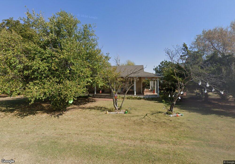
133 N Brookdale Rd Apache, OK 73006
Estimated Value: $114,288 - $192,000
2
Beds
1
Bath
1,400
Sq Ft
$112/Sq Ft
Est. Value
About This Home
This home is located at 133 N Brookdale Rd, Apache, OK 73006 and is currently estimated at $156,322, approximately $111 per square foot. 133 N Brookdale Rd is a home located in Comanche County with nearby schools including Apache Elementary School, Apache Middle School, and Apache High School.
Ownership History
Date
Name
Owned For
Owner Type
Purchase Details
Closed on
Mar 13, 2019
Sold by
Upton Cheryl and Mccracken Michael
Bought by
Pulsney Chad Anthony and Pulsney Shannon Marie
Current Estimated Value
Purchase Details
Closed on
Mar 2, 2017
Sold by
Puisney Chad and Puisney Shannon
Bought by
Puisney Chad A and Puisney Shannon M
Home Financials for this Owner
Home Financials are based on the most recent Mortgage that was taken out on this home.
Original Mortgage
$74,623
Interest Rate
3.37%
Mortgage Type
FHA
Purchase Details
Closed on
Jan 13, 2017
Sold by
Plotkin Lisa Gail and Blanchard Vicki Marie
Bought by
Pulsney Chad
Home Financials for this Owner
Home Financials are based on the most recent Mortgage that was taken out on this home.
Original Mortgage
$74,623
Interest Rate
3.37%
Mortgage Type
FHA
Create a Home Valuation Report for This Property
The Home Valuation Report is an in-depth analysis detailing your home's value as well as a comparison with similar homes in the area
Home Values in the Area
Average Home Value in this Area
Purchase History
| Date | Buyer | Sale Price | Title Company |
|---|---|---|---|
| Pulsney Chad Anthony | $2,000 | None Available | |
| Puisney Chad A | -- | None Available | |
| Pulsney Chad | $76,000 | Southwest Abstract & Title C |
Source: Public Records
Mortgage History
| Date | Status | Borrower | Loan Amount |
|---|---|---|---|
| Previous Owner | Pulsney Chad | $74,623 |
Source: Public Records
Tax History Compared to Growth
Tax History
| Year | Tax Paid | Tax Assessment Tax Assessment Total Assessment is a certain percentage of the fair market value that is determined by local assessors to be the total taxable value of land and additions on the property. | Land | Improvement |
|---|---|---|---|---|
| 2025 | $889 | $9,971 | $675 | $9,296 |
| 2024 | $889 | $9,971 | $675 | $9,296 |
| 2023 | $838 | $9,399 | $675 | $8,724 |
| 2022 | $783 | $9,125 | $675 | $8,450 |
| 2021 | $948 | $8,859 | $675 | $8,184 |
| 2020 | $800 | $8,601 | $675 | $7,926 |
| 2019 | $954 | $8,922 | $675 | $8,247 |
| 2018 | $1,209 | $10,498 | $169 | $10,329 |
| 2017 | $406 | $5,709 | $92 | $5,617 |
| 2016 | $413 | $5,708 | $81 | $5,627 |
| 2015 | $392 | $5,709 | $75 | $5,634 |
| 2014 | $324 | $5,709 | $75 | $5,634 |
Source: Public Records
Map
Nearby Homes
- 116 N Lakeside Dr
- 115 N Brookdale
- 207 N Hillside Rd
- 1100 NE King Rd
- 67 Ash Ave
- 48189 County Street 2580
- 14068 NE Prairie Hill Cir
- 13872 NW Stoney Point Rd
- 5605 NE Snowy Owl Rd
- 3438 Mesa Dr
- 3522 Mesa Dr
- 13265 NE Clearwater Cir
- 38 NE Sunset Dr
- 4322 Mesa Dr
- 12581 Big Horn Ln
- 12201 Big Horn Ln
- 15 Prairie View Rd
- 13543 NE Cornwallis Dr
- 4179 Peak Ln
- 4255 Peak Ln
- 133 N Brookdale Rd
- 135 N Brookdale Rd
- 506 Benbrook Rd
- 137 N Brookdale Rd
- 502 Benbrook Rd
- 198 N Lakeside Dr
- 131 N Lakeside Dr
- 131 N Lakeside Dr
- 125 N Brookdale Rd
- 402 Benbrook Rd
- 199 N Lakeside Dr
- 86 Circle Dr
- 611 Edgewater Rd
- 115 N Lakeside Dr
- 205 Hillside Rd
- 135 N Lakeview Rd
- 135 N Lakeview Rd
- 201 N Hillside Rd
- 432 Edgewater Blvd
- 615 Edgewater Rd