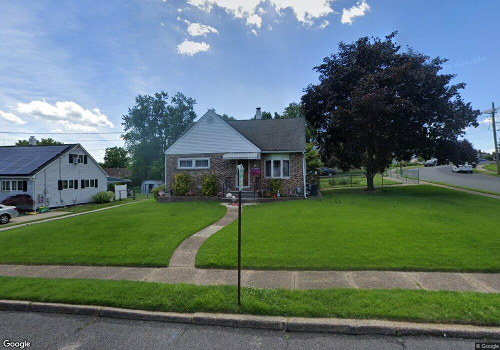
133 Patricia Ln Runnemede, NJ 08078
Estimated Value: $235,706 - $317,000
--
Bed
--
Bath
1,198
Sq Ft
$241/Sq Ft
Est. Value
About This Home
This home is located at 133 Patricia Ln, Runnemede, NJ 08078 and is currently estimated at $289,177, approximately $241 per square foot. 133 Patricia Ln is a home located in Camden County with nearby schools including Mary E. Volz Elementary School, Downing Elementary School, and Triton High School.
Ownership History
Date
Name
Owned For
Owner Type
Purchase Details
Closed on
Feb 23, 2020
Sold by
Churchill Chet
Bought by
Churchill Kathy
Current Estimated Value
Purchase Details
Closed on
Jan 27, 1994
Sold by
Bay Kenneth C
Bought by
Churchill Chet R and Churchill Kathy A
Home Financials for this Owner
Home Financials are based on the most recent Mortgage that was taken out on this home.
Original Mortgage
$91,000
Interest Rate
6.96%
Create a Home Valuation Report for This Property
The Home Valuation Report is an in-depth analysis detailing your home's value as well as a comparison with similar homes in the area
Home Values in the Area
Average Home Value in this Area
Purchase History
| Date | Buyer | Sale Price | Title Company |
|---|---|---|---|
| Churchill Kathy | -- | None Available | |
| Churchill Chet R | $101,500 | -- |
Source: Public Records
Mortgage History
| Date | Status | Borrower | Loan Amount |
|---|---|---|---|
| Closed | Churchill Chet R | $91,000 |
Source: Public Records
Tax History Compared to Growth
Tax History
| Year | Tax Paid | Tax Assessment Tax Assessment Total Assessment is a certain percentage of the fair market value that is determined by local assessors to be the total taxable value of land and additions on the property. | Land | Improvement |
|---|---|---|---|---|
| 2025 | $6,178 | $137,100 | $48,700 | $88,400 |
| 2024 | $5,990 | $137,100 | $48,700 | $88,400 |
| 2023 | $5,990 | $137,100 | $48,700 | $88,400 |
| 2022 | $5,799 | $137,100 | $48,700 | $88,400 |
| 2021 | $5,662 | $137,100 | $48,700 | $88,400 |
| 2020 | $5,606 | $137,100 | $48,700 | $88,400 |
| 2019 | $5,503 | $137,100 | $48,700 | $88,400 |
| 2018 | $5,398 | $137,100 | $48,700 | $88,400 |
| 2017 | $5,259 | $137,100 | $48,700 | $88,400 |
| 2016 | $5,193 | $137,100 | $48,700 | $88,400 |
| 2015 | $5,208 | $137,100 | $48,700 | $88,400 |
| 2014 | $5,141 | $137,100 | $48,700 | $88,400 |
Source: Public Records
Map
Nearby Homes
- 200 Knight Ave
- 230 E Evesham Rd Unit B-1
- 141 Oak Ave
- 14 E Evesham Rd
- 39 E 2nd Ave
- 108 Schubert Ave
- 2400 Hartford Dr
- 410 Sheffield Ct
- 27 Lillian Place
- 1100 Central Ave
- 30 12th Ave
- 21 S Oakland Ave
- 13 Albert Rd
- 400 N Black Horse Pike
- 200 E 9th Ave
- 32 Reagan Rd
- 30 Reagan Rd
- 24 Reagan Rd
- 26 Reagan Rd
- DELMAR Plan at Ashbrook Landing
- 137 Patricia Ln
- 129 Harding Ave
- 132 Harding Ave
- 141 Patricia Ln
- 128 Harding Ave
- 128 Patricia Ln
- 132 Patricia Ln
- 136 Patricia Ln
- 125 Harding Ave
- 124 Harding Ave
- 128 Johnson Ave
- 140 Patricia Ln
- 124 Johnson Ave
- 136 Harding Ave
- 141 Harding Ave
- 131 Mitchell Ave
- 132 Johnson Ave
- 144 Patricia Ln
- 120 Johnson Ave
- 120 Harding Ave