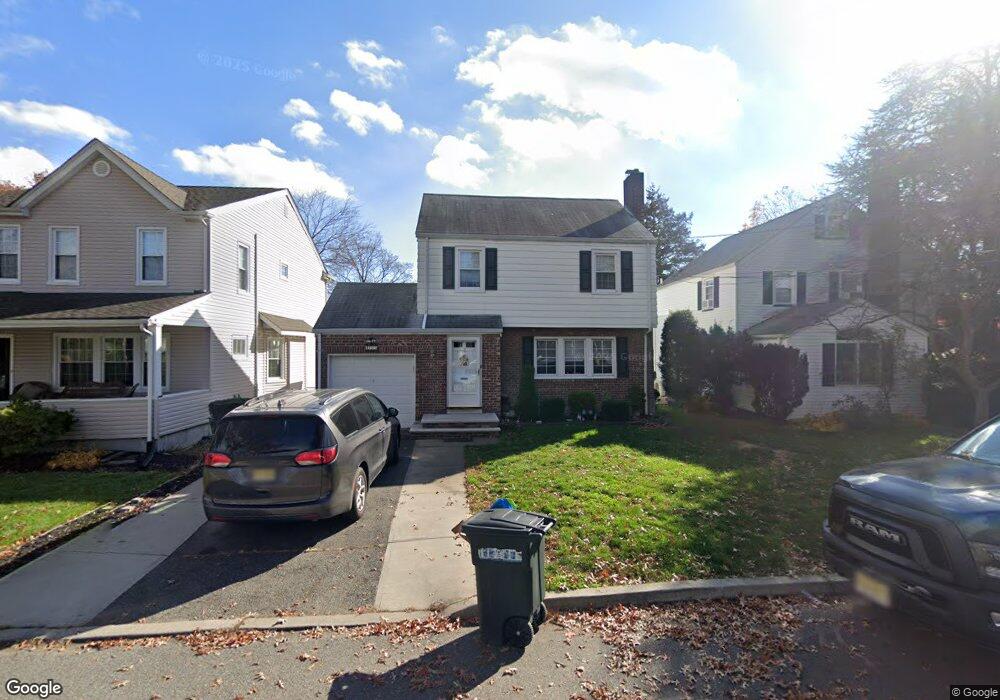
133 Pershing Rd Clifton, NJ 07013
Richfield NeighborhoodEstimated Value: $505,000 - $715,000
Studio
--
Bath
1,622
Sq Ft
$397/Sq Ft
Est. Value
About This Home
This home is located at 133 Pershing Rd, Clifton, NJ 07013 and is currently estimated at $643,677, approximately $396 per square foot. 133 Pershing Rd is a home located in Passaic County with nearby schools including Clifton High School, St Andrew Elementary School, and New Hope School.
Ownership History
Date
Name
Owned For
Owner Type
Purchase Details
Closed on
Feb 10, 2017
Sold by
Mb Propeties 1 Llc
Bought by
Camlebridge Capital Limited Liability Co
Current Estimated Value
Purchase Details
Closed on
Jul 23, 2003
Sold by
Deyoung Roberta
Bought by
Smith Douglas and Smith Lisa
Home Financials for this Owner
Home Financials are based on the most recent Mortgage that was taken out on this home.
Original Mortgage
$179,275
Interest Rate
6.22%
Purchase Details
Closed on
Nov 12, 1999
Sold by
Deyoung John and Deyoung Roberta M
Bought by
Deyoung John and Deyoung Roberta M
Create a Home Valuation Report for This Property
The Home Valuation Report is an in-depth analysis detailing your home's value as well as a comparison with similar homes in the area
Home Values in the Area
Average Home Value in this Area
Purchase History
| Date | Buyer | Sale Price | Title Company |
|---|---|---|---|
| Camlebridge Capital Limited Liability Co | -- | None Available | |
| Smith Douglas | $225,000 | -- | |
| Deyoung John | -- | -- |
Source: Public Records
Mortgage History
| Date | Status | Borrower | Loan Amount |
|---|---|---|---|
| Previous Owner | Smith Douglas | $179,275 |
Source: Public Records
Tax History
| Year | Tax Paid | Tax Assessment Tax Assessment Total Assessment is a certain percentage of the fair market value that is determined by local assessors to be the total taxable value of land and additions on the property. | Land | Improvement |
|---|---|---|---|---|
| 2025 | $11,546 | $216,900 | $93,400 | $123,500 |
| 2024 | $11,269 | $194,500 | $93,400 | $101,100 |
| 2022 | $11,106 | $194,500 | $93,400 | $101,100 |
| 2021 | $10,649 | $194,500 | $93,400 | $101,100 |
| 2020 | $10,684 | $194,500 | $93,400 | $101,100 |
| 2019 | $10,608 | $194,500 | $93,400 | $101,100 |
| 2018 | $10,548 | $194,500 | $93,400 | $101,100 |
| 2017 | $10,433 | $194,500 | $93,400 | $101,100 |
| 2016 | $10,231 | $194,500 | $93,400 | $101,100 |
| 2015 | $10,132 | $194,500 | $93,400 | $101,100 |
| 2014 | $9,923 | $194,500 | $93,400 | $101,100 |
Source: Public Records
Map
Nearby Homes
- 32 Greendale Rd
- 15 Saint Michaels Place
- 102 Barnsdale Rd
- 31 Barnsdale Rd
- 176 Colfax Ave
- 174 Colfax Ave
- 375 Colfax Ave
- 89 Susan Ct
- 117 Fornelius Ave
- 23 Devonshire Dr
- 23 Devonshire Dr Unit 118
- 54 Doherty Dr
- 415 Mount Prospect Ave
- 154 George Russell Way
- 33 Graydon Terrace
- 43 Graydon Terrace
- 479 Grove St
- 135 La Salle Ave
- 605 F8 Grove St Unit F8
- 565 Grove St Unit B12
- 131 Pershing Rd
- 135 Pershing Rd
- 5 Duane Rd
- 126 Pershing Rd
- 130 Pershing Rd
- 12 Saint James Place
- 14 Saint James Place
- 124 Pershing Rd
- 132 Pershing Rd
- 15 Duane Rd
- 145 Pershing Rd
- 6 Duane Rd
- 120 Pershing Rd
- 11 Saint James Place
- 9 Dalewood Rd
- 115 Pershing Rd
- 147 Pershing Rd
- 12 Duane Rd
- 19 Duane Rd
- 15 Saint James Place
Your Personal Tour Guide
Ask me questions while you tour the home.