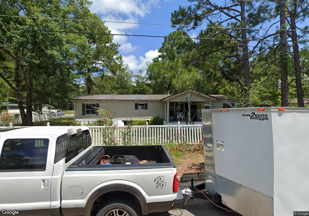
133 Phillips Ave Waycross, GA 31503
3
Beds
2
Baths
1,904
Sq Ft
11,326
Sq Ft Lot
About This Home
This home is located at 133 Phillips Ave, Waycross, GA 31503. 133 Phillips Ave is a home located in Ware County with nearby schools including Ruskin Elementary School, Ware County Middle School, and Ware County High School.
Ownership History
Date
Name
Owned For
Owner Type
Purchase Details
Closed on
May 26, 2023
Sold by
Jay Investment Group Llc
Bought by
Deloach William D
Purchase Details
Closed on
Dec 20, 2021
Sold by
Ellis Sonja Dillard
Bought by
Jay Investment Grp Llc
Purchase Details
Closed on
Mar 5, 2009
Sold by
Herrin Family Limited Partnership
Bought by
Ellis Sonja Dillard
Purchase Details
Closed on
Mar 4, 2009
Sold by
Suntrust Bank and Kopp John G
Bought by
Ellis Sonja Dillard
Purchase Details
Closed on
Jan 19, 1994
Bought by
Herrin P O Jr Trustee
Create a Home Valuation Report for This Property
The Home Valuation Report is an in-depth analysis detailing your home's value as well as a comparison with similar homes in the area
Purchase History
| Date | Buyer | Sale Price | Title Company |
|---|---|---|---|
| Deloach William D | $50,000 | -- | |
| Jay Investment Grp Llc | $8,000 | -- | |
| Jay Investment Grp Llc | $8,000 | -- | |
| Ellis Sonja Dillard | $4,125 | -- | |
| Ellis Sonja Dillard | $4,125 | -- | |
| Herrin P O Jr Trustee | -- | -- |
Source: Public Records
Tax History
| Year | Tax Paid | Tax Assessment Tax Assessment Total Assessment is a certain percentage of the fair market value that is determined by local assessors to be the total taxable value of land and additions on the property. | Land | Improvement |
|---|---|---|---|---|
| 2025 | $470 | $13,904 | $2,340 | $11,564 |
| 2024 | $184 | $4,609 | $2,340 | $2,269 |
| 2023 | $253 | $6,338 | $4,200 | $2,138 |
| 2022 | $128 | $3,200 | $3,200 | $0 |
| 2021 | $530 | $12,248 | $4,200 | $8,048 |
| 2020 | $454 | $11,879 | $4,200 | $7,679 |
| 2019 | $463 | $11,945 | $4,200 | $7,745 |
| 2018 | $461 | $11,794 | $4,200 | $7,594 |
| 2017 | $451 | $12,086 | $4,200 | $7,886 |
| 2016 | $451 | $11,832 | $4,200 | $7,632 |
| 2015 | $462 | $12,024 | $4,200 | $7,824 |
| 2014 | $461 | $12,019 | $4,200 | $7,819 |
| 2013 | -- | $12,215 | $4,200 | $8,015 |
Source: Public Records
Map
Nearby Homes
- 0 S Georgia Pkwy W
- 6905 Kendal Ct
- 0 Camp Branch Cross Rd Unit 25948480
- 920 Wilfred St
- 803 Bertha St
- 801 Bertha St
- 807 Bertha St
- 805 Bertha St
- 1009 Johanna St
- 1110 Elizabeth St
- 717 Glenmore Ave
- 00 Roosevelt St
- 1003 Carswell Ave
- 907 Mary St
- 905 Mary St
- 601 N Nicholls St
- 915 Carswell Ave
- 1721 Minnesota Ave
- 1006 Roosevelt St
- 000 Minnesota Ave
- 148 Phillips Ave
- 215 Norwood Dr
- 218 Norwood Dr
- 11111111 1111111111111111
- 140 Phillips Ave
- 112 Westgate Dr
- 117 Westgate Dr
- 127 Phillips Ave
- 212 Norwood Dr
- 108 Westgate Dr
- 45 Norwood Cir E
- 45 Norwood Cir E
- 132 Phillips Ave
- 121 Phillips Ave
- 32 Norwood Cir
- 128 Phillips Ave
- 117 Phillips Ave
- 204 Norwood Dr
- 115 Phillips Ave
- 113 Phillips Ave
Your Personal Tour Guide
Ask me questions while you tour the home.