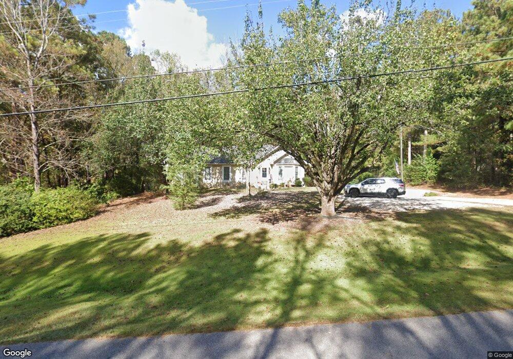
133 Plymouth Dr Lagrange, GA 30240
Estimated Value: $276,820 - $348,000
3
Beds
3
Baths
1,902
Sq Ft
$160/Sq Ft
Est. Value
About This Home
This home is located at 133 Plymouth Dr, Lagrange, GA 30240 and is currently estimated at $304,205, approximately $159 per square foot. 133 Plymouth Dr is a home located in Troup County with nearby schools including Long Cane Elementary School, Berta Weathersbee Elementary School, and Whitesville Road Elementary School.
Ownership History
Date
Name
Owned For
Owner Type
Purchase Details
Closed on
Mar 31, 2020
Sold by
Baker James G
Bought by
Akers Taylor
Current Estimated Value
Purchase Details
Closed on
Sep 15, 2014
Sold by
Baker James G
Bought by
Akers Kayla
Purchase Details
Closed on
Jan 23, 2009
Sold by
Johnson John V
Bought by
Baker James G
Purchase Details
Closed on
Apr 15, 1993
Sold by
Gregory P Redlin
Bought by
John V Johnson
Purchase Details
Closed on
Sep 10, 1991
Bought by
Gregory P Redlin
Purchase Details
Closed on
Sep 9, 1991
Sold by
Dan-Ric
Purchase Details
Closed on
Jun 1, 1986
Bought by
Dan-Ric
Create a Home Valuation Report for This Property
The Home Valuation Report is an in-depth analysis detailing your home's value as well as a comparison with similar homes in the area
Home Values in the Area
Average Home Value in this Area
Purchase History
| Date | Buyer | Sale Price | Title Company |
|---|---|---|---|
| Akers Taylor | -- | -- | |
| Akers Kayla | -- | -- | |
| Baker James G | $183,500 | -- | |
| Baker James G | $183,500 | -- | |
| John V Johnson | $122,400 | -- | |
| Gregory P Redlin | -- | -- | |
| -- | $118,000 | -- | |
| Dan-Ric | $124,500 | -- |
Source: Public Records
Tax History Compared to Growth
Tax History
| Year | Tax Paid | Tax Assessment Tax Assessment Total Assessment is a certain percentage of the fair market value that is determined by local assessors to be the total taxable value of land and additions on the property. | Land | Improvement |
|---|---|---|---|---|
| 2024 | $2,532 | $94,840 | $14,000 | $80,840 |
| 2023 | $2,348 | $88,080 | $14,000 | $74,080 |
| 2022 | $2,213 | $81,280 | $10,000 | $71,280 |
| 2021 | $2,124 | $70,440 | $10,000 | $60,440 |
| 2020 | $2,124 | $70,440 | $10,000 | $60,440 |
| 2019 | $2,123 | $70,400 | $8,000 | $62,400 |
| 2018 | $2,029 | $67,280 | $8,000 | $59,280 |
| 2017 | $2,029 | $67,280 | $8,000 | $59,280 |
| 2016 | $1,747 | $57,919 | $8,000 | $49,919 |
| 2015 | $1,750 | $57,919 | $8,000 | $49,919 |
| 2014 | $1,616 | $53,407 | $8,000 | $45,407 |
| 2013 | -- | $54,508 | $8,000 | $46,508 |
Source: Public Records
Map
Nearby Homes
- 141 Plymouth Dr
- 119 Plymouth Dr
- 102 Franklin Place
- 101 Ivy Springs Dr
- 474 Newton Rd
- 100 Huntcliff Ct
- 105 Hawthorne Cir
- 40 River Point Dr
- 103 Hawthorne Cir
- 110 Hawthorne Cir
- 135 Planters Ridge Dr
- 124 Foxdale Dr
- 190 Hill Rd
- 108 Hidden Springs Dr
- 0 Deming St Unit 10550189
- 1565 Glass Bridge Rd
- 205 Linda Ln
- 509 Connie Dr
- 106 Landings Way
- 102 Landings Way
- 131 Plymouth Dr
- 135 Plymouth Dr
- 137 Plymouth Dr
- 129 Plymouth Dr
- 107 Shady Oak Dr
- 109 Shady Oak Dr
- 105 Shady Oak Dr
- 139 Plymouth Dr
- 103 Shady Oak Dr
- 132 Plymouth Dr
- 111 Shady Oak Dr
- 111 Shady Oak Dr
- 113 Shady Oak Dr
- 101 Shady Oak Dr
- 125 Plymouth Dr
- 0 Shady Oak Dr Unit 8886489
- 0 Shady Oak Dr Unit 8845291
- 0 Shady Oak Dr Unit 8563202
- 0 Shady Oak Dr Unit 7563073
- 0 Shady Oak Dr