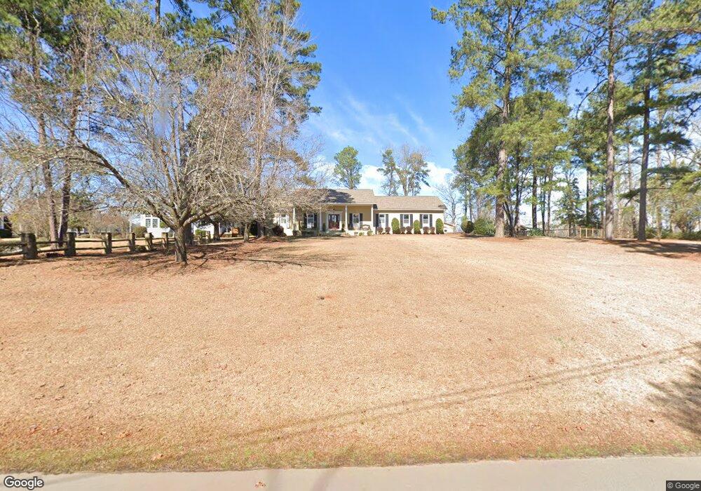
133 Power Point Ln Lexington, SC 29072
Estimated Value: $406,000 - $649,801
3
Beds
3
Baths
2,293
Sq Ft
$235/Sq Ft
Est. Value
About This Home
This home is located at 133 Power Point Ln, Lexington, SC 29072 and is currently estimated at $539,200, approximately $235 per square foot. 133 Power Point Ln is a home located in Lexington County with nearby schools including New Providence Elementary School, River Bluff High School, and Lake Murray Montessori School.
Ownership History
Date
Name
Owned For
Owner Type
Purchase Details
Closed on
Jun 5, 2019
Sold by
Crutchfield Thomas G and Crutchfield Amy J
Bought by
Crutchfield Thomas G and Crutchfield Amy J
Current Estimated Value
Purchase Details
Closed on
Dec 7, 2004
Sold by
Yaman Jason and Yaman Erika
Bought by
Crutchfield Thomas G and Crutchfield Amy J
Purchase Details
Closed on
Dec 28, 2001
Sold by
Suzie Q Llc
Bought by
Yaman Jason
Purchase Details
Closed on
Nov 29, 1999
Sold by
Scharpf Elaine S
Bought by
Power Point Llc
Create a Home Valuation Report for This Property
The Home Valuation Report is an in-depth analysis detailing your home's value as well as a comparison with similar homes in the area
Home Values in the Area
Average Home Value in this Area
Purchase History
| Date | Buyer | Sale Price | Title Company |
|---|---|---|---|
| Crutchfield Thomas G | -- | None Available | |
| Crutchfield Thomas G | $223,500 | -- | |
| Yaman Jason | $164,800 | -- | |
| Power Point Llc | $379,500 | -- |
Source: Public Records
Tax History Compared to Growth
Tax History
| Year | Tax Paid | Tax Assessment Tax Assessment Total Assessment is a certain percentage of the fair market value that is determined by local assessors to be the total taxable value of land and additions on the property. | Land | Improvement |
|---|---|---|---|---|
| 2024 | $1,867 | $11,450 | $5,600 | $5,850 |
| 2023 | $1,710 | $11,450 | $5,600 | $5,850 |
| 2022 | $1,705 | $11,450 | $5,600 | $5,850 |
| 2020 | $1,749 | $11,450 | $5,600 | $5,850 |
| 2019 | $1,724 | $11,086 | $4,800 | $6,286 |
| 2018 | $1,692 | $11,086 | $4,800 | $6,286 |
| 2017 | $1,581 | $10,678 | $4,800 | $5,878 |
| 2016 | $1,566 | $10,677 | $4,800 | $5,877 |
| 2014 | $1,341 | $9,558 | $3,200 | $6,358 |
| 2013 | -- | $9,560 | $3,200 | $6,360 |
Source: Public Records
Map
Nearby Homes
- 102 Longford Ct
- 206 Portsmouth Dr
- 704 Old Cherokee Rd
- 420 Plymouth Pass Dr
- 2225 Old Cherokee Rd Unit LOT 3
- 2235 Old Cherokee Rd Unit LOT 5
- 2229 Old Cherokee Rd Unit LOT 4
- 2247 Old Cherokee Rd Unit LOT 6
- 2221 Old Cherokee Rd Unit LOT 2
- 221 Yachting Rd
- 101 York Commons
- 561 Plymouth Pass Dr
- 117 York Commons
- 312 Settlers Trail
- 246 Cobbleview Dr
- 413 Settlers Trail
- 110 Hyler Dr
- 159 Maritime Trail
- 227 State Road S-32-145 Unit LOT 2
- 227 State Road S-32-145 Unit LOT 1
- 100 White Caps Way
- 204 Lanham Spring Dr
- 200 Lanham Spring Dr
- 149 Power Point Ln
- 125 Power Point Ln
- 121 Power Point Ln
- 208 Lanham Spring Dr
- 301 Lanham Spring Way
- 316 Lanham Spring Way
- 212 Lanham Spring Dr
- 138 Power Point Ln
- 117 Power Point Ln
- 300 Lanham Spring Way
- 140 Power Point Ln
- 134 Power Point Ln
- 215 Lanham Spring Dr
- 216 Lanham Spring Dr
- 305 Lanham Spring Way
- 309 Lanham Spring Way
- 155 Power Point Ln