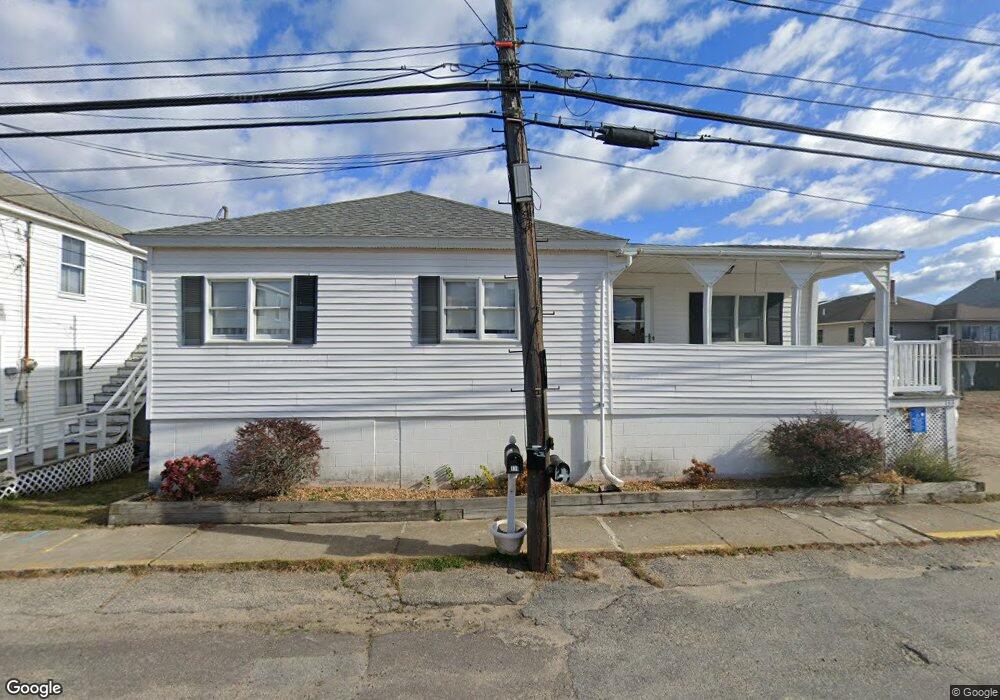
133 Railroad Ave Salisbury, MA 01952
Estimated Value: $353,000 - $604,000
6
Beds
2
Baths
1,180
Sq Ft
$438/Sq Ft
Est. Value
About This Home
This home is located at 133 Railroad Ave, Salisbury, MA 01952 and is currently estimated at $516,356, approximately $437 per square foot. 133 Railroad Ave is a home located in Essex County with nearby schools including Triton Regional High School.
Ownership History
Date
Name
Owned For
Owner Type
Purchase Details
Closed on
Jan 8, 2015
Sold by
Damato Anita M
Bought by
Damato Ft
Current Estimated Value
Purchase Details
Closed on
Apr 22, 1996
Sold by
Perrotti Carol R
Bought by
Phillips Rodney A
Home Financials for this Owner
Home Financials are based on the most recent Mortgage that was taken out on this home.
Original Mortgage
$69,250
Interest Rate
7.34%
Mortgage Type
Purchase Money Mortgage
Purchase Details
Closed on
Sep 28, 1992
Sold by
Pini Mary R
Bought by
Perrotti Carol R and Perrotti Phyllis M
Home Financials for this Owner
Home Financials are based on the most recent Mortgage that was taken out on this home.
Original Mortgage
$50,000
Interest Rate
7.9%
Mortgage Type
Purchase Money Mortgage
Create a Home Valuation Report for This Property
The Home Valuation Report is an in-depth analysis detailing your home's value as well as a comparison with similar homes in the area
Home Values in the Area
Average Home Value in this Area
Purchase History
| Date | Buyer | Sale Price | Title Company |
|---|---|---|---|
| Damato Ft | -- | -- | |
| Phillips Rodney A | $65,000 | -- | |
| Perrotti Carol R | $50,000 | -- |
Source: Public Records
Mortgage History
| Date | Status | Borrower | Loan Amount |
|---|---|---|---|
| Previous Owner | Phillips Rodney A | $69,250 | |
| Previous Owner | Perrotti Carol R | $50,000 |
Source: Public Records
Tax History Compared to Growth
Tax History
| Year | Tax Paid | Tax Assessment Tax Assessment Total Assessment is a certain percentage of the fair market value that is determined by local assessors to be the total taxable value of land and additions on the property. | Land | Improvement |
|---|---|---|---|---|
| 2025 | $4,540 | $450,400 | $245,200 | $205,200 |
| 2024 | $4,549 | $435,300 | $245,200 | $190,100 |
| 2023 | $3,851 | $366,200 | $196,200 | $170,000 |
| 2022 | $3,687 | $339,900 | $179,800 | $160,100 |
| 2021 | $3,701 | $329,900 | $179,800 | $150,100 |
| 2020 | $3,386 | $295,500 | $171,300 | $124,200 |
| 2019 | $3,429 | $263,000 | $149,800 | $113,200 |
| 2018 | $3,224 | $263,300 | $149,900 | $113,400 |
| 2017 | $2,374 | $253,700 | $145,600 | $108,100 |
| 2016 | $3,011 | $258,000 | $145,600 | $112,400 |
| 2015 | $2,903 | $247,100 | $145,600 | $101,500 |
Source: Public Records
Map
Nearby Homes
- 116 Railroad Ave
- 114 Railroad Ave
- 52 Brissette Ave
- 103 Railroad Ave
- 101 Cable Ave
- 141 Atlantic Ave
- 20 Cable Ave Unit 11
- 16 N End Blvd Unit 10
- 16 N End Blvd Unit 8
- 16 N End Blvd Unit 3
- 16 N End Blvd Unit 12
- 16 N End Blvd Unit 5
- 38-40 Central Ave
- 45 Old County Rd Unit 1
- 170 Beach Rd Unit 52
- 98 Central Ave
- 2 Old County Rd Unit 13
- 2 Old County Rd Unit 11
- 2 Old County Rd Unit 10
- 2 Old County Rd Unit 7
- 131 Railroad Ave
- 116 Atlantic Ave - Winter
- 132 Railroad Ave
- 120 Atlantic Ave
- 120 Atlantic Ave Unit 1
- 116 Atlantic Ave
- 130 Railroad Ave
- 134 Railroad Ave
- 114 Atlantic Ave
- 129 Railroad Ave
- 122 Atlantic Ave
- 112 Atlantic Ave
- 127 Railroad Ave
- 136 Railroad Ave
- 136 Railroad Ave Unit A
- 124 Atlantic Ave
- 125 Railroad Ave
- 110 Atlantic Ave
- 66 Brisette Ave
- 64 Brisette Ave