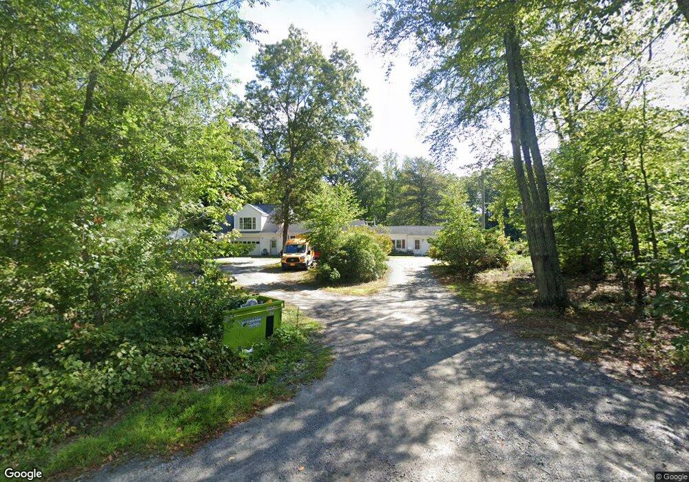
133 Reynolds Ave Rehoboth, MA 02769
Estimated Value: $624,000 - $671,000
4
Beds
3
Baths
3,192
Sq Ft
$203/Sq Ft
Est. Value
About This Home
This home is located at 133 Reynolds Ave, Rehoboth, MA 02769 and is currently estimated at $647,500, approximately $202 per square foot. 133 Reynolds Ave is a home located in Bristol County with nearby schools including Dighton-Rehoboth Regional High School, Cedar Brook School, and The Pinecroft School.
Ownership History
Date
Name
Owned For
Owner Type
Purchase Details
Closed on
Oct 21, 2009
Sold by
Est Macmanus Peter B and Dixon Helen
Bought by
Macmanus-Rayl Sarah
Current Estimated Value
Purchase Details
Closed on
Nov 13, 1991
Sold by
Macmanus Peter B
Bought by
Dixon Gary E and Dixon Helen E
Create a Home Valuation Report for This Property
The Home Valuation Report is an in-depth analysis detailing your home's value as well as a comparison with similar homes in the area
Home Values in the Area
Average Home Value in this Area
Purchase History
| Date | Buyer | Sale Price | Title Company |
|---|---|---|---|
| Macmanus-Rayl Sarah | $22,000 | -- | |
| Dixon Gary E | $25,000 | -- |
Source: Public Records
Mortgage History
| Date | Status | Borrower | Loan Amount |
|---|---|---|---|
| Previous Owner | Dixon Gary E | $50,000 | |
| Previous Owner | Dixon Gary E | $75,000 |
Source: Public Records
Tax History Compared to Growth
Tax History
| Year | Tax Paid | Tax Assessment Tax Assessment Total Assessment is a certain percentage of the fair market value that is determined by local assessors to be the total taxable value of land and additions on the property. | Land | Improvement |
|---|---|---|---|---|
| 2025 | $53 | $477,000 | $212,800 | $264,200 |
| 2024 | $5,259 | $462,900 | $212,800 | $250,100 |
| 2023 | $5,314 | $458,900 | $208,800 | $250,100 |
| 2022 | $5,708 | $450,500 | $200,400 | $250,100 |
| 2021 | $4,501 | $391,800 | $184,100 | $207,700 |
| 2020 | $5,140 | $391,800 | $184,100 | $207,700 |
| 2018 | $4,192 | $350,200 | $176,300 | $173,900 |
| 2017 | $0 | $350,200 | $176,300 | $173,900 |
| 2016 | $4,255 | $350,200 | $176,300 | $173,900 |
| 2015 | $4,180 | $339,600 | $169,100 | $170,500 |
| 2014 | $4,135 | $332,400 | $161,900 | $170,500 |
Source: Public Records
Map
Nearby Homes
- 29 & 43 Francis St
- 58 Peck St
- 48 Round Farm Rd
- 1 Round Farm Rd
- 2 Round Farm Rd
- 70 Forest Hill Dr
- 14 Tremont St
- 1120 Glebe St
- 2045 Winthrop St
- 805 Burt St
- 0 Kimberly Rd
- 701 Winthrop St Unit 312
- 27 Run Brook Cir
- 837 Glebe St
- 2181 Wheeler St
- 24 New St
- 0 Range Ave Unit 72771508
- 0 Range Ave Unit 72771509
- 257 Anawan St
- 133 Winthrop St
- 142 Reynolds Ave
- 137 Reynolds Ave
- 127 Reynolds Ave
- 130 Reynolds Ave
- Lot 31 Reynolds Ave
- 94 Reynolds Ave
- 98 Reynolds Ave
- 134 Reynolds Ave
- 138 Reynolds Ave
- 163 Peck St
- 121 Reynolds Ave
- 146 Reynolds Ave
- 146 Reynolds Ave
- 146 Reynolds Ave
- 122 Reynolds Ave
- 140 Reynolds Ave
- 156 Peck St
- 150 Reynolds Ave
- 150 Reynolds Ave
- 159 Peck St