
Seller's Agent in 2025
Kathy Golden
Coldwell Banker Spinks Brown
(706) 302-1245
67 Total Sales
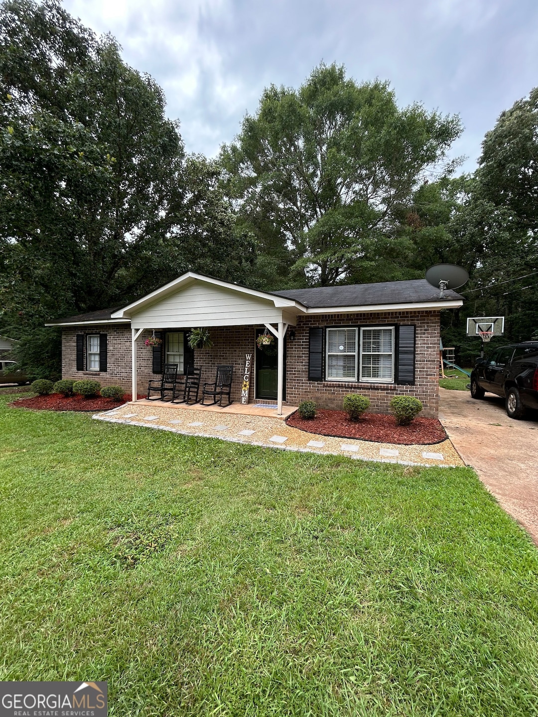
Attention all first-time buyers. This is the perfect opportunity to get your foot in the door of your new home. This low maintenance brick home, located in a peaceful country setting, offers a large deep yard with beautiful shade trees and a barn. Recent updates include fresh indoor paint, LVP flooring in the main gathering areas and a new storm door and exterior doors. Enjoy family time with the open floorplan in the main living area or while grilling on the patio off the kitchen. Washer and dryer to remain. Close proximity to I-85, KIA and elementary and middle schools. Don't let this home pass you by. Call today to schedule your private showing. Please try to give 24 hours' notice to show. Listing agent is aunt of sellers
Last Agent to Sell the Property
Coldwell Banker Spinks Brown License #252902 Listed on: 06/27/2025
| Date | Type | Sale Price | Title Company |
|---|---|---|---|
| Limited Warranty Deed | $190,000 | -- | |
| Warranty Deed | $99,700 | -- | |
| Special Warranty Deed | $44,400 | -- | |
| Special Warranty Deed | -- | -- | |
| Deed | $68,000 | -- | |
| Warranty Deed | $58,200 | -- | |
| Warranty Deed | -- | -- | |
| Deed | $36,000 | -- | |
| Deed | -- | -- |
| Date | Status | Loan Amount | Loan Type |
|---|---|---|---|
| Open | $185,541 | FHA | |
| Closed | $11,400 | New Conventional |
| Date | Event | Price | List to Sale | Price per Sq Ft |
|---|---|---|---|---|
| 08/22/2025 08/22/25 | Sold | $190,000 | -2.6% | $169 / Sq Ft |
| 07/04/2025 07/04/25 | Pending | -- | -- | -- |
| 06/27/2025 06/27/25 | For Sale | $195,000 | -- | $173 / Sq Ft |
| Year | Tax Paid | Tax Assessment Tax Assessment Total Assessment is a certain percentage of the fair market value that is determined by local assessors to be the total taxable value of land and additions on the property. | Land | Improvement |
|---|---|---|---|---|
| 2025 | $1,568 | $57,480 | $5,000 | $52,480 |
| 2024 | $1,308 | $47,960 | $5,000 | $42,960 |
| 2023 | $1,198 | $43,920 | $5,000 | $38,920 |
| 2022 | $1,160 | $41,560 | $5,000 | $36,560 |
| 2021 | $968 | $32,080 | $4,240 | $27,840 |
| 2020 | $968 | $32,080 | $4,240 | $27,840 |
| 2019 | $659 | $23,840 | $3,600 | $20,240 |
| 2018 | $664 | $22,000 | $3,600 | $18,400 |
| 2017 | $604 | $22,000 | $3,600 | $18,400 |
Seller's Agent in 2025
Kathy Golden
Coldwell Banker Spinks Brown
(706) 302-1245
67 Total Sales
Seller Co-Listing Agent in 2025
Grover Golden
Coldwell Banker Spinks Brown
(706) 302-1245
52 Total Sales
Buyer's Agent in 2025
Alyson Atkins
Lindsey's Inc., Realtors
(770) 301-8028
3 Total Sales
Source: Georgia MLS
MLS Number: 10556047
APN: 078-1-000-053
Disclaimer: Certain information contained herein is derived from information provided by parties other than Homes.com. All information provided is deemed reliable, but is not guaranteed to be accurate and should be independently verified.
![]() The data relating to real estate for sale on this web site comes in part from the Broker Reciprocity Program of Georgia MLS. Real estate listings held by brokerage firms other than Redfin are marked with the Broker Reciprocity logo and detailed information about them includes the name of the listing brokers. Information deemed reliable but not guaranteed. Copyright 2026 Georgia MLS. All rights reserved.
The data relating to real estate for sale on this web site comes in part from the Broker Reciprocity Program of Georgia MLS. Real estate listings held by brokerage firms other than Redfin are marked with the Broker Reciprocity logo and detailed information about them includes the name of the listing brokers. Information deemed reliable but not guaranteed. Copyright 2026 Georgia MLS. All rights reserved.
Ask me questions while you tour the home.