Estimated Value: $322,000 - $377,000
4
Beds
3
Baths
2,399
Sq Ft
$144/Sq Ft
Est. Value
About This Home
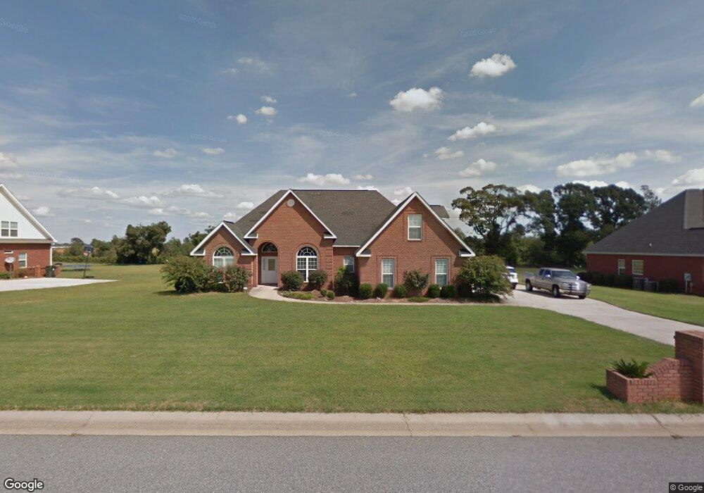
This home is located at 133 Rowland Cir, Byron, GA 31008 and is currently estimated at $345,361, approximately $143 per square foot. 133 Rowland Cir is a home located in Peach County with nearby schools including Kay Road Elementary School, Fort Valley Middle School, and Peach County High School.
Ownership History
Date
Name
Owned For
Owner Type
Purchase Details
Closed on
Feb 28, 2005
Sold by
Primo Homes Inc
Bought by
Jones Rudolph
Current Estimated Value
Home Financials for this Owner
Home Financials are based on the most recent Mortgage that was taken out on this home.
Original Mortgage
$192,500
Outstanding Balance
$99,333
Interest Rate
5.88%
Mortgage Type
New Conventional
Estimated Equity
$246,028
Purchase Details
Closed on
Jan 30, 2004
Sold by
Southern Star Properties Inc
Bought by
Primo Homes
Purchase Details
Closed on
Apr 19, 1999
Bought by
Southern Star Properties Inc
Create a Home Valuation Report for This Property
The Home Valuation Report is an in-depth analysis detailing your home's value as well as a comparison with similar homes in the area
Home Values in the Area
Average Home Value in this Area
Purchase History
| Date | Buyer | Sale Price | Title Company |
|---|---|---|---|
| Jones Rudolph | $192,500 | -- | |
| Primo Homes | $26,000 | -- | |
| Southern Star Properties Inc | -- | -- |
Source: Public Records
Mortgage History
| Date | Status | Borrower | Loan Amount |
|---|---|---|---|
| Open | Jones Rudolph | $192,500 |
Source: Public Records
Tax History Compared to Growth
Tax History
| Year | Tax Paid | Tax Assessment Tax Assessment Total Assessment is a certain percentage of the fair market value that is determined by local assessors to be the total taxable value of land and additions on the property. | Land | Improvement |
|---|---|---|---|---|
| 2024 | $3,018 | $107,440 | $12,800 | $94,640 |
| 2023 | $2,974 | $104,880 | $12,800 | $92,080 |
| 2022 | $2,756 | $96,800 | $12,800 | $84,000 |
| 2021 | $2,764 | $84,000 | $12,800 | $71,200 |
| 2020 | $2,752 | $83,600 | $12,800 | $70,800 |
| 2019 | $2,764 | $83,600 | $12,800 | $70,800 |
| 2018 | $2,777 | $83,600 | $12,800 | $70,800 |
| 2017 | $2,790 | $83,600 | $12,800 | $70,800 |
| 2016 | $2,779 | $83,600 | $12,800 | $70,800 |
| 2015 | $2,783 | $83,600 | $12,800 | $70,800 |
| 2014 | $2,787 | $83,600 | $12,800 | $70,800 |
| 2013 | -- | $83,600 | $12,800 | $70,800 |
Source: Public Records
Map
Nearby Homes
- 219 Rowland Cir
- 120 Hawks Place
- 117 Hawks Ridge Trace
- 120 Hawks Ridge Trace
- 107 Red Tail Cir
- 127 Hawks Ridge Trace
- 109 Red Tail Cir
- 199 Red Tail Cir
- 152 Hawks Ridge Trace
- 0 Barker Rd Unit 243030
- 0 Barker Rd Unit 14258525
- 0 Barker Rd Unit 175053
- 555 Kimberly Dr
- 800 John E Sullivan Rd
- 211 Serenity Ct
- 109 Early Dr
- 108 Early Dr
- 24C Sterling Dr
- 245 Sterling Dr
- 161 Rowland Cir
- 109 Rowland Cir
- 93 Rowland Cir
- 130 Rowland Cir
- 156 Rowland Cir
- 170 Rowland Cir
- 32 Rowland Cir
- 32 Rowland Cir
- 32 Rowland Cir
- 32 Rowland Cir
- 210 Rowland Cir
- 88 Joseph Place
- 78 Joseph Place
- 257 Rowland Cir
- 263 Rowland Cir
- 55 Rowland Cir
- 0 Lot 18 Rowland Cir Unit 225243
- 56 Joseph Place
- 12 Rowland Cir
- 222 Rowland Cir