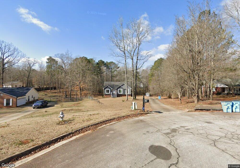
133 Royal Way McDonough, GA 30252
Estimated Value: $277,327 - $319,000
4
Beds
2
Baths
1,430
Sq Ft
$205/Sq Ft
Est. Value
About This Home
This home is located at 133 Royal Way, McDonough, GA 30252 and is currently estimated at $293,082, approximately $204 per square foot. 133 Royal Way is a home located in Henry County with nearby schools including Tussahaw Elementary School, Locust Grove Middle School, and Locust Grove High School.
Ownership History
Date
Name
Owned For
Owner Type
Purchase Details
Closed on
Aug 20, 1998
Sold by
Walters Iii John C and Walters Iii Smith, J
Bought by
Mines Michael O
Current Estimated Value
Home Financials for this Owner
Home Financials are based on the most recent Mortgage that was taken out on this home.
Original Mortgage
$131,840
Outstanding Balance
$27,600
Interest Rate
6.96%
Mortgage Type
VA
Estimated Equity
$265,482
Purchase Details
Closed on
Jun 30, 1997
Sold by
United Bnk
Bought by
Walters John C and Charles Smith J
Purchase Details
Closed on
May 6, 1997
Sold by
Cruce Alan
Bought by
United Bnk
Purchase Details
Closed on
Jan 9, 1996
Sold by
Walters John and Hanger John
Bought by
M Constr John C
Create a Home Valuation Report for This Property
The Home Valuation Report is an in-depth analysis detailing your home's value as well as a comparison with similar homes in the area
Home Values in the Area
Average Home Value in this Area
Purchase History
| Date | Buyer | Sale Price | Title Company |
|---|---|---|---|
| Mines Michael O | $128,000 | -- | |
| Walters John C | $45,000 | -- | |
| United Bnk | $6,125,400 | -- | |
| M Constr John C | $17,500 | -- |
Source: Public Records
Mortgage History
| Date | Status | Borrower | Loan Amount |
|---|---|---|---|
| Open | Mines Michael O | $131,840 | |
| Closed | M Constr John C | $0 |
Source: Public Records
Tax History Compared to Growth
Tax History
| Year | Tax Paid | Tax Assessment Tax Assessment Total Assessment is a certain percentage of the fair market value that is determined by local assessors to be the total taxable value of land and additions on the property. | Land | Improvement |
|---|---|---|---|---|
| 2025 | $95 | $123,640 | $16,000 | $107,640 |
| 2024 | $95 | $128,680 | $16,000 | $112,680 |
| 2023 | $95 | $133,080 | $14,000 | $119,080 |
| 2022 | $774 | $99,640 | $14,000 | $85,640 |
| 2021 | $774 | $81,680 | $14,000 | $67,680 |
| 2020 | $774 | $71,720 | $12,000 | $59,720 |
| 2019 | $775 | $72,480 | $12,000 | $60,480 |
| 2018 | $776 | $66,760 | $10,800 | $55,960 |
| 2016 | $654 | $52,960 | $10,000 | $42,960 |
| 2015 | $1,509 | $52,960 | $10,000 | $42,960 |
| 2014 | $1,209 | $52,960 | $10,000 | $42,960 |
Source: Public Records
Map
Nearby Homes
- 103 Royal Way
- 1171 King Mill Rd
- 205 Calvery Way
- 150 Whitaker Rd
- 224 Osier Dr
- 175 Osier Dr
- 450 Noblewood Dr
- 446 Noblewood Dr
- 435 Noblewood Dr
- 420 Tavistock Ct
- 168 Osier Dr
- 435 Rabbit Run
- 201 Nina Cir
- 705 S Bethany Rd
- 242 Old Jackson Rd
- 9054 Dawes Crossing
- 308 Stallings Dr
- 0 Nail Mill Rd
- 0 King Mill Rd Unit 10647914
- 0 King Mill Rd Unit 7684355
- 127 Royal Way
- 139 Royal Way
- 121 Royal Way
- 141 Royal Way
- 142 Royal Way
- 142 Royal Way Unit 11
- 130 Royal Way
- 115 Royal Way
- 136 Royal Way
- 124 Royal Way
- 400 Lancelot Trail
- 402 Lancelot Trail
- 118 Royal Way
- 109 Royal Way
- 404 Lancelot Trail
- 401 Lancelot Trail
- 971 King Mill Rd
- 112 Royal Way
- 941 King Mill Rd
- 407 Lancelot Trail