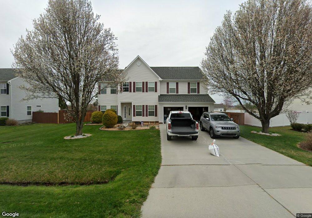
133 Saint Andrews Rd Moyock, NC 27958
Estimated Value: $427,000 - $497,857
5
Beds
3
Baths
3,024
Sq Ft
$158/Sq Ft
Est. Value
About This Home
This home is located at 133 Saint Andrews Rd, Moyock, NC 27958 and is currently estimated at $476,464, approximately $157 per square foot. 133 Saint Andrews Rd is a home located in Currituck County with nearby schools including Moyock Elementary School, Moyock Middle School, and Currituck County High School.
Ownership History
Date
Name
Owned For
Owner Type
Purchase Details
Closed on
Jun 3, 2005
Sold by
Jennings Sean B and Jennings Danielle L
Bought by
Atkins Shannon G and Atkins Carolyn J
Current Estimated Value
Home Financials for this Owner
Home Financials are based on the most recent Mortgage that was taken out on this home.
Original Mortgage
$32,500
Outstanding Balance
$16,945
Interest Rate
5.74%
Mortgage Type
Future Advance Clause Open End Mortgage
Estimated Equity
$459,519
Create a Home Valuation Report for This Property
The Home Valuation Report is an in-depth analysis detailing your home's value as well as a comparison with similar homes in the area
Home Values in the Area
Average Home Value in this Area
Purchase History
| Date | Buyer | Sale Price | Title Company |
|---|---|---|---|
| Atkins Shannon G | -- | None Available |
Source: Public Records
Mortgage History
| Date | Status | Borrower | Loan Amount |
|---|---|---|---|
| Open | Atkins Shannon G | $32,500 | |
| Open | Atkins Shannon G | $260,000 |
Source: Public Records
Tax History Compared to Growth
Tax History
| Year | Tax Paid | Tax Assessment Tax Assessment Total Assessment is a certain percentage of the fair market value that is determined by local assessors to be the total taxable value of land and additions on the property. | Land | Improvement |
|---|---|---|---|---|
| 2024 | $2,389 | $337,200 | $54,200 | $283,000 |
| 2023 | $2,397 | $337,200 | $54,200 | $283,000 |
| 2022 | $1,841 | $337,200 | $54,200 | $283,000 |
| 2021 | $1,833 | $241,800 | $49,200 | $192,600 |
| 2020 | $1,311 | $241,800 | $49,200 | $192,600 |
| 2019 | $1,311 | $241,800 | $49,200 | $192,600 |
| 2018 | $1,311 | $241,800 | $49,200 | $192,600 |
| 2017 | $1,275 | $241,800 | $49,200 | $192,600 |
| 2016 | $1,275 | $241,800 | $49,200 | $192,600 |
| 2015 | $1,275 | $241,800 | $49,200 | $192,600 |
Source: Public Records
Map
Nearby Homes
- 101 Claire Ct
- 182 Eagle Creek Rd
- 324 Sunny Lake Rd Unit Lot 41
- 324 Sunny Lake Rd
- 204 Leif St
- 216 Leif St
- 214 Leif St
- 201 Leif St
- Lot 2 Survey Rd Unit Lot 2
- Lot 2 Survey Rd
- 306 Sunny Lake Rd
- 306 Sunny Lake Rd Unit Lot 50
- 202 Green Lake Rd
- 163 Saint Andrews Rd
- 120 Ryker Rd W
- 100 Sunny Lake Rd Unit Lot 143
- 100 Sunny Lake Rd
- 309 Iris Cir Unit Lot 124
- 309 Iris Cir
- 307 Iris Cir Unit Lot 123
- 131 Saint Andrews Rd
- 135 Saint Andrews Rd
- 129 Saint Andrews Rd
- 127 Saint Andrews Rd
- 138 Saint Andrews Rd
- 137 Saint Andrews Rd
- 140 Saint Andrews Rd
- 139 Saint Andrews Rd
- 142 Saint Andrews Rd
- 142 St Andrews Rd
- 141 Saint Andrews Rd
- 143 Saint Andrews Rd
- 144 Saint Andrews Rd
- 179 Eagle Creek Rd
- 109 Saint Andrews Rd
- 181 Eagle Creek Rd
- 177 Eagle Creek Rd
- 183 Eagle Creek Rd
- 145 Saint Andrews Rd
- 146 Saint Andrews Rd