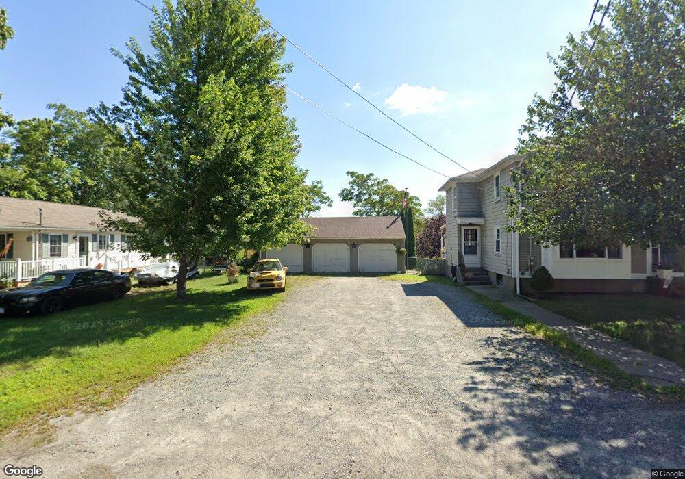
133 Scott St Attleboro, MA 02703
Estimated Value: $516,000 - $729,000
4
Beds
2
Baths
1,996
Sq Ft
$295/Sq Ft
Est. Value
About This Home
This home is located at 133 Scott St, Attleboro, MA 02703 and is currently estimated at $589,663, approximately $295 per square foot. 133 Scott St is a home located in Bristol County with nearby schools including Hill-Roberts Elementary School, Robert J. Coelho Middle School, and Attleboro High School.
Ownership History
Date
Name
Owned For
Owner Type
Purchase Details
Closed on
May 18, 2021
Sold by
Moreau Joann and Moreau Wayne
Bought by
Moreau Joann
Current Estimated Value
Home Financials for this Owner
Home Financials are based on the most recent Mortgage that was taken out on this home.
Original Mortgage
$200,000
Interest Rate
2.9%
Mortgage Type
New Conventional
Purchase Details
Closed on
Jan 1, 1984
Bought by
Moreau Wayne and Moreau Joann
Create a Home Valuation Report for This Property
The Home Valuation Report is an in-depth analysis detailing your home's value as well as a comparison with similar homes in the area
Home Values in the Area
Average Home Value in this Area
Purchase History
| Date | Buyer | Sale Price | Title Company |
|---|---|---|---|
| Moreau Joann | -- | None Available | |
| Moreau Joann | -- | None Available | |
| Moreau Wayne | -- | -- |
Source: Public Records
Mortgage History
| Date | Status | Borrower | Loan Amount |
|---|---|---|---|
| Previous Owner | Moreau Joann | $200,000 | |
| Previous Owner | Moreau Wayne | $96,000 | |
| Previous Owner | Moreau Wayne | $98,406 |
Source: Public Records
Tax History
| Year | Tax Paid | Tax Assessment Tax Assessment Total Assessment is a certain percentage of the fair market value that is determined by local assessors to be the total taxable value of land and additions on the property. | Land | Improvement |
|---|---|---|---|---|
| 2025 | $5,110 | $407,200 | $145,600 | $261,600 |
| 2024 | $5,302 | $416,500 | $145,600 | $270,900 |
| 2023 | $4,856 | $354,700 | $132,400 | $222,300 |
| 2022 | $4,956 | $343,000 | $126,200 | $216,800 |
| 2021 | $4,418 | $298,500 | $121,400 | $177,100 |
| 2020 | $4,285 | $294,300 | $117,800 | $176,500 |
| 2019 | $3,886 | $274,400 | $115,600 | $158,800 |
| 2018 | $2,295 | $263,400 | $112,200 | $151,200 |
| 2017 | $3,652 | $251,000 | $112,200 | $138,800 |
| 2016 | $3,730 | $251,700 | $110,100 | $141,600 |
| 2015 | $3,273 | $222,500 | $110,100 | $112,400 |
| 2014 | $3,505 | $236,000 | $104,800 | $131,200 |
Source: Public Records
Map
Nearby Homes
- 50 Pullman Ave Unit A
- 50 Pullman Ave Unit B
- 67 Norton St
- 61 Mendon Rd
- 37 Turner St
- 56 Baltic St Unit 56
- 386 Mendon Ave
- 54 Baltic St Unit 54
- 52 Baltic St Unit 52
- 18 Newton St
- 362 Kenyon Ave
- 79 Turner St
- 460 Collins St Unit 6
- 460 Collins St Unit 9
- 179 Columbine Ave
- 215 Kenyon Ave
- 548 Kenyon Ave Unit 25
- 548 Kenyon Ave Unit 4
- 40 Linton St
- 91 Greenwich St
- 131 Scott St
- 141 Scott St
- 131A Scott St
- 129 Scott St Unit 6
- 129 Scott St Unit 5
- 129 Scott St Unit 4
- 129 Scott St Unit 3
- 140 Scott St
- 150 Scott St
- 136 Scott St
- 10 Pullman Ave Unit 3
- 10 Pullman Ave Unit 2
- 10 Pullman Ave Unit 1
- 130 Scott St
- 150 Collins St
- 128 Scott St
- 156 Collins St
- 160 Collins St
- 136 Collins St
- 125 Scott St
Your Personal Tour Guide
Ask me questions while you tour the home.