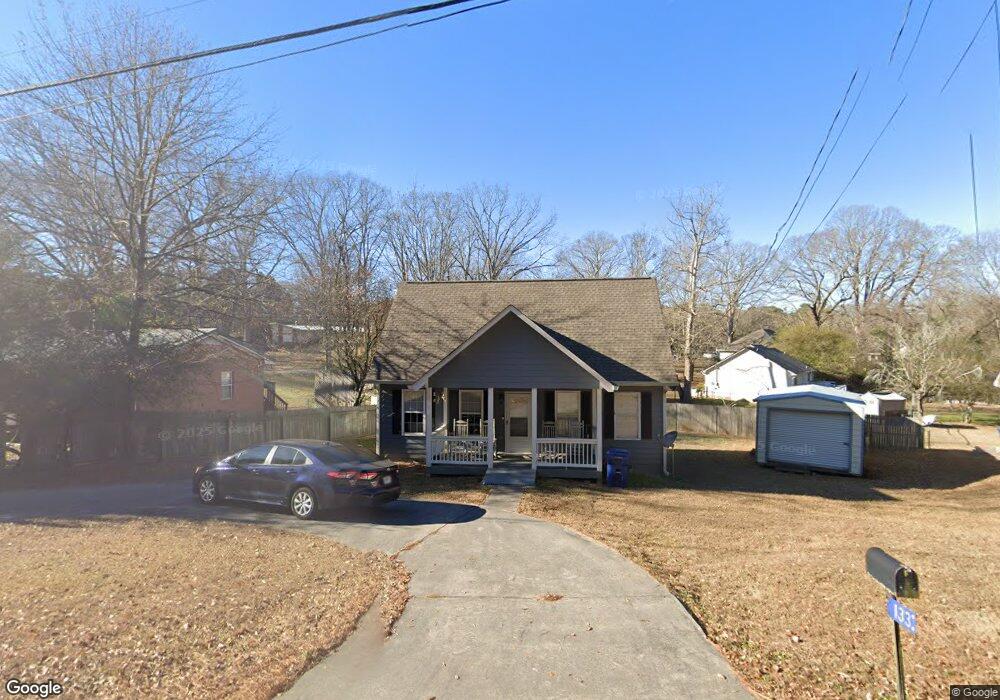
133 Sims Rd Winder, GA 30680
Estimated Value: $265,705 - $312,000
3
Beds
2
Baths
1,224
Sq Ft
$235/Sq Ft
Est. Value
About This Home
This home is located at 133 Sims Rd, Winder, GA 30680 and is currently estimated at $287,926, approximately $235 per square foot. 133 Sims Rd is a home located in Barrow County with nearby schools including County Line Elementary School, Russell Middle School, and Winder-Barrow High School.
Ownership History
Date
Name
Owned For
Owner Type
Purchase Details
Closed on
Jul 24, 2020
Sold by
Sleeper Shirley
Bought by
Sleeper Chris R
Current Estimated Value
Purchase Details
Closed on
Nov 27, 1995
Sold by
Hunter Hubert and Frost David
Bought by
Sleeper Chris Shirley
Create a Home Valuation Report for This Property
The Home Valuation Report is an in-depth analysis detailing your home's value as well as a comparison with similar homes in the area
Home Values in the Area
Average Home Value in this Area
Purchase History
| Date | Buyer | Sale Price | Title Company |
|---|---|---|---|
| Sleeper Chris R | -- | -- | |
| Sleeper Chris Shirley | $67,500 | -- |
Source: Public Records
Mortgage History
| Date | Status | Borrower | Loan Amount |
|---|---|---|---|
| Closed | Sleeper Chris Shirley | $0 |
Source: Public Records
Tax History
| Year | Tax Paid | Tax Assessment Tax Assessment Total Assessment is a certain percentage of the fair market value that is determined by local assessors to be the total taxable value of land and additions on the property. | Land | Improvement |
|---|---|---|---|---|
| 2025 | $1,863 | $66,294 | $20,000 | $46,294 |
| 2024 | $1,855 | $64,851 | $20,000 | $44,851 |
| 2023 | $1,850 | $64,851 | $20,000 | $44,851 |
| 2022 | $1,794 | $51,328 | $18,000 | $33,328 |
| 2021 | $1,548 | $41,142 | $14,400 | $26,742 |
| 2020 | $383 | $36,787 | $12,240 | $24,547 |
| 2019 | $490 | $30,852 | $8,500 | $22,352 |
| 2018 | $484 | $30,852 | $8,500 | $22,352 |
| 2017 | $764 | $25,620 | $7,140 | $18,480 |
| 2016 | $752 | $25,846 | $7,140 | $18,706 |
| 2015 | $802 | $27,332 | $8,400 | $18,932 |
| 2014 | $640 | $23,274 | $4,116 | $19,158 |
| 2013 | -- | $22,591 | $4,116 | $18,475 |
Source: Public Records
Map
Nearby Homes
- 326 Miles Patrick Rd
- 197 Buena Vista St
- 303 Rocky Point Ct
- 223 Lacey Ln
- 222 Ryan Rd
- 421 N 5th Ave
- 27 Creekside Dr
- 571 Greenvalley Dr
- 284 E 5th Ave
- 0 E Northcrest Dr Unit 10648147
- 206 E 5th Ave
- 352 3rd Ave
- 436 Northcrest Dr
- 326 Fayette Dr
- 469 Plantation Dr
- 538 Valleyview Dr
- 273 Partridge Trail
- 187 Bellview St
- 171 Brookview Terrace
- 217 Bellview St
- 333 Miles Patrick Rd
- 137 Sims Rd
- 129 Sims Rd
- 337 Miles Patrick Rd Unit 4
- 337 Miles Patrick Rd
- 140 Williamsburg Way
- 138 Williamsburg Way
- 341 Miles Patrick Rd
- 142 Williamsburg Way
- 136 Williamsburg Way
- 125 Sims Rd
- 334 Miles Patrick Rd
- 151 Saint Anthony Dr
- 179 Sims Rd
- 345 Miles Patrick Rd
- 144 Williamsburg Way
- 132 Williamsburg Way
- 141 Williamsburg Way
- 139 Williamsburg Way
- 340 Miles Patrick Rd